China Administrative Divisions: 34 Provincial-Level Units
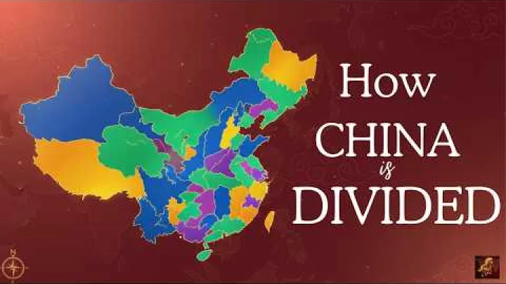
China's administrative divisions form a layered system rather than a simple list of places on a map. At the top are four types of provincial-level division: provinces, autonomous regions, municipalities directly under the central government, and special administrative regions. This guide explains the dated standard count, clarifies the status of Taiwan in the PRC framework, lists all provincial-level divisions, and shows how prefecture-, county-, and township-level units fit below them. It also provides practical guidance for reading China maps, addresses, and administrative datasets.
How China's Administrative Division System Is Organized
China uses administrative levels to define government responsibilities, public records, statistics, addresses, and geographic data. The most useful starting point is the provincial-level division, followed by prefecture-level, county-level, and township-level units in much of mainland China.
What Counts as a First-Level Administrative Division?
The official first-level concept is usually called a provincial-level administrative division. It includes four categories: provinces, autonomous regions, municipalities directly under the central government, and special administrative regions. These categories occupy the same broad position in the national hierarchy, even though they have different names, purposes, internal structures, and legal arrangements.
A province is the standard type of provincial-level unit. An autonomous region is a provincial-level unit designated within China's system of regional ethnic autonomy. A municipality directly under the central government is a city-region that is not placed under a province. Hong Kong and Macau are special administrative regions with separate arrangements under the national framework.
Being at the same level does not mean that these units should be treated as identical. A province normally contains prefecture-level units, while a municipality may contain county-level districts and counties without an intermediate prefecture-level tier. Hong Kong and Macau also have internal systems that should not automatically be translated into mainland administrative levels.
The expressions China states and China regions may appear in English-language searches, but state is not the official term for a first-level Chinese administrative unit. The more accurate term is provincial-level administrative division. The word region can also mean a broad geographic area, such as North China or the Yangtze River Delta, rather than a legal administrative unit.
The Province-to-Township Hierarchy
For most mainland administrative data, the practical structure has four principal levels. Each level contains several unit types, and the exact arrangement can differ between provinces, autonomous regions, municipalities, and special administrative regions.
| Level | Common unit types | Typical role |
|---|---|---|
| Provincial-level | Province, autonomous region, municipality, SAR | Highest main administrative level below the national government |
| Prefecture-level | Prefecture-level city, prefecture, autonomous prefecture, league | Intermediate regional administration in much of mainland China |
| County-level | District, county, county-level city, autonomous county, banner | Local administration below the prefecture level |
| Township-level | Town, township, ethnic township, subdistrict, sum | Basic administrative level for towns, rural areas, and urban neighborhoods |
A simple mainland example is China to Guangdong Province to Guangzhou, a prefecture-level city to Tianhe District to a township-level subdistrict. The example shows why a city name does not always identify the lowest or most urban part of an administrative area. A prefecture-level city can govern a large territory that includes built-up districts and less urban county-level units.
In a municipality such as Beijing, the structure may move from the provincial-level municipality directly to county-level districts and counties and then to township-level subdistricts or towns. Villages, residents' committees, and other grassroots units can appear below the township level, while statistical or address-coding layers may add further records. These should not be confused with additional national administrative tiers.
Hong Kong and Macau do not fit neatly into the mainland four-level model. Their internal districts, parishes, or other local areas have different functions and should be stored under their SAR parent rather than forced into mainland prefecture-, county-, or township-level categories.
Official Codes, Names, and Date Control
The Ministry of Civil Affairs maintains an archive of administrative-division code releases. These tables provide an official basis for identifying units, matching parent and child relationships, and supporting government and statistical records.
An administrative code is more reliable than an informal map label when a dataset needs to distinguish a district from a city or a current county from a former one. Names can be translated in several ways, while codes and unit types help preserve the intended hierarchy. A clean record should therefore keep the official name, Chinese name, division type, parent unit, and code as separate fields.
Date control is essential because counties can become districts, units can be merged, and administrative relationships can change. A map or database that does not identify its code release may combine a current name with an older boundary. When comparing sources, record the release year and publication date instead of treating every online list as a timeless reference.
How Many Provincial-Level Divisions Does China Have?
The answer depends on the date and the scope of the count. The commonly used standard PRC framework lists 34 provincial-level divisions, but that total includes four different categories and includes Taiwan as a claimed provincial-level unit. It should not be read as a count of 34 ordinary provinces or as an undifferentiated count of territory administered by the PRC government.
How Many First-Level Divisions Are Listed?
This article uses the 2022 administrative-division code release listed by the Ministry of Civil Affairs on April 23, 2023 as its dated baseline. On that standard PRC framework, the provincial-level total and category breakdown are as follows:
| Category | Number | How to read the count |
|---|---|---|
| All provincial-level divisions | 34 | Full standard PRC framework list |
| Provinces | 23 | Includes Taiwan in the PRC list |
| Autonomous regions | 5 | Provincial-level regions with autonomous-region designation |
| Municipalities directly under the central government | 4 | Beijing, Tianjin, Shanghai, and Chongqing |
| Special administrative regions | 2 | Hong Kong and Macau |
The category figures add up to 34, but the categories are not interchangeable. Beijing is included as a municipality rather than as a province, and Hong Kong is included as a special administrative region. The Ministry of Civil Affairs archive is the appropriate place to check whether a newer dated code release has replaced the 2022 baseline for a particular use.
Administered Units and Taiwan's Claimed Status
Taiwan Province appears in the standard PRC framework as a claimed provincial-level unit. However, the PRC government does not administer Taiwan in practice. The distinction matters because a framework list and a list of units under effective administration answer different questions.
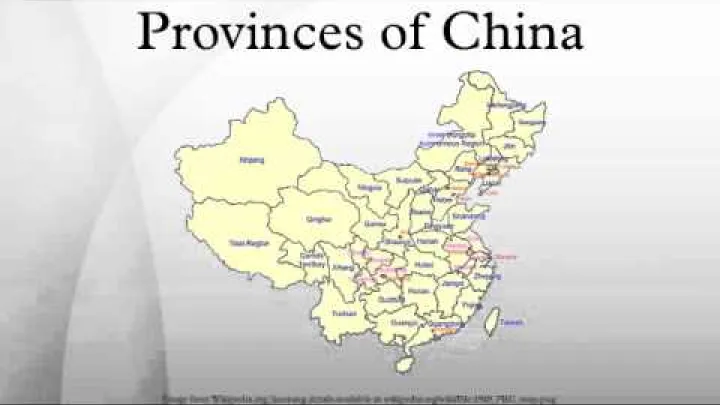
The Taiwan Province reference describes this difference between the PRC claim and actual control. In a map or database, use a clear status field such as listed in the PRC framework and avoid presenting Taiwan's claimed internal divisions as current PRC-administered divisions.
If a project needs a count of units administered by a particular government, define that scope separately from the standard 34-unit framework. Do not silently change the meaning of the total by removing or retaining Taiwan without explaining what the list represents.
Why Search Results Also Say China States or China Regions
China states is an understandable English analogy for readers familiar with the United States, India, Australia, or other federations, but it is not the official Chinese classification. Chinese provincial-level divisions are not normally called states in official English administrative terminology.
China regions is broader and can refer to two different things. It may mean administrative regions, such as provinces and autonomous regions, or physical and cultural groupings such as eastern China, southern China, or western China. The second use is geographic rather than hierarchical.
A China regions map may therefore show provincial boundaries, broad directional regions, economic groupings, river basins, or cultural areas. Read the map legend before using it as an administrative reference. A map labeled as a China provinces map is more likely to show provincial-level boundaries, but it should still identify its date and whether it includes claimed or separately administered areas.
The Four Types of First-Level Divisions
The four provincial-level categories make the national list easier to understand. Their common position in the hierarchy should not obscure the different administrative traditions and internal structures represented by each type.
Provinces
Provinces are the standard and most numerous type of provincial-level division. The standard PRC list contains 23 provinces when Taiwan is included. The Taiwan entry requires the status distinction explained above; the presence of a name in the framework list does not by itself describe effective administration.
Most provinces contain prefecture-level units, which in turn contain county-level and township-level units. Provinces can include large metropolitan areas, rural counties, border areas, islands, and densely settled coastal zones. Their internal geography can be very different, but the province remains the same broad administrative level.
For addresses and datasets, the province is usually the first major administrative parent below China. It should be stored separately from broad labels such as eastern China or the Yangtze River region, which may overlap several provinces and do not normally function as administrative parents.
Autonomous Regions
China has five autonomous regions: the Inner Mongolia Autonomous Region, Guangxi Zhuang Autonomous Region, Tibet Autonomous Region, Ningxia Hui Autonomous Region, and Xinjiang Uygur Autonomous Region.
Autonomous regions are provincial-level peers designated within China's system of regional ethnic autonomy. Their names identify both the provincial-level status and the relevant autonomous-region designation. They are not a lower level than provinces, and they should not be placed below a province in an administrative data tree.
Some lower-level terms are especially associated with autonomous regions. Inner Mongolia uses terms such as leagues and banners in parts of its hierarchy, while sums and ethnic sums also appear in regional administrative terminology. These names describe units within the hierarchy; they do not create additional national levels.
The label autonomous should be explained as an administrative and legal designation rather than used to make broad assumptions about the practical extent of local autonomy. Detailed claims about legal powers, language policy, or leadership requirements belong to the current legal framework and should not be inferred from the name alone.
Municipalities Directly Under the Central Government
The four municipalities directly under the central government are Beijing, Tianjin, Shanghai, and Chongqing. Each is a provincial-level city-region, not an ordinary prefecture-level city.
A municipality can contain urban districts, counties, and other county-level units. Its administrative boundary may extend far beyond the continuous built-up center. This is especially important for Chongqing, a geographically extensive municipality in southwest China, while Beijing provides a clear example of a capital-region municipality with a large urban and outer-area structure.
Municipality status does not place these areas below a province. Beijing, Tianjin, Shanghai, and Chongqing are direct provincial-level entries in the national hierarchy. They should not be labeled city-states, and they should not be nested under a neighboring province merely because they are geographically surrounded by or close to one.
Special Administrative Regions
China's two special administrative regions are Hong Kong and Macau. Both appear as provincial-level entries in the broad national classification, but they are distinct from ordinary provinces, autonomous regions, and municipalities.
The two SARs operate under the one country, two systems framework and have separate Basic Law-based legal and administrative arrangements. The Practical Law reference identifies Macau as one of China's two special administrative regions, with Hong Kong as the other.
Hong Kong's districts and Macau's internal areas should not automatically be mapped to mainland prefecture-, county-, or township-level divisions. For a clean hierarchy, treat each SAR as a provincial-level parent and preserve its own internal terminology and legal structure beneath that parent.
The Complete List of China's Provincial-Level Divisions
The following tables use standard English names, Chinese official names, and pinyin where it helps identify a unit. The descriptions are intentionally short so the list works as an administrative reference rather than a travel guide.
The 23 Provinces in the Standard PRC List
| Province | Chinese name and pinyin | Short identification | Status in the standard list |
|---|---|---|---|
| Hebei | 河北省, Héběi Shěng | Northern province that surrounds or borders Beijing and Tianjin. | Province in standard PRC list |
| Shanxi | 山西省, Shānxī Shěng | Inland north China province west of Hebei and east of Shaanxi. | Province in standard PRC list |
| Liaoning | 辽宁省, Liáoníng Shěng | Northeastern coastal province including the Liaodong Peninsula. | Province in standard PRC list |
| Jilin | 吉林省, Jílín Shěng | Northeastern province between Liaoning and Heilongjiang, with borders toward Korea and Russia. | Province in standard PRC list |
| Heilongjiang | 黑龙江省, Hēilóngjiāng Shěng | China's far northeastern province, bordering Russia. | Province in standard PRC list |
| Jiangsu | 江苏省, Jiāngsū Shěng | Eastern coastal province associated with the lower Yangtze region. | Province in standard PRC list |
| Zhejiang | 浙江省, Zhèjiāng Shěng | Eastern and southeastern coastal province that includes Hangzhou. | Province in standard PRC list |
| Anhui | 安徽省, Ānhuī Shěng | Inland eastern province between the lower Yangtze area and central China. | Province in standard PRC list |
| Fujian | 福建省, Fújiàn Shěng | Southeastern coastal province facing the Taiwan Strait. | Province in standard PRC list |
| Jiangxi | 江西省, Jiāngxī Shěng | Inland southeastern province between coastal and central provinces. | Province in standard PRC list |
| Shandong | 山东省, Shāndōng Shěng | Eastern coastal province centered on the Shandong Peninsula. | Province in standard PRC list |
| Henan | 河南省, Hénán Shěng | Central inland province in the North China and central plains transition zone. | Province in standard PRC list |
| Hubei | 湖北省, Húběi Shěng | Central province along the middle Yangtze, including Wuhan. | Province in standard PRC list |
| Hunan | 湖南省, Húnán Shěng | South-central inland province south of Hubei and west of Jiangxi. | Province in standard PRC list |
| Guangdong | 广东省, Guǎngdōng Shěng | Southern coastal province bordering Hong Kong and Macau. | Province in standard PRC list |
| Hainan | 海南省, Hǎinán Shěng | Island province south of mainland China. | Province in standard PRC list |
| Sichuan | 四川省, Sìchuān Shěng | Large southwestern inland province including the Sichuan Basin and western highlands. | Province in standard PRC list |
| Guizhou | 贵州省, Guìzhōu Shěng | Southwestern inland province east of Yunnan and south of Sichuan. | Province in standard PRC list |
| Yunnan | 云南省, Yúnnán Shěng | Southwestern border province adjoining several countries in Southeast Asia. | Province in standard PRC list |
| Shaanxi | 陕西省, Shǎnxī Shěng | Inland northwestern-central province distinct from Shanxi. | Province in standard PRC list |
| Gansu | 甘肃省, Gānsù Shěng | Long, narrow northwestern province linking parts of inland northern and western China. | Province in standard PRC list |
| Qinghai | 青海省, Qīnghǎi Shěng | Large western highland province with extensive inland territory. | Province in standard PRC list |
| Taiwan | 台湾省, Táiwān Shěng | Island unit included as a claimed province in the PRC framework. | Claimed in PRC framework; not administered by PRC |
The list excludes former provinces, abolished units, and broad directional labels. Names such as East China or northern China may be useful for geography, but they are not additional provincial-level divisions.
The Other 11 Provincial-Level Divisions
| Division | Category | Chinese name and pinyin | Short identification |
|---|---|---|---|
| Inner Mongolia Autonomous Region | Autonomous region | 内蒙古自治区, Nèi Měnggǔ Zìzhìqū | Northern autonomous region where leagues, banners, and sums appear in parts of the lower hierarchy. |
| Guangxi Zhuang Autonomous Region | Autonomous region | 广西壮族自治区, Guǎngxī Zhuàngzú Zìzhìqū | Southern autonomous region whose official name includes the Zhuang designation. |
| Tibet Autonomous Region | Autonomous region | 西藏自治区, Xīzàng Zìzhìqū | Southwestern highland autonomous region with regional administrative terminology. |
| Ningxia Hui Autonomous Region | Autonomous region | 宁夏回族自治区, Níngxià Huízú Zìzhìqū | North-central autonomous region whose official name includes the Hui designation. |
| Xinjiang Uygur Autonomous Region | Autonomous region | 新疆维吾尔自治区, Xīnjiāng Wéiwú'ěr Zìzhìqū | Large northwestern autonomous region with extensive border areas. |
| Beijing Municipality | Municipality directly under the central government | 北京市, Běijīng Shì | National capital and provincial-level municipality with urban and outer districts. |
| Tianjin Municipality | Municipality directly under the central government | 天津市, Tiānjīn Shì | Northern coastal municipality and major port-region administrative unit. |
| Shanghai Municipality | Municipality directly under the central government | 上海市, Shànghǎi Shì | Eastern coastal municipality centered on the lower Yangtze economic area. |
| Chongqing Municipality | Municipality directly under the central government | 重庆市, Chóngqìng Shì | Large southwestern inland municipality containing extensive urban and peripheral territory. |
| Hong Kong Special Administrative Region | Special administrative region | 香港特别行政区, Xiānggǎng Tèbié Xíngzhèngqū | SAR with separate legal and administrative arrangements under its Basic Law. |
| Macau Special Administrative Region | Special administrative region | 澳门特别行政区, Àomén Tèbié Xíngzhèngqū | SAR with a distinct internal administrative and legal framework. |
The category column is important when this list is imported into a directory or map. A municipality should not be treated as an ordinary prefecture-level city, and an SAR should not be assigned a mainland county-level structure simply because all entries appear in one provincial-level table.
How Lower-Level Divisions Fit Into the Hierarchy
Provincial-level divisions are only the first major layer used in everyday administrative records. Below them, the terms city, district, county, town, and township describe different levels and functions.
Prefecture-Level Divisions
Prefecture-level is the main intermediate level in much of mainland China. Its principal categories are prefecture-level cities, prefectures, autonomous prefectures, and leagues.

| Type | Chinese term | Practical meaning |
|---|---|---|
| Prefecture-level city | 地级市 | Regional unit that may govern districts, counties, and county-level cities. |
| Prefecture | 地区 | Regional administrative unit used where this form remains part of the hierarchy. |
| Autonomous prefecture | 自治州 | Prefecture-level unit with an autonomous designation within the national system. |
| League | 盟 | Prefecture-level term used especially in parts of Inner Mongolia. |
A prefecture-level city is an administrative area, not simply the dense urban center shown on a street map. For example, Guangzhou is a prefecture-level city whose county-level units include urban districts such as Tianhe and Yuexiu. The city name identifies a parent administration, while the district identifies a lower-level unit within it.
Prefectures and autonomous prefectures preserve different regional arrangements, while leagues are associated particularly with Inner Mongolia. The National Bureau of Statistics presents provincial-, prefectural-, and county-level classifications in its statistical tables. Use those categories when comparing official data rather than assuming that every source counts the same kinds of unit.
County-Level and Township-Level Divisions
County-level units sit below the prefecture level in the common mainland structure. Township-level units sit below county-level units and provide a more local administrative layer. The terminology varies by region, but the levels remain useful for organizing addresses and datasets.
| Level | Common examples | Key point |
|---|---|---|
| County-level | District, county, county-level city, autonomous county, banner, autonomous banner | A district is generally county-level even when it forms part of a major metropolitan area. |
| Township-level | Town, township, ethnic township, subdistrict, sum, ethnic sum | These units provide local administration for urban neighborhoods, towns, and rural areas. |
A county-level city has the word city in its name but remains county-level. An autonomous county or autonomous banner carries a special designation while remaining at the county level. Banners and autonomous banners are especially associated with Inner Mongolia and should be translated according to their official unit type.
At township level, towns and townships are common, ethnic townships have a specific designation, and subdistricts generally serve urban neighborhoods. Sums and ethnic sums are regional terms used in parts of the autonomous-region hierarchy. Other special entries may appear in official tables, so read the unit type instead of treating every local term as a separate national tier.
Why the Word City Can Mean Different Levels
The word city can refer to three different positions in the hierarchy. A municipality directly under the central government is provincial-level. A prefecture-level city is an intermediate regional unit. A county-level city is below the prefecture level, even though its name also uses the word city.
- Provincial-level municipality: Beijing Municipality contains county-level districts such as Chaoyang District.
- Prefecture-level city: Chengdu is a prefecture-level city that contains county-level districts and counties.
- County-level city: This is a county-level parent for township-level units and is not equivalent to a municipality.
The physical urban area may cross several administrative units, while a single administrative city may include rural territory far from its central business district. For maps, addresses, and databases, check the unit type and parent relationship instead of inferring hierarchy from the English word city alone.
Using China Administrative Divisions in Maps, Addresses, and Data
Administrative names become most useful when they are stored consistently. A map label, an address field, and a statistical record may use different translations for the same unit, so the data structure should preserve both official identity and readable display names.
Reading Chinese and English Names in Maps
For each major area, consider storing at least three name fields: the standard English name, the Chinese official name, and pinyin or another standard local-language form. Keep aliases in a separate field rather than mixing several translations into one display label.
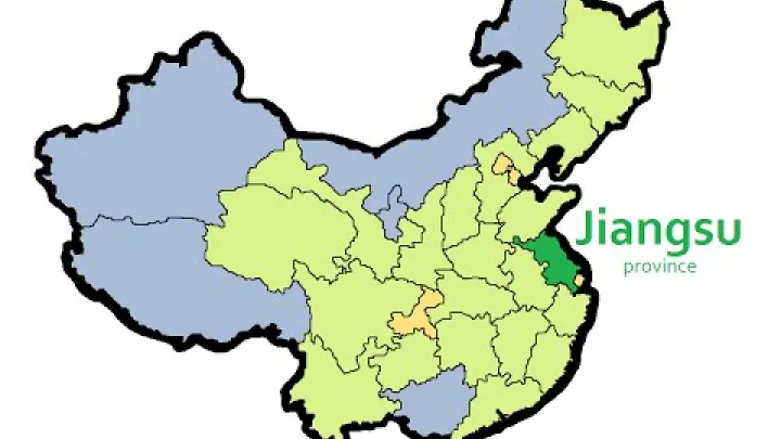
Some names need special care. Inner Mongolia Autonomous Region is not the same type of entry as Mongolia, the neighboring country. Tibet and Xizang may appear as different English labels in maps and datasets. Xinjiang Uygur may also be rendered with a different English spelling for the ethnic designation. A canonical name plus an alias field allows search without creating duplicate administrative records.
Shanxi and Shaanxi are another practical example. Their English spellings are similar, while their Chinese names and pinyin differ: 山西省, Shānxī Shěng, and 陕西省, Shǎnxī Shěng. Province abbreviations and official administrative codes can help separate such names, but use a verified current standard rather than an informal abbreviation.
When reading a China provinces map or a China map in Chinese, first identify whether the labels are administrative, geographic, or statistical. A Chinese-language map may use Chinese names only, while an international map may use English names, pinyin, or a mixture. Consistent fields make it possible to search in one language while displaying another.
Building a Clean Area Hierarchy
A directory such as Listingal's Area hierarchy works best when it separates parent-child relationships from category labels. Do not store all provincial-level entries as if they were ordinary provinces, and do not make broad geographic regions automatic parents of administrative units.
| Layer or record type | Recommended handling | Example |
|---|---|---|
| Country | Top-level geographic parent | China |
| Provincial-level entry | Store level, division type, official names, status, and code | Guangdong Province or Beijing Municipality |
| Mainland lower-level entry | Connect by parent ID and retain prefecture, county, or township type | Guangzhou to Tianhe District |
| SAR internal entry | Use the SAR as parent and preserve its separate internal structure | Hong Kong SAR to a Hong Kong district |
| Claimed or separately administered entry | Keep list membership and administration status in separate fields | Taiwan in the PRC framework |
| Geographic grouping | Store as a separate classification, not as an automatic administrative parent | East China or the Yangtze River Delta |
Useful fields include parent_id, level, division_type, official_name_en, official_name_zh, pinyin, code, and status. Stable codes and internal identifiers should be used as primary references because names may change spelling, translation, or administrative form.
This model lets a user browse from China to a provincial-level unit and then to the appropriate lower-level unit without pretending that provinces, municipalities, autonomous regions, and SARs have identical internal structures. It also allows geographic tags to coexist with official administrative records without confusing the two.
How to Check That a Division Is Current
Administrative lists can become outdated when a county changes into a district, units are merged, names are revised, or a source changes its counting method. Use a short, repeatable check before adding a division to a map, dataset, address directory, or area page.
- Identify the scope and type. Decide whether the record is provincial-level, prefecture-level, county-level, township-level, an SAR internal unit, or a geographic grouping.
- Open the latest dated Ministry of Civil Affairs code table. Record the release year and publication date, and compare it with the date of the map or dataset you are updating.
- Compare statistical classifications. Check relevant National Bureau of Statistics tables when a total or level-specific count is important, because statistical tables may group unit types differently.
- Record changes instead of overwriting history. If a county becomes a district or a unit is renamed, retain the effective date and, where useful, the former name as an alias.
- Handle special frameworks separately. Check relevant current legal or official SAR information for Hong Kong and Macau, and preserve the correct status wording for entries that are listed in a framework but are not administered by the PRC government.
The headline total, lower-level totals, names, boundaries, and parent relationships should all carry a clear date or source-release reference. An undated search result or third-party map is not enough to establish that a division is current.
Conclusion: How to Read China's Administrative Divisions
China's first-level administrative divisions are best understood as four provincial-level categories: 23 provinces in the standard PRC list, 5 autonomous regions, 4 municipalities directly under the central government, and 2 special administrative regions. Together, the dated framework used here contains 34 entries, but the total does not mean that all 34 are ordinary provinces or that every listed entry has the same administration and internal hierarchy.
For practical work, begin with the unit type and date. Then connect each area to its correct parent, distinguish prefecture-, county-, and township-level units, preserve Chinese and English names separately, and keep broad geographic regions outside the official administrative tree. This approach makes China maps, addresses, statistical data, and area directories easier to read and less likely to contain duplicate or outdated records.
Select area
Create a post
Posting is free and no registration is required.