China Continent and Region: What Continent Is China In?

If you are asking what continent China is in, the direct answer is Asia. China is generally classified more specifically as part of East Asia, a subregion on the eastern side of the Asian mainland. Its large mainland territory faces the Pacific Ocean and connects geographically with several other Asian subregions. This guide explains China’s continent, region, map location, physical geography, and the differences between common and institutional regional labels.
China Is in Asia, Specifically East Asia
The Direct Answer: China Is in Asia
China is a country on the continent of Asia. Its usual geographic region is East Asia. Britannica describes China as a country of East Asia, which is the standard answer used in geography, education, and general reference materials.
China is not a continent. The country, the continent, and the subregion are three different levels of geographic description. China is the country; Asia is the continent; and East Asia is the subregion. Therefore, if a form asks what continent China is in, answer Asia. If it asks which region China is in, East Asia is usually the most precise general answer.
This distinction also explains the common search wording China continent. In most cases, that phrase means which continent contains China, not whether China itself is a continent. A clear one-sentence answer is: China is in Asia, specifically in East Asia.
Where China Is Located in Asia
On a world map, locate Asia first, then move toward its eastern side. China occupies a broad part of the Asian mainland and extends toward the western Pacific. Its position includes a large interior land area as well as a long coast facing seas connected with the Pacific Ocean.
A simple map-reading sequence is useful. First, identify the continuous landmass of Asia and Europe. Next, find East Asia on the eastern side of that landmass. China is the large mainland country at the center of this East Asian area, with Mongolia and Russia to the north, Central Asian landscapes to the west, highland and Himalayan areas to the southwest, and mainland Southeast Asia to the south.
This location gives China both continental and maritime connections. Land routes connect its western and northern areas with the interior of Asia, while coastal routes connect its eastern and southern areas with the Pacific region. These surrounding connections do not change the basic answer: China is geographically in Asia and is generally placed in East Asia.
What Region Is China In?
The word region can have more than one meaning. In this article, it means China’s broad geographic subregion within Asia. It does not mean a province, autonomous area, municipality, or other internal administrative division inside China.
Geographic Region Versus an Internal Administrative Region
When people search for China region, they may be asking about East Asia, or they may be looking for an internal division of China. Those are different uses of the word. East Asia is an international geographic subregion. An internal Chinese region is an administrative or local area used to organize government, services, business, or travel.
For a question about the continent or international location of the country, the relevant answer is Asia and East Asia. A list of Chinese provinces or autonomous regions would not answer that question. It would describe how the country is organized internally rather than where the country is located on a world map.
The same distinction is useful in business and data systems. A company may create a China region for sales, customer service, or operations, and a travel website may divide the country into regional destinations. Those labels can be useful for a specific organization, but they are not alternatives to China’s geographic classification.
East Asia as China’s Main Geographic Region
East Asia is a subregion of Asia, not a separate continent. China is one of its core geographic areas. Britannica’s overview of East Asia commonly includes China, Japan, Mongolia, North Korea, South Korea, and Taiwan. Depending on the purpose of a map or dataset, Hong Kong and Macao may also be discussed separately as places within the wider East Asian setting.
East Asia is used in more than one way. A physical geography description may focus on neighboring landforms, coastlines, and countries. A cultural or historical description may use a broader regional idea. A statistical organization may use its own list of economies and territories. For that reason, the exact membership of East Asia can vary slightly between sources, even though China’s position in the region is widely recognized.
East Asia should also be distinguished from Eastern Asia. East Asia is the familiar phrase used in ordinary geographic writing. Eastern Asia is a formal wording used in some statistical classification systems, including United Nations geographic frameworks. In both cases, the practical map location is the same: China is in the eastern part of Asia.
China’s Connections to Other Asian Subregions
China’s size and central position in eastern Eurasia place it near several other Asian subregions. Its western areas face Central Asia through inland borderlands and historic overland corridors. Its southwestern areas connect geographically with South Asia through highland systems, including the Tibetan Plateau and the Himalayas. Its southern areas have land and maritime connections with mainland Southeast Asia.
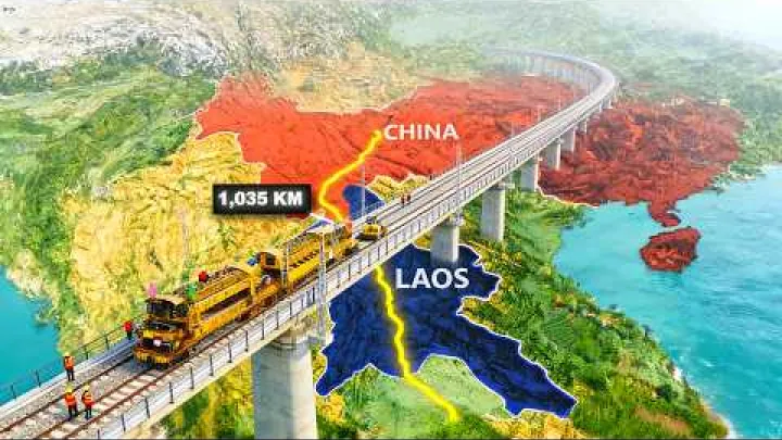
These connections explain why a search about China may also mention Central Asia, South Asia, Southeast Asia, or the Asia-Pacific region. A country can be adjacent to several subregions without belonging primarily to all of them. Border proximity, trade, transport, cultural exchange, and institutional cooperation are not identical to formal geographic membership.
For example, a map of transport routes may show China linked with Central Asian corridors. A map of Himalayan geography may show connections with South Asia. A map of coastal trade may emphasize Southeast Asia and the wider Pacific. Each map has a different purpose, but none of these connections replaces China’s usual classification as an East Asian country.
When answering a general location question, use the narrowest standard label that fits the question. Asia is the continent. East Asia is the main geographic subregion. Central Asia, South Asia, and Southeast Asia describe nearby or connected areas rather than China’s primary regional identity.
China’s Physical Geography Within East Asia
China’s physical geography helps explain why its location can look different on different maps. It includes high plateaus in the west, interior basins and deserts, broad plains, major river systems, and a Pacific-facing coast. These features make China a large and varied part of the East Asian mainland.
Mainland, Plateaus, Plains, and Major Rivers
Western China is associated with high plateaus and extensive mountain systems. The Tibetan Plateau is the most important geographic anchor in this area. It forms a highland region in the southwest and helps explain the strong contrast between China’s elevated western landscapes and its lower eastern areas.
Farther inland, China includes basins, dry regions, and deserts. These areas form a transition between the highlands in the west and the more open plains toward the east. The physical pattern is not a simple straight division, but a broad map view often shows higher terrain in the west and southwest with lower land extending toward the eastern coast.
The Yellow River and the Yangtze River are useful reference points for understanding this layout. Both major rivers are associated with the interior and eastern parts of China and generally drain toward the east. Their courses connect inland landscapes with the eastern side of the country, reinforcing the sense of China as a large continuous part of the East Asian mainland.
These physical features do not create separate continents or change China’s regional classification. They help explain the country’s internal variety. When locating China, it is useful to see the Tibetan Plateau, the major river plains, and the eastern coast as connected parts of one Asian country rather than as unrelated geographic zones.
Pacific Coast and Marginal Seas
China’s eastern and southern sides have a Pacific-facing maritime setting. The Bohai Sea, Yellow Sea, East China Sea, and South China Sea are important map references along or near the country’s coastal edge. They help show how China’s geography combines a large continental interior with access to the western Pacific.
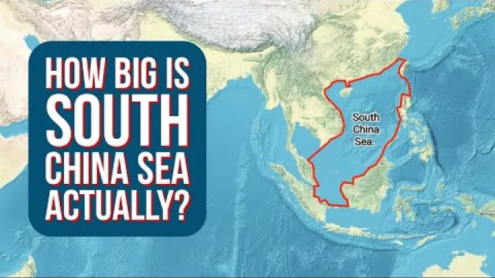
The coast also explains why China may appear in descriptions of the Asia-Pacific region. Asia-Pacific is a broad term that often includes East Asian countries, Pacific island areas, and wider economic or geopolitical connections across the ocean. It is not a continent, and it does not replace Asia as China’s continental classification.
Physical maritime geography should be kept separate from political or economic labels. A map showing a sea, shipping route, or Pacific connection is describing China’s coastal setting. It is not necessarily assigning China to a different subregion. For the basic location question, China remains an Asian country in East Asia.
How International Organizations Classify China
International organizations sometimes use regional groupings for statistics, development work, lending, or administration. These groupings can be broader than the regions used on a general geography map. Understanding their purpose prevents institutional labels from being mistaken for alternative continents.
The United Nations’ Eastern Asia Classification
A United Nations geographic and statistical framework places China in Asia and in the Eastern Asia subregion. The wording Eastern Asia is a formal classification term, while East Asia is the more common wording in everyday geography. An overview of the United Nations geoscheme shows how such systems divide the world into regions and subregions for consistent comparison.
The purpose of this type of classification is statistical organization. It allows data about population, trade, development, health, education, or other subjects to be grouped in a consistent way. It is not a political alliance, a statement that all listed places have the same government, or a claim that Eastern Asia is a separate continent.
Some statistical datasets may show Hong Kong Special Administrative Region and Macao Special Administrative Region as separate reporting entries. A separate row or data entry reflects the way that particular system records information. It does not create separate continental locations and does not change the primary geographic answer for China.
Regional lists and statistical practices can be presented differently across editions and organizations. If an exact Eastern Asia membership list or statistical code is important for research, reporting, or comparison, use the current official United Nations geographic classification rather than relying only on a general map or an older summary. The practical answer remains stable: China is in Asia and is classified in Eastern Asia.
The World Bank’s East Asia and Pacific Grouping
The World Bank uses an operational grouping called East Asia and Pacific for development analysis and institutional work. This grouping is broader than the narrow geographic meaning of East Asia because it can include Pacific economies and other places that are connected through development programs or regional operations. The World Bank country and lending groups provide the organization’s current grouping information.
This difference is important when reading reports. If a World Bank table places China under East Asia and Pacific, the label describes the World Bank’s operational structure. It does not mean that all locations in that group are part of geographic East Asia, and it does not mean that China is part of a new continent.
Asia-Pacific and APAC are also broad terms. Businesses, universities, governments, and international organizations may use them for different combinations of East Asian, Southeast Asian, South Asian, and Pacific markets. The exact membership depends on the organization and the purpose of the document. When a source uses one of these terms, read the heading or definition before treating it as a geographic classification.
A useful comparison is simple. Asia is the continent. East Asia is China’s usual geographic subregion. Eastern Asia is a formal statistical wording in some systems. East Asia and Pacific is an institutional grouping used by the World Bank. Asia-Pacific or APAC is a broad regional expression. These labels overlap, but they are not interchangeable.
Common Confusions About China’s Location
Most confusion comes from mixing different geographic levels or from treating broad institutional labels as if they were fixed map regions. The following distinctions provide a quick way to interpret common questions about China’s location.
China Is a Country, Not a Continent
The answer to is China a country or continent is direct: China is a country. Asia is the continent that contains China, and East Asia is the subregion where China is generally located.
- China: A country in eastern Eurasia.
- Asia: The continent containing China.
- East Asia: China’s usual geographic subregion.
The phrase China continent is therefore shorthand for asking which continent China belongs to. It should normally be answered with Asia, followed by East Asia if a more detailed regional description is useful.
Why China Is Not Usually Classified as Southeast Asia
China is not usually classified as a Southeast Asian country. Its primary geographic subregion is East Asia. Southeast Asia is a separate subregion farther south and includes both mainland and island areas of Asia.
China is nevertheless connected with Southeast Asia. Its southern areas are near mainland Southeast Asian countries, and its southern coast faces important maritime routes in the wider region. Economic reports, trade studies, and Asia-Pacific organizations may discuss China together with Southeast Asian countries. Those connections describe proximity or cooperation, not a change in China’s standard geographic classification.
If a school form, map, or general reference asks which region China is in, East Asia is the clearest answer. If a business report uses a broader market group, read the report’s definition. A broad grouping can include China and Southeast Asia without making China a Southeast Asian country.
China, Asia, and Eurasia
Eurasia is a term for the connected landmass of Europe and Asia. It is useful when discussing physical geography, land routes, geology, or the fact that Europe and Asia are joined rather than separated by a large ocean. China is part of this continuous Eurasian landmass.
For ordinary continental classification, however, China is placed in Asia. It is not usually treated as a transcontinental country divided between Europe and Asia. The fact that China can be reached through a connected landmass extending toward Europe does not change the answer used on a standard world map.
Use the terms according to the question. Say Asia when the question asks for the continent, East Asia when it asks for the geographic subregion, and Eurasia when the discussion concerns the larger connected Europe-Asia landmass. This keeps the physical-landmass idea separate from the conventional continental label.
Conclusion: China Is in Asia and East Asia
China is in Asia, specifically East Asia. It occupies a large part of the eastern Asian mainland and has a Pacific-facing coast, with physical connections toward Central Asia, South Asia, Southeast Asia, and the wider Pacific region.
For most location questions, the best answer is China is an East Asian country in the continent of Asia. When reading international reports, remember that Eastern Asia, East Asia and Pacific, and Asia-Pacific may be institutional or broader regional labels rather than different answers to the continent question.
Select area
Create a post
Posting is free and no registration is required.