Japan Administrative Divisions: 47 Prefectures & Regions
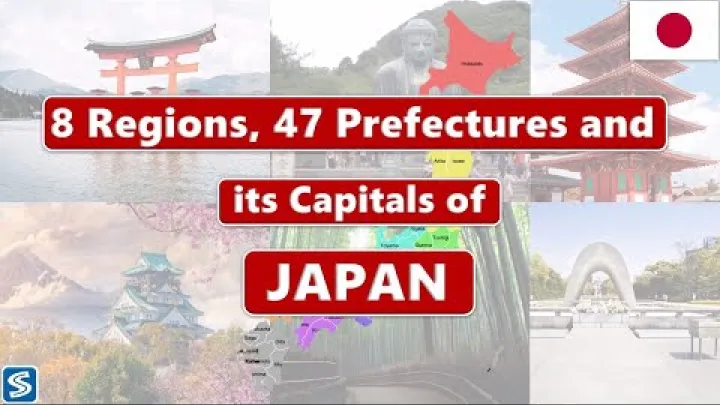
Japan administrative divisions are easiest to understand when legal government levels are separated from geographic labels. Japan is a unitary country with 47 prefectures as its first-level local divisions, and municipalities sit below them. Broad areas such as Kanto and Kansai are useful regions, but they are not a regular government tier. This guide explains the prefecture system, lists all 47 prefectures by a common regional convention, and shows how municipalities and Tokyo’s special wards fit into the hierarchy.
How Japan Is Divided: The Quick Answer
The short answer is that Japan has a national government, 47 prefectures, and municipalities below the prefectures. Regions, historical provinces, and districts may appear on maps or in addresses, but they do not all have the same legal status.
The National, Prefectural, and Municipal Levels
Japan is a unitary state rather than a federation of sovereign states. The national government operates across the country, while prefectures and municipalities are local public bodies with responsibilities established by national law and local ordinances.
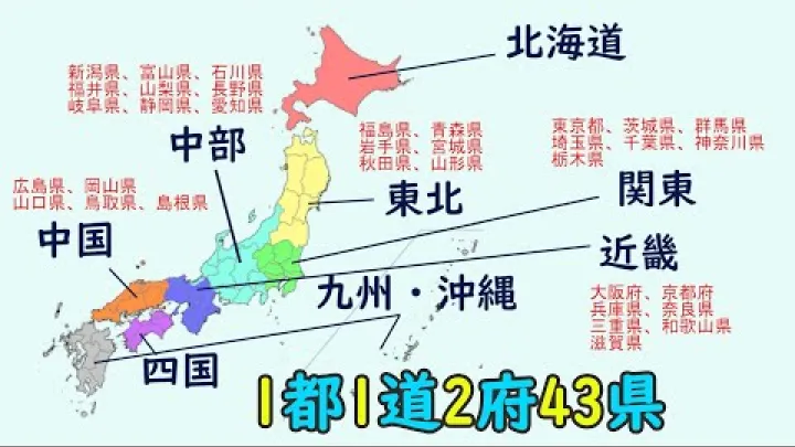
Prefectures are the first-level local divisions immediately below the national government. They are wide-area governments that encompass municipalities. An overview published by PMC describes the 47 prefectures as wide-area local governments. The basic structure can be read as follows:
| Level | What it includes | How to understand it |
|---|---|---|
| National government | Japan as a whole | Countrywide government |
| Prefectural level | 47 prefectures | First-level local divisions |
| Municipal level | Cities, towns, villages, and Tokyo’s special wards | Local governments closest to residents |
| Internal administration | Wards inside designated cities | Subdivisions of a municipality, not extra prefectures |
For example, Kyoto City is a municipality within Kyoto Prefecture, while Kyoto Prefecture is the wider first-level division. In central Tokyo, Shinjuku Ward is a special ward within Tokyo Metropolis; it is not a prefecture. A designated-city ward, by contrast, belongs internally to its city. These examples show why a place name alone may not identify its administrative level.
The legal picture also includes ordinary and special local public bodies. This is why Tokyo’s 23 special wards cannot simply be treated as ordinary city wards, even though both types of ward operate below the prefectural level. A broad region is normally left out of the hierarchy because it is a geographic grouping rather than a regular elected government.
Prefecture, Region, Municipality, and District: The Basic Terms
Several English terms are used together in maps, directories, and search results. They should not be treated as interchangeable.
| Term | Current status | Practical meaning |
|---|---|---|
| Prefecture | Legal first-level local division | Wide-area government below the national level |
| Region | Geographic grouping | Common label for maps, statistics, weather, and culture |
| Municipality | Legal local government | City, town, village, or special ward |
| District | Usually not an independent municipality | Geographic grouping, often associated with towns and villages |
| Historical province | Former territorial system | Historical or cultural reference, not a current prefecture |
| State or province | Not a current Japanese category | Search terms that usually point to prefectures |
A useful reading rule is to ask what the label can do. If it has a governor and prefectural assembly, it is a prefecture; if it has a mayor and municipal assembly, it is a municipality; if it groups several prefectures without a corresponding ordinary elected government, it is a region. A district in an address can narrow the location without being a municipality. This distinction prevents a map’s visual hierarchy from being mistaken for the legal hierarchy.
For this reason, a search for Japan states, states in Japan, Japan provinces, or whether Japan has provinces usually needs an explanation of prefectures. A map may also show a region or historical province next to a current prefecture. The label alone does not tell you whether it is a government unit.
The 47 Prefectures: Japan’s First-Level Divisions
Japan’s 47 prefectures are collectively called todōfuken in Japanese, written 都道府県. The term combines the four official designation types used within the prefectural system. Each designation has a historical background, but none is a separate sovereign level comparable to a state in a federal country.
The Four Official Prefecture Designations
The four designations are to, dō, fu, and ken. In English, they are generally translated using the common word prefecture, except that Tokyo is often called Tokyo Metropolis and Hokkaido is usually called Hokkaido.
| Designation | Japanese form | Count | Current example |
|---|---|---|---|
| Tokyo-to | 都 (to) | 1 | Tokyo Metropolis |
| Hokkaido-dō | 道 (dō) | 1 | Hokkaido |
| Fu | 府 (fu) | 2 | Kyoto and Osaka |
| Ken | 県 (ken) | 43 | All remaining prefectures |
Tokyo-to is commonly rendered as Tokyo Metropolis. Hokkaido is the only current prefecture using the dō designation. Kyoto and Osaka retain the fu designation, while the other 43 prefectures use ken. These names reflect historical and institutional distinctions, not four different levels of government.
The count used in this guide is 47 as of August 16, 2026. If the number, English spelling, Japanese romanization, or legal status matters for an address, statistical analysis, or official record, compare the result with a current Japanese government or statistical list and record that list’s publication date.
All 47 Prefectures Grouped by Common Region
The directory below uses one common eight-region convention: Hokkaido, Tohoku, Kanto, Chubu, Kansai or Kinki, Chugoku, Shikoku, and Kyushu and Okinawa. Each prefecture appears once. The regional column is for geographic orientation; it does not create an additional government level.
| Prefecture | Japanese name | Common region | Short identifier |
|---|---|---|---|
| Hokkaido | 北海道 (Hokkaidō) | Hokkaido | Northern island and prefecture |
| Aomori Prefecture | 青森県 (Aomori-ken) | Tohoku | Northern tip of Honshu |
| Iwate Prefecture | 岩手県 (Iwate-ken) | Tohoku | Northeastern Pacific coast |
| Miyagi Prefecture | 宮城県 (Miyagi-ken) | Tohoku | Pacific-facing central Tohoku |
| Akita Prefecture | 秋田県 (Akita-ken) | Tohoku | Northwestern Tohoku |
| Yamagata Prefecture | 山形県 (Yamagata-ken) | Tohoku | Southwestern Tohoku |
| Fukushima Prefecture | 福島県 (Fukushima-ken) | Tohoku | Southern Tohoku |
| Ibaraki Prefecture | 茨城県 (Ibaraki-ken) | Kanto | Northeastern Kanto coast |
| Tochigi Prefecture | 栃木県 (Tochigi-ken) | Kanto | Inland northern Kanto |
| Gunma Prefecture | 群馬県 (Gunma-ken) | Kanto | Inland northwestern Kanto |
| Saitama Prefecture | 埼玉県 (Saitama-ken) | Kanto | Inland area north of Tokyo |
| Chiba Prefecture | 千葉県 (Chiba-ken) | Kanto | Peninsula east of Tokyo Bay |
| Tokyo Metropolis | 東京都 (Tōkyō-to) | Kanto | Metropolitan prefecture and islands |
| Kanagawa Prefecture | 神奈川県 (Kanagawa-ken) | Kanto | Southwestern Kanto coast |
| Niigata Prefecture | 新潟県 (Niigata-ken) | Chubu | Northern Sea of Japan coast |
| Toyama Prefecture | 富山県 (Toyama-ken) | Chubu | Central northern coast |
| Ishikawa Prefecture | 石川県 (Ishikawa-ken) | Chubu | Noto Peninsula and Kanazawa area |
| Fukui Prefecture | 福井県 (Fukui-ken) | Chubu | Western central coast |
| Yamanashi Prefecture | 山梨県 (Yamanashi-ken) | Chubu | Inland prefecture near Mount Fuji |
| Nagano Prefecture | 長野県 (Nagano-ken) | Chubu | Mountainous inland Chubu |
| Gifu Prefecture | 岐阜県 (Gifu-ken) | Chubu | Inland central Honshu |
| Shizuoka Prefecture | 静岡県 (Shizuoka-ken) | Chubu | Pacific coast south of the Alps |
| Aichi Prefecture | 愛知県 (Aichi-ken) | Chubu | Central Pacific coast |
| Mie Prefecture | 三重県 (Mie-ken) | Kansai or Kinki | Pacific side of central Honshu |
| Shiga Prefecture | 滋賀県 (Shiga-ken) | Kansai or Kinki | Prefecture around Lake Biwa |
| Kyoto Prefecture | 京都府 (Kyōto-fu) | Kansai or Kinki | Central and northern Kansai |
| Osaka Prefecture | 大阪府 (Ōsaka-fu) | Kansai or Kinki | Urban Osaka Bay area |
| Hyogo Prefecture | 兵庫県 (Hyōgo-ken) | Kansai or Kinki | Western Kansai with two coasts |
| Nara Prefecture | 奈良県 (Nara-ken) | Kansai or Kinki | Inland Kii Peninsula area |
| Wakayama Prefecture | 和歌山県 (Wakayama-ken) | Kansai or Kinki | Southern Kii Peninsula |
| Tottori Prefecture | 鳥取県 (Tottori-ken) | Chugoku | Eastern Sea of Japan coast |
| Shimane Prefecture | 島根県 (Shimane-ken) | Chugoku | Western Sea of Japan coast |
| Okayama Prefecture | 岡山県 (Okayama-ken) | Chugoku | Southern Chugoku coast |
| Hiroshima Prefecture | 広島県 (Hiroshima-ken) | Chugoku | Southwestern Chugoku |
| Yamaguchi Prefecture | 山口県 (Yamaguchi-ken) | Chugoku | Western end of Honshu |
| Tokushima Prefecture | 徳島県 (Tokushima-ken) | Shikoku | Eastern Shikoku |
| Kagawa Prefecture | 香川県 (Kagawa-ken) | Shikoku | Northeastern Shikoku |
| Ehime Prefecture | 愛媛県 (Ehime-ken) | Shikoku | Northwestern Shikoku |
| Kochi Prefecture | 高知県 (Kōchi-ken) | Shikoku | Southern Shikoku |
| Fukuoka Prefecture | 福岡県 (Fukuoka-ken) | Kyushu and Okinawa | Northern Kyushu |
| Saga Prefecture | 佐賀県 (Saga-ken) | Kyushu and Okinawa | Northwestern Kyushu |
| Nagasaki Prefecture | 長崎県 (Nagasaki-ken) | Kyushu and Okinawa | Western Kyushu and islands |
| Kumamoto Prefecture | 熊本県 (Kumamoto-ken) | Kyushu and Okinawa | Central Kyushu |
| Oita Prefecture | 大分県 (Ōita-ken) | Kyushu and Okinawa | Northeastern Kyushu |
| Miyazaki Prefecture | 宮崎県 (Miyazaki-ken) | Kyushu and Okinawa | Southeastern Pacific coast |
| Kagoshima Prefecture | 鹿児島県 (Kagoshima-ken) | Kyushu and Okinawa | Southern Kyushu and islands |
| Okinawa Prefecture | 沖縄県 (Okinawa-ken) | Kyushu and Okinawa | Southwestern island chain |
For map users, the table can be read from broad to narrow: select a region, find the prefecture, and then locate its municipalities in a more detailed source. Island geography can make the visual layout non-linear: Tokyo includes mainland and island municipalities, Nagasaki includes islands, and Kagoshima and Okinawa extend across island groups. Those geographic facts do not change the prefecture count or the parent-child structure.
Regional membership is a convention, not a change to the list of prefectures. Mie is often associated with Tokai or another Chubu grouping, while Okinawa may be shown separately from Kyushu. The directory labels its chosen convention so that the 47 official units remain clear even when a map uses different regional boundaries.
Municipalities Beneath the Prefectures
Prefectures provide a wide-area framework, but municipalities are usually the level people encounter in daily life. A municipality may appear in an address, resident record, public-service application, statistical table, or local government website.
Cities, Towns, Villages, and Districts
The main municipality categories are cities, towns, and villages. Their Japanese terms are useful when reading Japanese addresses or government names, but the English translation does not always show every legal distinction.
| Municipal category | Japanese term | Role in the hierarchy |
|---|---|---|
| City | shi (市) | Municipal government with city status |
| Town | chō or machi (町) | Municipal government below the prefecture |
| Village | son or mura (村) | Municipal government below the prefecture |
| District | gun (郡) | Geographic grouping mainly associated with towns and villages |
Cities, towns, and villages are municipalities, so they have their own local institutions and budgets. They commonly handle services close to residents, such as local facilities, waste management, resident administration, welfare programs, and some education and utility services. Prefectural and municipal responsibilities can overlap, and a service may be coordinated across several municipalities.
Municipal status is not the same as population rank or urban prominence. A city remains a municipality because of its legal designation, while a town or village remains a municipality even if its area is rural, coastal, or spread across islands. For an address or dataset, use the named municipality rather than inferring it from the nearest major city.
A district, commonly translated as gun, should not be counted as a fourth municipal level. It can help identify a group of towns or villages and may occur in a Japanese address, but it does not function like a prefecture or an independent city government. Historical provinces and feudal domains are also separate from current municipalities.
Designated Cities and Administrative Wards
Some large cities are designated by the national government for expanded administrative responsibilities. They remain municipalities within their prefectures. For internal management, a designated city is divided into administrative wards, often called city wards.
An administrative ward inside a designated city is not an additional prefecture and does not become a separate municipality. Its ward office operates as part of the city government. This is different from Tokyo’s special wards, which are municipal-level entities within Tokyo Metropolis and have a distinct legal arrangement.
| Type of ward | Located inside | Legal position |
|---|---|---|
| Administrative ward | Designated city | Internal subdivision of the city |
| Special ward | Tokyo Metropolis | Municipal-level local entity under a special arrangement |
On a nested map, the correct path might therefore be Chubu → Aichi Prefecture → Nagoya City → one of Nagoya’s administrative wards. The ward helps identify the locality, but the municipality is Nagoya City. In Tokyo, the path may instead be Kanto → Tokyo Metropolis → Setagaya Special Ward, where the special ward itself is the municipality. The same word “ward” thus requires context.
This distinction matters on maps and in databases. A designated-city ward should normally inherit the designated city as its municipality and the surrounding prefecture as its prefectural parent. A Tokyo special ward is normally represented as its own municipality beneath Tokyo Metropolis.
Regions, Historical Provinces, and Common Search Terms
Japan’s regions help people describe broad geography, while historical provinces explain older place names. Neither should be substituted for a current prefecture when a form or dataset asks for the official first-level division.
The Eight Common Geographic Regions
One widely used model organizes Japan into eight regions. These labels appear in education, weather reporting, media, maps, statistics, and business descriptions. The List of Regions of Japan describes this common eight-region approach while also showing that other groupings exist.
| Region | Common scope in this guide | Administrative status |
|---|---|---|
| Hokkaido | Hokkaido island and prefecture | One prefecture, not a separate regional government |
| Tohoku | Northeastern Honshu | Six prefectures grouped geographically |
| Kanto | Eastern Honshu around Tokyo | Seven prefectures grouped geographically |
| Chubu | Central Honshu | Nine prefectures in this convention |
| Kansai or Kinki | Western-central Honshu | Seven prefectures in this convention |
| Chugoku | Western Honshu | Five prefectures grouped geographically |
| Shikoku | Shikoku island | Four prefectures grouped geographically |
| Kyushu and Okinawa | Kyushu and the Okinawa island chain | Eight prefectures in this convention |
There is no single universal answer to “how many regions” unless the source defines its scheme. The eight-region model is useful for a general map, but a weather bulletin, government dataset, or travel reference may combine or split areas for its own purpose. Treat a region name as metadata that explains the grouping, not as a replacement field for the prefecture.
These regions do not have their own ordinary elected governors or regional assemblies. They are useful because they make a map easier to read and provide a convenient way to compare neighboring prefectures. Regional names and membership can vary by government agency, statistical publication, weather service, school textbook, or cultural context. Before comparing prefectures in a map or dataset, read the stated regional convention, especially when it places Mie or Okinawa differently.
Historical Provinces and Former Territorial Systems
Historical provinces, known as kuni (国), belong to earlier territorial systems. Names such as Musashi, Yamato, and Tosa may appear in historical maps, literature, cultural descriptions, or regional branding, but they are not current prefectures.
Feudal domains, known as han (藩), were another former system associated with the shogunate-era political order. Domains were not modern local governments in the present sense, and their boundaries did not provide the current prefecture hierarchy. During the nineteenth-century transition to modern prefectural administration, the domain system was abolished and replaced by the prefectural framework.
Historical terms can still be valuable for understanding culture and older records. They should be labeled as historical whenever they appear beside current place names. A historical province or domain should not be added as a current parent above a prefecture or municipality.
Does Japan Have States or Provinces?
No. Japan does not use states or provinces as its current first-level government units. The official category is prefecture, and Japan’s 47 prefectures sit directly below the national government in the local administrative structure.
People sometimes compare a Japanese prefecture loosely with a province or state in another country because both can be large subnational areas. The comparison is only approximate. Japanese prefectures are not sovereign states in a federal system, and they do not have the constitutional position of states in countries such as the United States.
Therefore, search phrases such as Japan states and Japan provinces are usually asking for a list of prefectures. Regions are geographic groupings, and historical provinces are former territorial concepts. Neither is an alternative current category to prefectures.
Tokyo’s Special Administrative Structure
Tokyo is the part of Japan’s administrative system most likely to cause confusion. The name can refer to a prefecture-level entity, a special ward, a municipality elsewhere in the prefecture, or a broader metropolitan area used in everyday speech.
Tokyo Metropolis, the Capital, and the 23 Special Wards
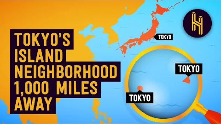
Tokyo Metropolis, or Tokyo-to, is one of Japan’s 47 prefectures. It has a metropolitan government and contains the 23 special wards in the central urban area, as well as other municipalities in western Tokyo and the outlying islands.
The 23 special wards are municipal-level entities. They are not ordinary administrative wards inside one city. Each has its own local government structure under the special-ward arrangement. A useful overview of this distinction is provided by Special Wards of Tokyo.
| Scope | What it means | Place in the hierarchy |
|---|---|---|
| Tokyo Metropolis | Prefecture-level metropolitan entity | One of the 47 first-level divisions |
| 23 special wards | Central urban municipalities | Municipal level within Tokyo Metropolis |
| Other Tokyo municipalities | Cities, towns, and villages in western Tokyo and the islands | Municipal level within Tokyo Metropolis |
| Greater Tokyo | Broader metropolitan-area idea used in some contexts | Not a single prefectural government |
Tokyo is commonly described as Japan’s capital because it performs the country’s central capital functions and is the seat of the national government. In this administrative hierarchy, however, it is treated as Tokyo Metropolis rather than as a separate federal capital district or an additional first-level category.
For practical lookup, “Tokyo” in a postal or statistical record should be expanded to the most specific available name. A record for Minato-ku belongs to Tokyo’s special-ward system, whereas a record for Hachioji-shi identifies an ordinary municipality within Tokyo Metropolis. A record for the Izu Islands may still use Tokyo Metropolis as its prefectural parent even though it is far from the central wards. Readers should follow the source’s naming convention when translating or matching these records.
When an address, map, directory, or statistic says Tokyo, confirm whether it means Tokyo Metropolis, one of the 23 special wards, another Tokyo municipality, or a broader metropolitan area. The scope affects comparisons of population, services, boundaries, and local government responsibilities.
How Japan’s Administrative Divisions Work in Practice
The hierarchy is useful because it connects a place name to the government or geographic area responsible for it. It is not, however, a perfectly rigid division of every public service. National, prefectural, and municipal bodies can share responsibilities or delegate tasks under Japanese law.
Prefectural and Municipal Responsibilities
Japan’s constitutional local-autonomy framework and Local Autonomy Act provide the basis for elected local institutions, local ordinances, budgets, and the relationship between prefectures and municipalities. The CLAIR overview distinguishes ordinary local public bodies from special local public bodies, which helps explain why Tokyo’s structure requires separate treatment.
As a general guide, prefectures coordinate issues that cross municipal boundaries, while municipalities focus on many services closest to residents. The exact assignment depends on the service and the applicable law.
| Level | Typical emphasis | Examples |
|---|---|---|
| Prefecture | Wide-area coordination | Some roads, rivers, public health, police, disaster coordination, and education functions |
| Municipality | Resident-facing local services | Resident administration, waste, local facilities, welfare, utilities, and many schools |
Both levels have elected institutions. A prefecture has a governor and prefectural assembly, while a municipality has a mayor and municipal assembly. This is why a prefecture should not be understood merely as a branch office of the national government, and a municipality should not be understood merely as an office of the prefecture.
Using Administrative Divisions in Maps, Addresses, Statistics, and Directories
A practical nesting order is: common region, prefecture, municipality, and then any ward, district, neighborhood, or smaller locality shown by the relevant source. The region is optional and descriptive. The prefecture and municipality are the key legal parents for most location records.
For example, “Kansai → Osaka Prefecture → Osaka City → a city ward” describes two descriptive or legal levels and one internal subdivision. By contrast, “Kanto → Tokyo Metropolis → Chiyoda Special Ward” ends at a municipal-level special ward. If a database has separate fields for country, region, prefecture, municipality, and ward, fill only the fields supported by the source; do not force a region or district into a legal field.
Not every map or dataset displays every level. A national map may show only prefectures. A regional map may group several prefectures under Kanto or Chubu. An address directory may show a city ward or a district, while a statistical table may use Tokyo Metropolis or an individual special ward as its reporting unit. A region should not replace a prefecture when the source requires an official administrative field.
For a location directory, preserve the current parent-child relationship of each municipality and use consistent English and Japanese names where both improve identification. Keep alternate romanizations or aliases as search aids rather than treating each alias as a separate place. Historical provinces and broad metropolitan labels should remain separate from current administrative records.
The 47-prefecture table in this guide also provides a text-based alternative to a visual Japan regions map. For an accessible location reference, combine that table with clear region headings and the municipality name. For Tokyo records, retain the exact scope named by the source, such as Tokyo Metropolis, a special ward, or another municipality within Tokyo, instead of flattening all of them into one label.
- Identify whether the source is using a prefecture, municipality, region, district, or ward.
- Record the current prefecture and municipality separately when both are available.
- Read the map or dataset’s regional convention before comparing regions.
- Keep administrative wards inside designated cities distinct from Tokyo special wards.
- Preserve the source’s stated Tokyo scope and the official spelling used for the record.
Conclusion: The Simple Way to Understand Japan’s Divisions
Japan’s current first-level administrative divisions are 47 prefectures, not states or provinces. Municipalities such as cities, towns, villages, and Tokyo’s 23 special wards sit below the prefectural level, while designated-city wards are internal subdivisions. Regions such as Kanto, Kansai, and Kyushu and Okinawa make maps and comparisons easier, but they are not regular governments.
For most practical purposes, identify the prefecture first, then the municipality, and treat regions and historical provinces as separate geographic or historical labels. Tokyo requires an extra scope check because Tokyo Metropolis, its special wards, other municipalities, and the broader capital area can all be described simply as Tokyo.
Select area
Create a post
Posting is free and no registration is required.