Japan Neighboring Countries: Land Borders & Maritime Neighbors
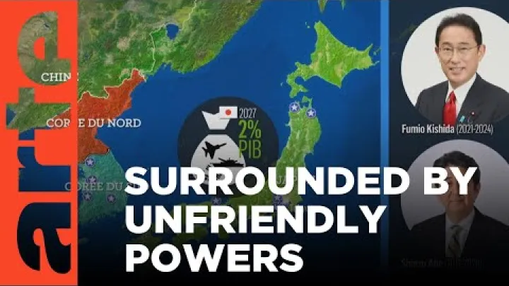
Japan neighboring countries are often discussed as though Japan had conventional national borders. It does not: Japan is an island country, so no other country shares a land border with it. The countries most often described as Japan’s neighbors lie across seas and straits, or are close to particular Japanese islands. This guide separates land borders from maritime and regional proximity, identifies the surrounding waters, and explains why disputed islands can make maps and country lists look different.
Does Japan Have Any Land Borders?
Japan’s geography explains why the answer differs from a typical country-border list. Its territory is spread across an island chain, so every international approach is across water rather than across a conventional land frontier.
Japan Has No Land-Bordering Countries
Japan has no land-bordering countries. No foreign country shares a terrestrial boundary with Japan. The Japanese archipelago, including Hokkaido and the southwestern Ryukyu Islands, is separated from neighboring coasts by seas and straits.
Therefore, the answer to questions such as what countries border Japan is none when border means a land border. A list of countries near Japan may still be useful, but it is a different list: it describes maritime or geographic neighbors, not countries that touch Japanese land. For the same reason, a standard land-border length is not applicable.
This distinction applies whether the comparison is made with a mainland state, such as China or Russia, or with a nearby island or peninsula. Physical closeness does not remove the water separating Japan from another country.
Neighboring Countries Are Not Always Nearest Countries
The word neighboring can describe several different geographic relationships. These terms should not be treated as interchangeable:
- Land-bordering country: a country whose territory touches Japan across a terrestrial boundary. Japan has none.
- Maritime neighbor: a country whose coast or islands lie across water from Japan and whose maritime zones may be relevant to a boundary discussion.
- Near neighbor: a country that is geographically close to some part of Japan, even when the relationship is not being described as a formally delimited maritime boundary.
This is why a search for the nearest country to Japan does not always produce one universal answer. The result depends on the Japanese reference point and the method of comparison. A point in Hokkaido can produce a different result from a point in Kyushu, Tsushima, or the Ryukyu Islands. Coast-to-coast distance, island-to-island distance, and distance between major cities also answer different questions.
Maps add another layer of complexity. A map may show a coastline, territorial sea, exclusive economic zone, claimed median line, or disputed boundary using different symbols. Before treating a maritime line as an agreed national boundary, check the map’s legend, terminology, and publication date. This is especially important when a country list uses neighboring as a broad geographic term rather than a legal one.
Which Countries Are Japan's Maritime Neighbors?
Because Japan has no land borders, commonly cited neighboring countries are separated from it by maritime space. Russia, North Korea, South Korea, China, and Taiwan are associated with Japan’s northern, western, or southwestern maritime neighborhood. The classification is geographic and does not mean that every related maritime line has been finally agreed.
Russia, North Korea, and South Korea
| Country | General direction | Main waters or feature | Geographic classification |
|---|---|---|---|
| Russia | North and northeast | Northern waters and the Kuril area | Maritime or near neighbor; island dispute affects maps |
| North Korea | West and northwest | Sea of Japan | Maritime or near neighbor; no land border |
| South Korea | West and southwest | Korea Strait and Sea of Japan | Maritime or near neighbor; separate island dispute |
Russia is part of Japan’s northern maritime geography. Hokkaido faces the Russian Far East across northern waters, while the Kuril island chain is important to the way maps describe the area between Japan and Russia. This relationship is therefore both geographically close and affected by an unresolved island dispute.
North Korea lies across the Sea of Japan from the Japanese archipelago. It has no land border with Japan. Its position is usually included in a broad list of countries near Japan because the two countries face one another across maritime space rather than because they share a conventional boundary.
South Korea is particularly important in descriptions of southwestern Japan because the Korea Strait separates the Korean Peninsula from Japanese islands including Kyushu and Tsushima. South Korea is also connected to the separate dispute over the Liancourt Rocks, known as Dokdo in Korean usage and Takeshima in Japanese usage. That dispute affects related maritime discussions, but it does not turn the Korea Strait into a land border.
Russia, North Korea, and South Korea should remain separate entries in a country list. They are located in different directions, are separated by different waters, and have different boundary and island issues. Calling all three maritime neighbors is a geographic shorthand, not a statement that their maritime relationships have identical legal status.
China and Taiwan Across the East China Sea
China and Taiwan are commonly included when describing Japan’s southwestern maritime neighborhood. Japan’s southwestern islands, including the Ryukyu Islands, face the East China Sea and the waters toward the Asian mainland and Taiwan.
China is a maritime and near neighbor across the East China Sea. Taiwan is also a distinct geographic reference point near the southern end of Japan’s island chain. In this article, Taiwan is discussed as a geographic entity to explain location. Political status and naming conventions vary among sources, so including Taiwan in a geographic list does not itself express a position on political recognition.
Proximity, overlapping maritime claims, and an agreed sovereign boundary are different things. A map may place Japan, China, and Taiwan close together while using different terminology for the islands, waters, or lines shown. For that reason, a careful list can identify China and Taiwan as maritime or near neighbors without presenting the relationship as a settled land border or as one universally accepted maritime boundary.
The Philippines and Japan's Southern Maritime Neighborhood
The Philippines lies south of Japan in the broader western Pacific and Philippine Sea region. It can appear on a regional map of countries connected to Japan’s southern maritime neighborhood, especially when the map includes Japan’s far-southern islands and the wider Pacific setting.
For a focused answer about Japan’s closest neighboring countries, the Philippines is better described here as a regional near neighbor rather than as an equivalent entry to a country across a narrow strait. Japan and the Philippines do not share a land border, and this geographic description does not assert a direct, fully delimited bilateral maritime boundary.
This distinction keeps the list useful. It acknowledges the Philippines’ regional proximity without suggesting that every country in the western Pacific should be presented as a direct neighbor in the same sense as South Korea, Russia, or China.
Seas and Straits Around Japan
Named seas and straits provide the clearest answer to what separates Japan from its neighboring countries. They also show why Japan’s borders are maritime rather than terrestrial.
The Sea of Japan and the Korea Strait
The Sea of Japan lies between the Japanese archipelago, the Korean Peninsula, and the Russian Far East. It is the main geographic water body used when describing Japan’s relationship with both North Korea and South Korea, as well as with Russia’s eastern region.
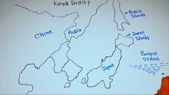
The Korea Strait is a key passage between the Korean Peninsula and southwestern Japan. It separates South Korea from Japanese islands such as Kyushu and Tsushima and provides a more specific geographic description than simply saying that the two countries are across the sea from one another.
Some Korean-language sources use the name East Sea for the body commonly called the Sea of Japan in English-language international geography. The alternate name can be explained as a naming convention without turning the article into a political argument. The important geographic point is that a named sea or strait separates the coasts; the name itself does not determine the legal status of maritime boundaries.
The East China Sea, Sea of Okhotsk, and Pacific Ocean
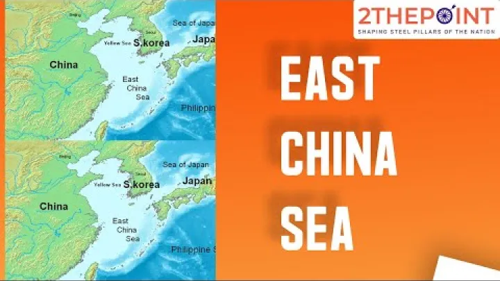
The East China Sea is west and southwest of Japan. It is the principal water setting for Japan’s geographic relationship with China and Taiwan and for the waters around the southwestern Japanese islands. The Sea of Okhotsk is north of Hokkaido and the northern island area, while the Pacific Ocean extends to the east of the main Japanese archipelago.
The Pacific Ocean is an ocean, not a country. Therefore, a statement that the Pacific borders Japan geographically should not be converted into a list of neighboring countries. It describes the body of water on Japan’s eastern side.
The Ryukyu Islands are useful geographic anchors because they extend Japan’s southwestern island setting toward the East China Sea and the waters near Taiwan. Their location helps explain why a map focused only on Honshu, Japan’s largest central island, can give a different impression from a map that includes the full Japanese archipelago.
The East China Sea also shows why geographic setting and maritime delimitation must be kept separate. The U.S. Energy Information Administration describes the Chunxiao oil and natural gas field near the Okinawa Trough and places the discussion in relation to China’s side of the EEZ under Japan’s median-line claim. That example concerns a maritime interpretation and resource context; it is not evidence of a land border.
How Japan's Maritime Borders Work
An island country can have extensive maritime zones even though it has no land-bordering country. Understanding the difference between those zones and a national land border makes Japan’s geography easier to read.
Territorial Seas and Exclusive Economic Zones
A territorial sea is the belt of water next to a coast in which the coastal state exercises sovereignty, subject to international law. An exclusive economic zone, or EEZ, is different. It gives the coastal state specified rights over natural resources and certain economic or jurisdictional matters, but it is not the same as full territorial ownership of all the water within the zone.

For Japan, islands can generate maritime zones even when no foreign coast touches Japanese land. This is why an island country can have a large and complex maritime neighborhood. The shape and reach of a maritime zone can depend on the relevant coast, islands, legal rules, and whether another state has a competing entitlement.
A broad background overview is provided by Exclusive economic zone of Japan. The core point for a general geography question is simple: an EEZ is a legal maritime zone, not a synonym for land territory and not proof that a country shares a land border with Japan.
Overlapping Claims and Unsettled Delimitation
Maritime entitlements can overlap when coasts or islands are close. Governments may agree on a boundary, adopt a provisional arrangement, or leave delimitation unresolved. A median or equidistance line shown on a map may represent one state’s claim or a working assumption rather than a universally accepted boundary.
![Preview image for the video "[1st Year_Week 9-3] "Maritime Boundary and Overlapping Claims Area"".](/sites/default/files/styles/media_720x405/public/oembed_thumbnails/2026-08/GrHqtH4lz614Gk0o7f7Ja1dpZHQGQRZL7_eo2iSPTc0.jpg.webp?itok=mSwT9T1g "Preview image for the video \"[1st Year_Week 9-3] "Maritime Boundary and Overlapping Claims Area"\".")
Small islands and disputed features can affect the shape of maritime claims, but an overlapping EEZ does not by itself decide sovereignty over an island or settle the entire maritime frontier. A claim to resource rights is also not the same as a determination of territorial title.
For a legal, academic, navigation, or policy purpose, check current official boundary information before relying on an EEZ limit, maritime claim, or disputed line. Confirm whether the source marks the line as agreed, claimed, provisional, or disputed, and note its publication date. This matters because maps can simplify changing positions and may use different baselines or terms.
Disputed Frontiers in Japan's Neighborhood
The absence of land borders does not mean that Japan has no frontier disputes. Several small islands and island groups affect how surrounding waters and maritime claims are described. These disputes should be kept separate from the basic geographic fact that Japan is an island country with no conventional land border.
The Kuril Islands and the Northern Territories
Japan and Russia dispute the status of the four southernmost Kuril Islands. In Japanese usage, the islands are commonly called the Northern Territories, while Kuril Islands is the broader geographic term used in other contexts. The different labels reflect differing historical and political positions and should not be treated as proof that the sovereignty question has been resolved.
The islands are part of the northern setting near Hokkaido, so their status affects how maps describe Japan’s northern maritime frontier and the surrounding waters. It does not change the basic classification used in this article: Japan has no conventional land border with Russia.
For background on the disagreement over the four southernmost islands, see the Kuril Islands dispute.
The Senkaku, Diaoyu, and Tiaoyutai Islands
The island group known as the Senkaku Islands in Japan, the Diaoyu Islands in China, and the Tiaoyutai Islands in Taiwan is disputed by Japan, China, and Taiwan. The features are in the East China Sea, so their status is linked to arguments about surrounding maritime claims as well as to the wider geography of Japan’s southwestern islands.
All three principal names can appear in maps and articles. A neutral geographic explanation can identify the names without endorsing one claim. The dispute concerns islands and their maritime implications; it is not a land border between the Japanese mainland and a neighboring country.
A background account of the competing positions appears in the Senkaku Islands dispute. It should be read as background on the claims and terminology, not as a final ruling on sovereignty or on the legal consequences of every surrounding maritime line.
The Liancourt Rocks, Dokdo, and Takeshima
The Liancourt Rocks are a disputed feature known as Dokdo in Korean usage and Takeshima in Japanese usage. Japan and South Korea maintain competing positions on the feature. Its location near the Korean Peninsula makes it relevant to discussions of Japan-South Korea maritime delimitation, but physical proximity alone does not determine sovereignty or create a conventional land border.
The names should be presented together when the goal is to help international readers recognize the same geographic feature in different sources. A specialist legal analysis available through Digital Commons examines Dokdo and Takeshima in relation to maritime delimitation. That context helps explain why a very small feature can matter to the drawing of maritime claims while remaining separate from the simple answer that Japan has no land-bordering country.
Conclusion: Japan Has Maritime Neighbors, Not Land Borders
Japan shares no land border with another country. Russia, North Korea, South Korea, and China are commonly described as maritime or near neighbors; Taiwan can be included as a distinct geographic entity with a neutral status note, and the Philippines is better treated here as a broader regional near neighbor. None of these descriptions should be read as a claim that every maritime line is agreed.
The main waters to remember are the Sea of Japan, Korea Strait, East China Sea, Sea of Okhotsk, and Pacific Ocean. Separating physical proximity from territorial seas, EEZs, agreed delimitations, and disputed claims gives the clearest answer to questions about Japan borders and Japan’s nearest countries.
Select area
Create a post
Posting is free and no registration is required.