AIR KBZ | Takeoff from Kengtung Airport. ATR 72-600 | XY-AMF
Footage of an Air KBZ ATR 72-600 taking off from Kengtung Airport, with clear airport and flight-operation context for travelers arriving in Kengtung.
Browse videos about Myanmar, including local walks, travel tips, daily life, and area guides.
Footage of an Air KBZ ATR 72-600 taking off from Kengtung Airport, with clear airport and flight-operation context for travelers arriving in Kengtung.

A firsthand Yangon-to-Naypyidaw train journey that concludes at Naypyidaw Railway Station, showing the train interior and the station arrival environment.

A step-by-step visual guide to buying Yangon–Naypyidaw–Mandalay DEMU train tickets online, including route selection and the booking process.

Footage of an official arrival at Nay Pyi Taw International Airport, showing the aircraft, tarmac, terminal exterior, and the airport arrival sequence.

Footage from Bago showing record October rain, flooded roads, and the effects of extreme monsoon conditions on transport and access.
News footage showing severe monsoon flooding in Bago and its effects on homes, waterways, roads, and local movement.
A day in Bago visiting major cultural and historic landmarks, including Shwemawdaw Pagoda, Hinthar Kon Pagoda, Maha Zedi Pagoda, and the ancient city walls.
A travel guide covering Yangon and Bago, with on-the-ground views of Bago’s landmarks, local streets, and day-trip experience.
A short visual montage of Mrauk U showing local markets, river transport, temple and palace remains, and the atmosphere of the central area.

A detailed visual tour of Koe Thaung Temple highlights its large scale, maze-like passages, architectural details, and numerous Buddha images within the monument.

A visual tour of Mrauk U’s distinctive grey-stone temples, thick walls, enclosed passages, and religious monuments set within the surrounding Rakhine landscape.

This firsthand departure video shows the practical airport experience at Sittwe, including the terminal, tarmac boarding process, and baggage handling.

A firsthand 2013 travel view of Sittwe, including local streets and everyday urban scenes that help establish the feel of the city’s central areas.

International Crisis Group maps the conflict in western Myanmar and explains the strategic and humanitarian significance of Sittwe within the wider Rakhine State fighting.

A route-focused transport overview for reaching Mrauk U, including the flight-and-boat option and comparisons with longer overland journeys.
A short first-hand view of boarding and leaving Sittwe by ferry for Mrauk U, showing the boat and river departure experience.

An English-language introduction to Rakhine cuisine, including Rakhine Mont Di and coastal seafood dishes, with explanations of ingredients, preparation, and regional food traditions.
An English-language visit to Mrauk U featuring a local meal and street-food experiences, offering a practical visual sense of casual dining in town.

This English-language documentary visits a local restaurant in Mrauk-U and explores traditional Rakhine food, food-security pressures, and the changing cost of meals.

A brief promotional look at Mrauk U Princess, including the resort grounds, pool, rooms, and surrounding landscape.
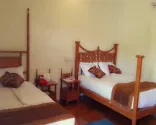
A short visual room tour of Nawarat Hotel in Mrauk U, showing the room layout, bathroom, and basic facilities that help travelers compare local accommodation standards.

Footage of a long-distance bus journey in Myanmar, including boarding, the road experience, and roadside rest stops relevant to planning an extended overland trip.

A cockpit-view ATR 72-600 landing at Sittwe Airport, showing the approach and runway at AKY/VYSW from the air.
This short travel video shows rural paths, local life, and the terrain around Mrauk U, offering a grounded look at conditions encountered beyond the main temple sites.
High-quality 4K drone footage captures Mrauk U's temple complexes from above, including atmospheric sunrise views that showcase the area's scale, architecture, and surrounding landscape.

An English-language visual guide to Mrauk U's principal temples and archaeological sites, showing how the major cultural sights can be explored on foot.

A narrated visit to Mrauk U's ancient temples, with clear footage of the archaeological sites and practical context for experiencing the area during the more favorable travel season.
This Japanese-language travel vlog follows a journey from Yangon to Sittwe, comparing air and bus travel while showing the route, travel time, and historical fare context.
A Myanmar-focused disaster-preparedness video demonstrating practical actions and safety measures for storms and cyclones affecting coastal communities.

News footage from Cyclone Mocha shows flooding and infrastructure damage in Sittwe, illustrating how severe coastal weather can disrupt streets, transport, and port activity.

Footage of the river journey from Sittwe to Mrauk U, showing boat travel and changing views along the Kaladan River in Rakhine State.

An English-language overview of Sittwe Port on the Kaladan River, showing the port's coastal setting and its role in the India–Myanmar Kaladan transport connection.
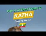
A brief visual guide to four attractions in Katha, including the Chindwin riverfront, central market, and local temples, offering a useful overview of the town’s sightseeing geography.
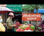
A vivid morning visit to Myitkyina Market, showing local stalls, activity, and the everyday atmosphere around one of the city's central visitor anchors.

A Burmese documentary on Myanmar Railways featuring historical maps, photographs and archival footage that illustrate the country's railway development.

A journey through Katha exploring its association with George Orwell, Burmese Days and the town's colonial-era landmarks and atmosphere.

A wordless visual journey across Indawgyi Lake, showing boat-based life, expansive lake scenery, and the Shwe Myitzu Pagoda.
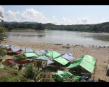
Footage of the Myitsone confluence shows the meeting of the rivers, surrounding landscape, and visitor area north of Myitkyina.

This video shows an aircraft’s approach and landing at Myitkyina Airport, offering a clear visual impression of the arrival experience.

A visual walkthrough of the Myanma Railways online ticketing process, including the screens and steps travelers may encounter when checking rail bookings.

This short video provides a clear visual look at Myitkyina Airport, including the terminal building and passenger arrival area after landing.

This English-language report examines the operational status and security situation along the Mandalay–Myitkyina road corridor, including its significance for overland travel.
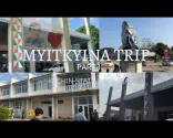
This travel vlog documents a flight from Yangon to Myitkyina, including the arrival at Myitkyina Airport and the first stages of reaching Kachin State.
A short visual tour of Hotel King in Katha, showing room configurations, lobby areas, and basic facilities relevant to comparing local accommodation standards.
A road-trip video following the transfer from Myitkyina to Putao, showing the vehicle, loading process, road conditions, stops, and practical realities of a longer regional excursion.
A short travelogue of the train journey to Myitkyina, including the route experience and ticket pricing, helping illustrate the time and fare trade-offs of rail travel from Mandalay.

A Burmese-language street-food tour in Myitkyina showing local dishes and pricing information, useful for visualizing the meals and market-style foods behind a low-cost daily food budget.
A travelogue of an Irrawaddy riverboat journey in November, with boat views, village stops, temples, riverbanks, and interactions with local communities.

A walking tour of Katha showing riverside activity, local markets, temples, and everyday town life in clear, dry-looking conditions.
![【K】Myanmar Travel-Myitkyina[미얀마 여행-미치나]이라와디 강이 시작되는 미치나/Irrawaddy River/Start point](/sites/default/files/styles/regional_content_list_1x/public/oembed_thumbnails/2026-08/VJELqp88ZlCeHchl1Om3XQM23V_9TuwFFBgz-v39pcA.jpg.webp?itok=p43ewn0x)
This short travel segment introduces Myitkyina and the Irrawaddy River, including the area where the river begins at the meeting of the N'Mai and Mali rivers.

A short visual tour of Myitkyina highlights cultural landmarks, natural attractions, and the local night market.

Footage from Myitkyina shows severe monsoon flooding, including submerged streets and homes, illustrating how heavy rain can affect low-lying parts of the city.

High-definition footage of Marcus Island in the Mergui Archipelago, illustrating the remote island setting, offshore scenery, and resort-style alternative to staying in Myeik city.

A short walking vlog around Myeik's waterfront and harbor area, offering visual context for Strand Road, working-city activity, and the relationship between central streets and the water.
A street-level look at Kan Phyar Road in Myeik, showing the road environment and everyday city feel around one of the town's practical accommodation corridors.

A visual montage of Kawthaung landmarks, including hilltop viewpoints, pagodas, and Bayintnaung-area sights around Myanmar’s southernmost town.

A short Burmese-language visit to a scenic island viewpoint near Kawthaung, offering visual context for adding a viewpoint to a local sightseeing loop.
Visual footage of a longtail boat crossing from Ranong in Thailand to Kawthaung in Myanmar, illustrating the maritime border journey.
News footage showing buses and trucks blocked on the Dawei–Myeik road, illustrating how checkpoints, disruptions, and long delays can affect overland travel in the region.

A first-person arrival at Myeik Airport, including views of the terminal and airport grounds that help show what the MGZ arrival experience looks like on the ground.

A visual overview of the Myeik Archipelago, featuring island scenery, beaches, and coastal landscapes that convey the range of experiences available beyond the city.

A detailed walk around Myeik, with views of the waterfront, city streets, local surroundings, and a pagoda hike that helps illustrate the city’s urban sightseeing experience.

An English-language firsthand look at Kawthaung Airport, showing the small terminal, arrival environment, and the basic airport infrastructure travelers encounter before arranging a local transfer.

This boat-crossing video shows arrival in Myanmar from Thailand, including the Kawthaung landing area and the onward immigration process at the jetty.
A detailed visual account of crossing by boat from Ranong to Kawthaung, including Thai and Myanmar immigration steps, boarding, and the river journey between the two ports.
A short Kawthaung-based feature about a low-cost island day-tour package, showing the trip experience and package-focused travel context.
A two-day overland journey from Myeik to Kawthaung, documenting the road conditions, geography, and practical time commitment involved in travelling through southeastern Myanmar.

A detailed tour of Sate Nge Market in Myeik, featuring local produce, seafood, and other goods with prices shown throughout the market visit.
A concise visual tour of Eain Taw Phyu Hotel in Myeik, covering room configurations, amenities, and the overall standard of a comfortable city hotel.
A short walkthrough of Hotel Drift in Myeik, showing its room categories, including a dormitory option, along with the property’s facilities and layout.

A visual tour of beaches and islands in the Myeik Archipelago highlights aerial coastal views, turquoise water, island scenery, and photography opportunities near Kawthaung.

A short city tour of Kawthaung shows local streets, market scenes, everyday town life, and the coastal setting around Myanmar’s southern border town.
A motorcycle journey from Bokpyin to Kawthaung captures real road conditions and travel through Myanmar’s rainy-season landscape in the Tanintharyi region.
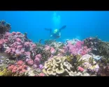
Short footage from a dive at Bond Rock in the Mergui Archipelago, showing the setting for underwater activities around Myanmar's remote islands.
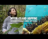
An island-hopping travelogue featuring sandy and rocky beaches, island landscapes, boat transfers, and outdoor exploration in the Myeik Archipelago.

Travel footage showing Myeik's coastal setting, including the transition from land transport to boat travel toward the archipelago.
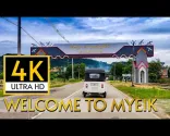
A continuous drive through Myeik filmed during the monsoon season, showing local streets, traffic, and wet-season conditions in the city.
A visual tour around Dawei city center, showing local streets, traditional wooden architecture, commercial areas, shops, and the everyday atmosphere of the town.

Short atmospheric footage of Mount Zwekabin, the surrounding plains, and monastery grounds, conveying the scenery and quieter retreat-style setting outside central Hpa-An.
An English-language Hpa-An travel vlog showing a countryside outing, motorbike rental, Saddan Cave, and the boat journey connected with a typical sightseeing day.

An English-language day in Hpa-An covering local transport, tuk-tuk arrangements, and the practical process of reaching countryside attractions from town.

Footage from Hpa-An showing the Thanlwin (Salween) River, nearby scenery, and the wider landscape around the town and Mount Zwekabin.
A visual visit to Kan Thar Yar Lake in Hpa-An, including the lake, bridge, and surrounding public spaces that help illustrate the feel of the central area.
A concise English-language city tour of Mawlamyine covering key landmarks and a segment along Strand Road, helping visualize the city's layout and central areas.
A continuous walking tour along Mawlamyine's Strand Road beside the Thanlwin River, showing the promenade, street environment, and waterfront atmosphere.
A short observational video of local bus transport in Mawlamyine, showing the practical feel of regional bus travel and arrival logistics.
A visual tour of several prominent pagodas in Dawei, showing their architecture, grounds, and religious setting as cultural landmarks within the city.
A walk through Dawei’s downtown market, showing local products, stalls, food, and the atmosphere of everyday shopping in the town center.

A concise visual visit to Maungmagan Beach near Dawei, showing the shoreline, beach atmosphere, and surrounding coastal setting without relying on detailed narration.

A short travel film showcasing Dawei and the wider Tanintharyi Region, including cultural sites, markets, coastal scenery, and everyday landscapes. Burmese narration is accompanied by English captions.
A concise Hpa-An sights overview with visual coverage of Kyauk Ka Lat and the area’s cave, pagoda, and limestone landscapes.
A concise visual record of the Taung Wine Mountain climb near Hpa-An, showing the steep jungle trail, iron staircase, and summit views across the surrounding landscape.
An English-language tour of Sadan Cave and Yathaypyan Cave, including cave interiors, surrounding scenery, and the distinctive religious atmosphere of Hpa-An’s limestone sites.

A short visual introduction to Hpa-An and Kayin State, showing the town’s limestone landscape, rural surroundings, and prominent religious sites.
A detailed visit to Mawlamyine's Mon Cultural Museum, covering exhibits and cultural insights about Mon identity, traditions, clothing, and local history.

A firsthand visual journey on the railway between Ye and Dawei, showing the scenery, train conditions, stations, and the slow pace of travel along Myanmar’s southern rail corridor.

An English-language account of traveling by long-tail boat from Mawlamyine to Hpa-An on the Thanlwin River, showing the boat, river scenery, and journey experience.
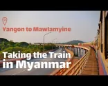
An English-language first-person account of the train journey from Yangon to Mawlamyine, showing stations, the carriage experience, and scenery along the rail route.
An English-language news report showing the second Thai-Myanmar Friendship Bridge between Mae Sot and Myawaddy and its reopening for border trade.

A road journey from Yangon to Hpa-An showing the route through Bago and Thaton, key bridges, changing road scenery, and arrival in Hpa-An.
Posting is free and no registration is required.