Mawlamyine Travel Guide: Places, Costs & Travel Advice
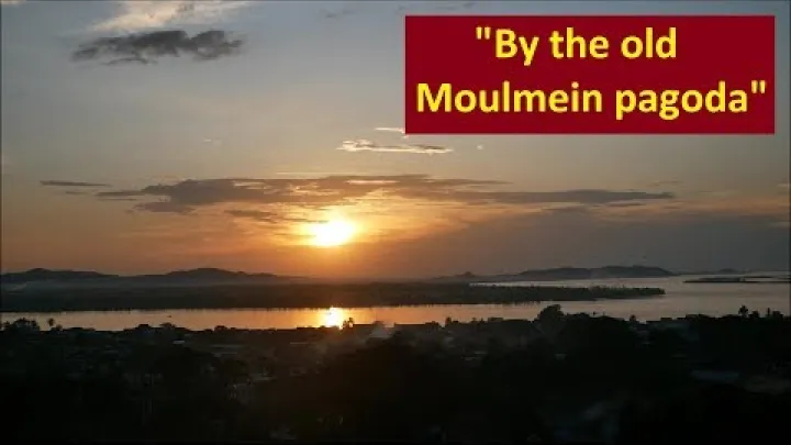
Mawlamyine is a riverfront city in Mon State with a slower travel rhythm, a strong Mon cultural setting, hilltop pagodas, historic streets, and views across the Thanlwin River. For a future visit, however, the first question is whether travel to the intended part of Myanmar is currently appropriate, not which attraction to visit. This Mawlamyine travel guide explains where to base yourself, how the city is laid out, what to see, when to go, how transport has worked historically, and how to plan costs. Use it as a flexible planning framework, while treating current safety, entry, access, transport, and prices as separate checks.
Check Current Travel Conditions Before Planning a Trip
Mawlamyine should not be planned in isolation from Myanmar's wider security and administrative conditions. Start with the current travel decision, then research the destination details that will help if a later trip becomes suitable.
Read the Current Advisory Before You Book
Update note: 8 August 2026. The latest GOV.UK Myanmar travel advice, updated 4 August 2026, says that the conflict is increasingly volatile and advises against all travel to parts of the country. Read its regional wording carefully for Mon State, Mawlamyine, and every road or connection included in a proposed itinerary.
This is a go-or-no-go decision, not a minor planning detail. If the intended destination, route, or transfer point is covered by an official warning against travel, postpone a leisure trip rather than relying on an older blog, a hotel confirmation, or a recent-looking social media post. A general description of Mawlamyine as calm, welcoming, or easy to reach at some point in the past cannot establish that it is suitable now.
Older travel guides often describe easy overland circuits from Yangon through southern Myanmar. That information can explain the city's historical position on a regional route, but it does not confirm present safety, border access, road conditions, checkpoint arrangements, or the operation of attractions. Keep research for a later trip separate from the current decision to travel.
If the official guidance permits the intended journey at a later date, use flexible bookings and avoid making the first plan dependent on a single nonrefundable room, boat, road connection, or excursion. The purpose of this guide is to help you understand the destination when conditions support travel, not to encourage travel against current advice.
Verify Entry, Permissions, and Route Status
Entry formalities and local access are two different checks. Before departure, confirm both through a current Myanmar diplomatic or immigration channel and through the relevant transport or local authority where appropriate.
- Entry documents: Confirm visa eligibility, passport requirements, entry documents, and any conditions attached to your nationality or point of entry. Do not copy historical visa validity or entry rules from an old travel guide.
- Permitted areas: Ask whether foreign visitors may travel to the intended part of Mon State and whether any local permission is required for a road, rural area, island, religious site, or border-adjacent destination.
- Route status: Check whether the intended road, checkpoint sequence, railway connection, bus route, or border crossing is open and permitted. A route shown on a map may not be usable.
- Booking evidence: Treat a reservation as evidence that a provider accepted a booking, not as proof that authorities permit the journey or that the service will operate.
Record the date and channel used for each confirmation. If an embassy, consulate, immigration office, carrier, or station gives information that differs from an old online source, use the current official or direct operator information and reconsider the itinerary. Keep a simple pre-departure checklist covering travel advice, entry eligibility, local permissions, the route, transport departures, and the access status of any essential attraction.
Understand Mawlamyine's Setting and Character
Once the trip is appropriate to consider, Mawlamyine makes more sense when viewed as a connected urban landscape rather than a list of isolated sights. Its river, religious ridge, commercial streets, and transport hubs create different experiences within a relatively elongated city.
See Mawlamyine as a Mon, River, and Colonial Heritage City
Mawlamyine is the capital of Mon State and is shaped by Mon cultural heritage, Theravada Buddhist institutions, river commerce, and colonial-era history. Older English-language sources may use the name Moulmein, so that spelling can be useful when reading historical material or comparing older maps.
Mon identity is not simply a theme for visitors to consume. It is part of the region's language, history, religious life, food traditions, and cultural institutions. A respectful visitor should approach the Mon Cultural Museum and religious sites as places of local meaning, not only as stops on a sightseeing checklist.
The Thanlwin, also known internationally as the Salween, is central to the city's character. The river helps explain the importance of the waterfront, the broad views, the possibility of island and boat excursions, and the way daily activity can feel connected to water transport. On land, pagodas and other religious institutions occupy the hill ridge, while commercial streets and older buildings form a more practical urban core.
Mawlamyine's historic appeal comes from these layers existing together. A short walk may combine a market, a tea shop, a religious building, a river view, and older architecture. The experience is less about one monumental complex and more about noticing how Mon, Buddhist, commercial, and colonial influences meet in the same city.
Use the Riverfront, Hill Ridge, and Central Core to Get Oriented
For a first visit, read the city through practical zones:
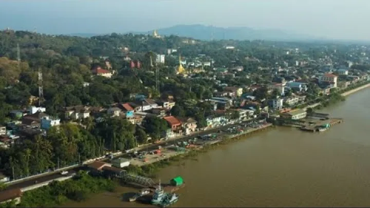
- Thanlwin riverfront: Useful for walks, views, orientation, and observing river life. It is also the starting point for asking about possible boat or island trips.
- Hilltop pagoda ridge: The area around Kyaikthanlan Pagoda and other elevated religious sites is important for temple visits and views, but uphill movement can be tiring in hot weather.
- Central commercial area: This is the most useful zone for everyday food, markets, local services, errands, and a first introduction to city life.
- Transport hubs: Mawlamyine railway station and the intercity bus station are logistics landmarks. They may be useful for arrival or departure without being the best places for a complete sightseeing base.
- Southern and rural access roads: These lead toward selected excursions and countryside areas, but they should be treated separately from the compact city core.
A Wikivoyage city guide describes Mawlamyine as extending roughly 5.5 kilometres along the river. The exact figure is less important than the planning lesson: the city is elongated, so two places that look close on a broad map may still require a ride, especially when one is uphill or near a transport hub. Use functional zones to choose accommodation and plan each day instead of assuming that every sight is within a short walk.
Match the City to a Slower, Culture-Led Trip
Mawlamyine suits travelers who want time for pagodas, riverfront walks, markets, local food, photography, and conversations or observations of everyday city life. It is better approached as a place to absorb gradually than as a destination where every hour must be filled with attractions.
A two-night stay is a useful framework for the central city: one day can cover orientation, the riverfront, historic areas, and the pagoda ridge, while another can include the Mon Cultural Museum and one carefully selected optional activity. Three or four nights allow more rest, better pacing in heat, repeat visits to the riverfront or hilltop, and a possible excursion if transport and access suit the conditions.
This slower structure also makes the city easier to combine with a broader Myanmar itinerary. If you prefer tightly scheduled attractions, extensive nightlife, or a large choice of internationally oriented services, Mawlamyine may require more preparation than Yangon. If you value cultural context and flexible days, its layout can become part of the experience.
Choose Where to Stay in Mawlamyine
Where to stay in Mawlamyine affects how much time you spend walking, using local transport, reaching the river, and preparing for an early departure. Choose by function rather than by an unverified hotel ranking or an assumption that every listed property is currently operating.
Riverfront and Central Commercial Area: Best All-Round Base
For a future first visit, the riverfront and nearby central commercial area are the most practical default base areas. They place you closer to river walks, local markets, eateries, everyday services, and the streets that help you understand the city. They also offer a reasonable starting point for reaching the hilltop pagoda ridge by foot or local ride, depending on the exact location and the day's heat.
This base works especially well for travelers who want a mix of sightseeing and ordinary logistics. You can begin with a market or breakfast, return to rest during the hottest part of the day, and go out again for the riverfront or pagoda views. It is also easier to find food and solve small practical problems when you are near the central commercial area.
The trade-off is atmosphere. A central location may be livelier and less quiet than a peripheral or hill-based stay. A river-facing room can provide a pleasant setting, but do not assume that every property has an unobstructed view, reliable services, or current availability. Compare the exact location, access, payment terms, and departure arrangements before confirming.
Hill Ridge and Transport Hubs: Quieter or More Practical Alternatives
A stay near the hill ridge may suit visitors who value temple access, elevated views, or a quieter setting. The disadvantage is that riverfront walks, markets, and practical errands may require a longer walk or a local ride. This option is strongest when the accommodation itself is the main part of the experience and you do not need to return to the central area several times a day.
Accommodation near the railway station or intercity bus station can be useful for an early departure or a late arrival. It is less convenient as a general sightseeing base if the main activities are along the riverfront, central streets, or hill ridge. Peripheral or southern accommodation may provide more space or easier access to a particular excursion, but it can reduce food choices and increase reliance on local transport.
| Base area | Best for | Main advantages | Trade-off |
|---|---|---|---|
| Riverfront and central area | Most first-time visitors | Food, markets, walks, services, orientation | More activity and possible noise |
| Hill ridge | Views and temple access | Quieter setting and proximity to pagodas | Less convenient for riverfront errands |
| Railway or bus station area | Early or late intercity travel | Practical departure logistics | Less convenient for daily sightseeing |
| Peripheral or southern area | Space or excursion focus | Potentially easier rural access | Fewer services and more rides needed |
Plan What to See and Do
A useful Mawlamyine itinerary combines a small number of named anchors with time to walk, rest, and respond to local conditions. Begin with the city core, then add the river and one optional excursion rather than trying to cover every possible site.
Visit the Pagoda Ridge and Historic City Core
Kyaikthanlan Pagoda is the clearest starting point for the hilltop religious landscape. It is associated with elevated views and a long regional Buddhist history. The Kyaikthanlan Pagoda reference provides basic historical orientation, but historical descriptions should not be treated as proof that the site is currently open, fully accessible, or operating under unchanged visitor rules.
Walk or ride through the hilltop pagoda ridge according to your energy and the weather. Then connect that experience with the Mon Cultural Museum, central commercial streets, local markets, and historic streets where older architectural layers may still be visible. The value of the route lies in the connection between religious, cultural, commercial, and colonial-era settings rather than in collecting a fixed number of buildings.
Religious sites require respectful clothing and behavior. Cover shoulders and knees, remove footwear where required, follow signs or local instructions, and avoid treating active worship as a photo opportunity. Opening times, photography rules, preservation conditions, and visitor access can differ between sites, so use the information available locally on the day instead of assuming that an old guide describes every current rule.
Use the Riverfront for Walks, Views, and Possible Boat Trips
The Thanlwin riverfront is one of the easiest ways to experience Mawlamyine without arranging a full excursion. A walk can provide orientation, broad river views, opportunities to observe daily activity, and a different perspective on the hill ridge. Late afternoon or evening may be more comfortable than the hottest part of the day, while daylight is useful when you want to understand the layout.
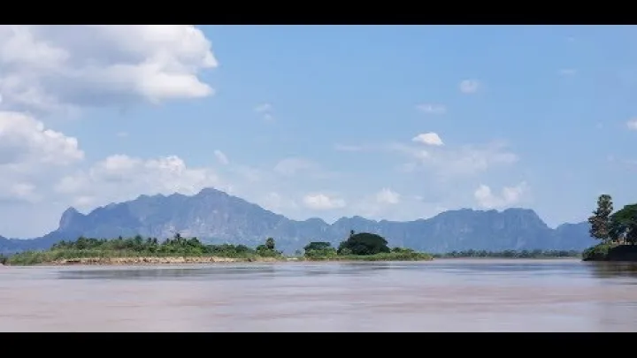
Nearby islands may be visible from the waterfront, and local boat trips or island visits may sometimes be possible. Treat these as separately arranged activities, not as an automatic extension of a riverfront walk. A boat trip can depend on the person operating it, river conditions, weather, local rules, return arrangements, and whether visitors are permitted to land at the intended place.
For that reason, do not build an essential itinerary around an informal boat schedule or an assumed fare. If a water excursion cannot be arranged, the riverfront walk remains a complete activity in its own right. Combining it with the market, the historic core, or a second visit to the pagoda ridge can preserve the character of the day without forcing a replacement attraction.
Treat Nearby Excursions as Conditional Day Trips
Win Sein Taw Ya, nearby beaches, island outings, and countryside areas can add a different dimension to a future Mawlamyine trip. They should remain optional until the route, transport, time, and local access fit the conditions. Think of them as additions to a city stay rather than reasons to ignore the city itself.
- Win Sein Taw Ya: Consider it for travelers interested in Buddhist sites and large-scale religious imagery. It is better treated as a dedicated outing than as a quick stop added to a crowded city day.
- Nearby beaches: Choose these for open space and a change from temples and urban streets. Allow flexibility for road conditions, weather, and the amount of time needed to return.
- Island or river excursions: Choose these for river scenery and a closer connection to the Thanlwin landscape. They require more local arrangement than a waterfront walk.
- Countryside areas: Choose these for rural atmosphere and slower observation, but expect fewer services and less predictable transport than in the central city.
Rank options by purpose instead of listing them as equal attractions. A traveler interested in religion may prefer Win Sein Taw Ya, while a photographer may prefer the riverfront or an island view. A short city-area outing is not the same as a more distant regional journey, so leave enough time for the return and keep a city-focused fallback.
Choose the Best Time to Visit
Weather affects Mawlamyine most when your plans depend on long walks, hill climbs, river views, boats, or rural roads. Seasonal patterns can guide the first draft of an itinerary, but they cannot replace a current local forecast for a specific departure date.
November to February: The Most Comfortable General Window
November to February is the broadest favorable period for a future Mawlamyine visit. Conditions are typically drier and somewhat cooler than in the hotter months, which can make walking through the central area, climbing toward the pagoda ridge, and spending time on the riverfront more comfortable.
Clearer conditions can also improve the experience of Kyaikthanlan Pagoda and other elevated viewpoints. This is a climate tendency, not a guarantee of clear skies every day. Build a little flexibility into the plan, especially if a particular view or boat trip matters to you.
Even in this general window, current safety and access remain more important than seasonal comfort. A pleasant forecast does not make a destination suitable if official travel guidance or local access conditions do not support the journey.
March to May: Plan Around Heat
March to May can be very hot and humid. Long walks, hill climbs, crowded market visits, and rural outings may feel much harder than the same plans in the cooler part of the year, especially for travelers who are not used to tropical heat.
Use an early-morning and late-afternoon rhythm. Visit a market or complete a longer walk before the day becomes hottest, take a midday rest, and place museums or other indoor activities in the less comfortable hours when possible. Carry water, use shade, and allow more time than a map suggests for uphill movement.
Wear clothing that supports both heat management and religious-site etiquette. Lightweight clothing can still cover shoulders and knees, and comfortable footwear is valuable when a day combines uneven streets, steps, and temple grounds. Travelers planning a strenuous excursion should be especially conservative about distance and return time.
June to October: Weigh Monsoon and Shoulder-Season Trade-Offs
June through September is generally the main monsoon period, with heavier rain and a greater chance of reduced visibility. A broad Myanmar travel-season guide from Adventure In You identifies November to February as the more comfortable period and advises caution about June to September. For Mawlamyine, rain can complicate road travel, boat arrangements, hill paths, river views, and rural excursions.
October is a variable transition month. It may offer useful breaks between rainy periods, but it is not a reliable substitute for a dry-season guarantee. A wet-season or shoulder-season trip works best when the city itself is the main plan and outdoor excursions are optional.
Before scheduling a wet-season boat trip or rural excursion, check a current local forecast and a flood or road-condition update. If those reports are unfavorable, replace the outing with the central streets, museum, pagoda area, market, or riverfront when conditions allow.
| Period | General pattern | Activities that usually fit best | Planning approach |
|---|---|---|---|
| November to February | Drier and somewhat cooler | Walking, hilltop views, riverfront time | Best broad window, with normal flexibility |
| March to May | Hot and humid | Early walks, shaded visits, shorter outings | Rest during the hottest hours |
| June to September | Monsoon rain and lower visibility | City activities with optional outdoor plans | Use current forecast and road information |
| October | Variable transition period | Flexible city sightseeing and selected outings | Keep the schedule adaptable |
Get to and Around Mawlamyine
Transport planning has two parts: reaching Mawlamyine from Yangon and moving between the riverfront, central streets, hill ridge, and outlying sites. Historical routes are useful for understanding the choices, but they should not be mistaken for a current timetable.
Reach Mawlamyine from Yangon by Road or Rail
Road and rail have historically offered different experiences on the Yangon–Mawlamyine corridor. Road travel has generally been the more time-efficient and flexible choice for travelers who want to select a departure and reach the city sooner. Rail has appealed to travelers who value a slower journey and the experience of traveling through the landscape, even though it has historically involved a long journey and limited flexibility.
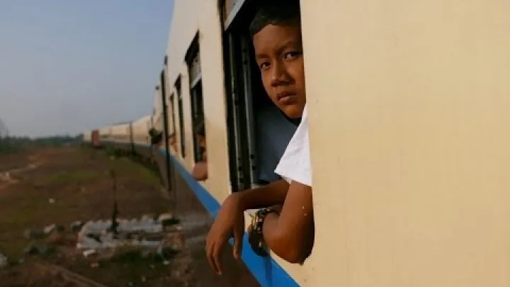
For historical context, Myanmar Trains reports a Yangon–Mawlamyine rail distance of 319 kilometres and a scheduled journey of 10 hours and 20 minutes. Those figures describe historical planning information, not a current operating promise.
| Mode | Historical planning pattern | Main advantage | Main uncertainty |
|---|---|---|---|
| Road bus or private vehicle | Usually chosen for speed and flexibility | More control over departure and stops | Carrier, road, checkpoint, and route status |
| Rail | Long journey; historical schedule around 10 hours 20 minutes | Slower travel experience and landscape views | Frequency, comfort, schedule, and operation |
Before a future trip, reconfirm current departures, departure points, terminals, carriers, fares, and route status directly with the transport provider or station. In particular, confirm whether the service leaves from the railway station or the intercity bus station you expect, and allow time for a change if the information differs between an online listing and a local notice.
Move Around the City on Foot and by Local Taxi
Central Mawlamyine can be explored on foot in sections, especially when your route stays within the commercial core, market area, and nearby riverfront. The elongated riverfront layout, the hill ridge, the heat, and the distance from the transport hubs make local rides useful for longer connections or uphill journeys.
Moto-taxis, trishaws, tuk-tuks, and pick-up vehicles have historically been used for movement around the city. Their availability, names, and operating practices can vary. Do not build a daily budget around an old fare example; use the actual price agreed for the ride.
Keep local transport communication simple. Carry the destination written clearly or saved on an offline map, show the exact hotel or landmark, and confirm the total fare before boarding. Clarify whether the price is per passenger or for the vehicle and whether waiting time is included. If the driver does not understand the destination or the price is unclear, find another option rather than trying to resolve the issue after departure.
Plan Your Budget and Daily Logistics
Mawlamyine has historically been described as relatively affordable, but a current daily total is difficult to promise. Accommodation availability, currency volatility, inflation, supply changes, private transport, and reduced services can alter the cost more than a standard destination guide suggests.
Build a Flexible Daily Budget from Historical Price Patterns
Build the budget by category rather than starting with a fixed dollar amount. The main categories are accommodation, local meals and drinks, city rides, intercity transport, admissions, boat trips, optional excursions, and a contingency amount.
| Planning style | Usually includes | Largest cost pressures |
|---|---|---|
| Lean city stay | Simple room, local meals, walking, occasional rides | Room availability and repeated local transport |
| Comfortable independent stay | Better room, mixed meals, regular city rides | Accommodation standard and transport frequency |
| Excursion-led stay | City stay plus private vehicle, boat, admissions, or day trips | Distance, operator arrangements, and private transport |
A low-to-midrange plan can therefore remain affordable in principle while still becoming expensive on an excursion day. The largest choices are usually room standard, whether you rely on local meals or imported food, how often you use private transport, and whether you add a boat or rural trip. Keep intercity transport as a separate line instead of hiding it inside a daily estimate.
Use historical prices only to understand the categories. For a future trip, ask for current room, ride, ticket, and excursion prices in the currency you will actually use, then add a contingency rather than treating an old online estimate as a budget promise.
Prepare for Cash, Connectivity, and Booking Uncertainty
Historical traveler planning for Myanmar has often been cash-first. Current conditions can involve changing exchange rates, inflation, limited card acceptance, ATM uncertainty, service interruptions, and mobile connectivity that is not dependable in every situation. These conditions make a single digital payment plan or one online reservation fragile.
- Cash: Carry an emergency cash reserve that does not depend on an ATM, card network, or mobile connection working. Keep it secure and separate from the money used for the day, rather than carrying every travel fund in one place.
- Payments: Ask accommodation and transport providers which payment methods they accept and whether the quoted price can change. Do not assume that a familiar international card or wallet will work.
- Connectivity: Save offline maps, hotel details, station names, important phone numbers, and copies of essential documents before leaving reliable internet access.
- Bookings: Prefer flexible or refundable arrangements where possible. Do not make the itinerary depend on one unconfirmed hotel, boat, road connection, or digital ticket.
Keep a written record of your accommodation address, transport contacts, and any agreed arrangements. Offline preparation is especially useful when you need to explain a destination to a driver, find a station, or continue planning after a phone loses signal or power.
Build a Flexible Mawlamyine Itinerary
The best Mawlamyine itinerary leaves space between major activities. Group sights by area, avoid crossing the city repeatedly in the heat, and treat excursions as optional modules that can be removed without breaking the whole trip.
A Two-Day First-Time Mawlamyine Itinerary
- Day one: understand the city. Begin in the central commercial area with local food, markets, or a walk through the historic core. Continue toward the Thanlwin riverfront for orientation and views, then use the cooler part of the day for Kyaikthanlan Pagoda and the hilltop religious ridge. Keep the route flexible so you can shorten the walk and use a local ride when the heat or distance becomes tiring.
- Day two: add culture and one optional element. Visit the Mon Cultural Museum if it is accessible, then spend more time with the historic streets, religious architecture, or a second riverfront walk. If a boat trip, Win Sein Taw Ya visit, beach outing, or countryside excursion can be arranged suitably, use it as the optional part of the day. If not, make the city itself the fallback by combining the museum, market, pagoda ridge, and riverfront at a slower pace.
This is a framework, not a fixed timetable. A morning start, a midday rest, and a late-afternoon return to outdoor areas will usually make the plan more comfortable than a continuous schedule. Religious-site etiquette, walking distances, and local operating arrangements should shape the order.
A Three- to Four-Day Slow-Travel Version
With three or four nights, use the extra time to slow down rather than add several remote locations. Reserve one morning for a market and central streets, one late afternoon for the riverfront, and another period for the pagoda ridge or the Mon Cultural Museum. Repeat a favorite area at a different time of day if it helps you understand the city rather than treating repetition as wasted time.
Choose one excursion by interest:
- Mon and colonial history: Give more time to the museum, historic streets, and the relationship between the commercial core and older religious buildings.
- Religious architecture: Focus on the Kyaikthanlan Pagoda area and consider Win Sein Taw Ya as a separate outing.
- River scenery: Prioritize the Thanlwin waterfront and add a boat or island option only if the arrangement is suitable.
- Everyday city life: Keep mornings and evenings open for markets, local meals, walking, and observation rather than filling every period with distant sites.
An extra day is also a useful buffer. It can absorb a delayed arrival, a tiring hot day, an unavailable excursion, or a change in the transport plan without forcing you to remove the central experiences that brought you to Mawlamyine.
When to Combine Mawlamyine with Southern Myanmar
Mawlamyine can be understood as part of a historical southern Myanmar route from Yangon, but each base offers a different reason to stay. Yangon generally provides the broadest range of services and international travel connections. Kyaiktiyo is associated primarily with pilgrimage and religious travel. Hpa-an is known for karst landscapes and nature-focused outings. Mawlamyine offers a stronger combination of Mon cultural context, riverfront atmosphere, pagoda views, markets, and historic urban layers.
A future planning concept such as Yangon–Kyaiktiyo–Hpa-an–Mawlamyine can work for travelers who want culture, pilgrimage, nature, and a river city in one route. It is not a current recommendation by itself. Do not assume that every leg, road, checkpoint, attraction, or border-adjacent connection is available simply because it appears in a historical itinerary.
Choose the number of nights by interest rather than by trying to make every stop equal. Use Yangon for services and international logistics, Kyaiktiyo for pilgrimage, Hpa-an for karst scenery, and Mawlamyine for a slower culture-led city stay. If conditions do not support the full circuit, a shorter city-focused plan is more useful than a route that depends on several uncertain connections.
Conclusion: Plan Mawlamyine for the Right Conditions
Mawlamyine is best planned as a flexible, culture-led stay built around the Thanlwin riverfront, Kyaikthanlan Pagoda and the hilltop ridge, the Mon Cultural Museum, central streets, markets, and selected optional excursions. The riverfront and central commercial area are the strongest all-round base, while the hill ridge and transport hubs suit more specific priorities.
Start with the current travel decision, then verify entry and access separately. If conditions support a future visit, choose the season and pace that fit your comfort, treat historical transport and prices as planning context, and keep enough flexibility for local logistics. A modest two-day framework can show the city's character, while three or four nights allow Mawlamyine to be experienced without rushing it.
Select area
Create a post
Posting is free and no registration is required.