Timor-Leste Administrative Divisions: 14 Municipalities
Timor-Leste administrative divisions are easiest to understand when the country's official terminology is used: the first-level units are municipalities, not provinces or states. As of 16 August 2026, the official listing used for this article contains 14 municipalities, including the island municipality of Atauro and the geographically separated municipality of Oecusse. This guide lists all 14 units, explains their capitals and special arrangements, and shows how administrative posts, sucos, and aldeias fit below them. It also explains how to read Timor-Leste regions maps and area directories without creating duplicate or outdated entries.
How Timor-Leste Is Divided
What the First-Level Units Are Called
The direct answer is that Timor-Leste's official first-level territorial units are called municipalities. The country has 14 municipalities in the official listing reviewed for this article on 16 August 2026. The INETL, Timor-Leste's national statistics institution, uses municipality names in its national territorial data.
Terms such as regions, states, and provinces may appear in international searches, school materials, map labels, or informal descriptions. They are useful search terms when a reader does not yet know the country's system, but they should not replace municipality in a current administrative record. Timor-Leste is a unitary state, so its municipalities are not federal states or provinces with separate sovereignty.
A municipality is also not the same thing as every place that shares its name. Dili, for example, is both the national capital and a municipality, but Dili city and Dili municipality are different geographic ideas. Below the municipality level are administrative posts, sucos, and aldeias. These lower units should be kept separate when reading a map, completing an address, or building a country area directory.
The Hierarchy from the First Level to Local Units
The basic territorial and local hierarchy can be shown as follows:
- Municipality: the first-level unit and the main division used in the national list of 14.
- Administrative post: the level below a municipality, used as an intermediate framework for local administration and service coordination.
- Suco: a community-level unit below an administrative post, important for local representation and everyday place identification.
- Aldeia: the smallest level in this hierarchy, nested within a suco and used for fine-grained community or settlement identification.
These levels do not all have the same legal or political status. Municipalities are the first-level territorial divisions for the main list in this article. Administrative posts are administrative subdivisions, while sucos and aldeias are more closely connected with community organization, local representation, and detailed geographic identification. A directory should preserve the nesting instead of flattening every unit into a generic region.
The 14 Municipalities of Timor-Leste
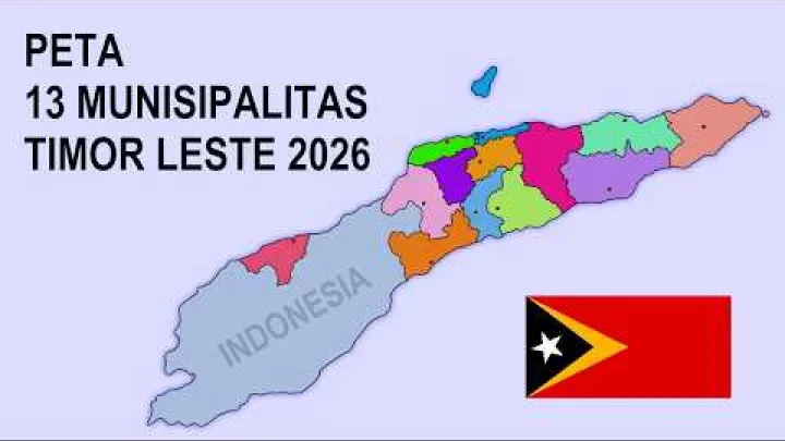
The following list uses one row for each current municipality. It includes Atauro as a separate municipality and Oecusse as the short municipal name associated with the special regional regime of Oe-Cusse Ambeno. The total is therefore 14, not 13 or 15.
Complete List of the 14 Municipalities
The table uses the canonical municipality spellings used for this article and the commonly associated administrative capitals or centers. Spellings can differ between English, Portuguese, Tetum, and older map sources. For a formal address or official record, match the municipality and capital spelling to the latest INETL record or relevant municipal record.
| Municipality | Administrative capital or center | Short identifier |
|---|---|---|
| Aileu | Aileu | Inland central municipality |
| Ainaro | Ainaro | South-central municipality |
| Atauro | Vila Maumeta | Island municipality north of the mainland |
| Baucau | Baucau | Eastern mainland municipality |
| Bobonaro | Maliana | Western municipality |
| Covalima | Suai | Southwestern municipality |
| Dili | Dili | National capital municipality |
| Ermera | Gleno | Central-western highland municipality |
| Lautém | Lospalos | Easternmost mainland municipality |
| Liquiçá | Liquiçá | Northwestern coastal municipality |
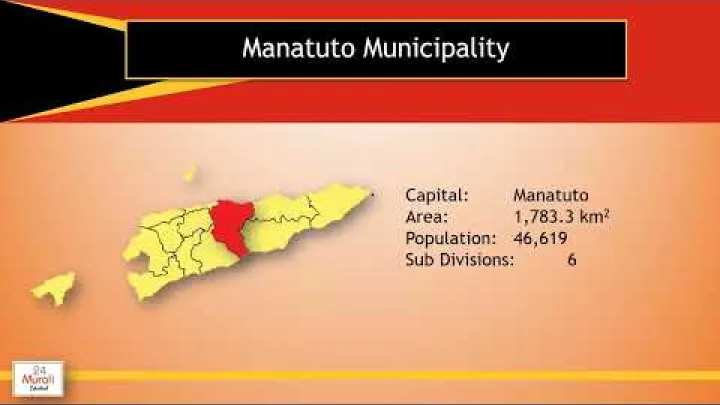
| Manatuto | Manatuto | North-coast municipality east of Dili |
| Manufahi | Same | South-central municipality |
| Oecusse | Pante Macassar | Separated municipality with special regional status |
| Viqueque | Viqueque | Southeastern municipality |
Names in the table are individual municipal entries, not broad directional regions. For example, Aileu and Ainaro should remain separate records even though both are in the central part of the country. The same principle applies to Bobonaro and Covalima in the west and southwest, and to Baucau, Lautém, and Viqueque in the east. Geographic descriptions help with map reading, but they do not create additional official divisions.
Short Identifiers for Every Municipality
Each row has one short, neutral identifier to make the list easier to scan. The identifiers rely on stable administrative or geographic facts: Dili is the national capital municipality, Atauro is an island municipality, Oecusse is geographically separated and has a special regional regime, and the other municipalities are identified by broad map position or their administrative center.
These descriptions are intentionally not travel profiles. They do not rank municipalities, describe population or economic performance, or suggest that one area is more important than another. A map user can use the capital, island status, or broad position to identify a municipality, then move down to the relevant administrative post, suco, or aldeia for more precise information.
Special Status and Capital Arrangements
Three municipalities often cause confusion in lists and maps: Oecusse Ambeno has a special administrative regime, Atauro is a separate island municipality, and Dili combines municipal and national-capital roles.
Oecusse Ambeno and Its Special Administrative Region
Oecusse is included in the municipal system, but it also functions as the Região Administrativa Especial de Oe-Cusse Ambeno, commonly shortened to RAEOA. The region is geographically separated from the main part of Timor-Leste because it is surrounded by Indonesian territory on Timor island. This geographic separation explains why it appears as a special case in administrative and map descriptions.

Law No. 3/2014 defines the special region's legal framework. In broad terms, the law gives the region administrative, financial, and patrimonial autonomy, as well as legal personality. These provisions create a distinct regional management arrangement within Timor-Leste; they do not create legislative independence or a separate sovereign state.
Oecusse should therefore be represented in two connected ways: as the municipality in the national first-level list, and as the municipality carrying the RAEOA special-status attribute. It should not be entered once as Oecusse municipality and again as a separate province, state, or sovereign territory. The special status operates within the constitutional and national framework of Timor-Leste.
The associated Special Social Market Economy Zone is an economic and development designation linked to the region. It is not an additional municipality. When a map or directory includes that economic designation, it should attach it to Oecusse Ambeno rather than create another first-level territorial unit.
Atauro as an Island Municipality
Atauro is a separate island municipality, not a municipality within Dili. The current INETL listing identifies Atauro Municipality, and the national municipal map presents Atauro as its own municipal area. This is important because older maps may place Atauro under Dili or describe it as part of Dili's administrative area.

There is a useful distinction between the reported transition and the legal status used in a current directory. In late 2021, the government announced that Atauro would be officially declared a new municipality in January 2022. Tatoli reported that planned process. Because an announcement is not necessarily the same as the final legal instrument, January 2022 is best described as the reported transition period unless a specific legal record is being cited.
For current map and directory purposes, the practical result is clear: Atauro is treated as its own municipality. The municipal capital or administrative center is commonly given as Vila Maumeta. Use Atauro as the canonical English-facing name in a list, while preserving Ataúro when it appears in an official Portuguese or local-language document.
Atauro's island status and any special administrative or economic attention do not make it RAEOA. It is not the Oecusse special administrative region, and it is not a second national capital district. It remains a distinct municipality in the first-level list.
Dili as the National Capital Municipality
Dili has two related but different meanings. Dili city is the national capital and the principal urban place, while Dili municipality is the wider first-level administrative area. A city label and a municipality label may therefore appear together in an address without being exact synonyms.
The official first-level list treats Dili as a municipality. It does not require a separate entry called capital district for the national list unless a current legal or statistical source specifically uses that classification. This distinction prevents a directory from counting Dili city and Dili municipality as two municipalities.
Dili municipality also contains lower-level administrative areas, including administrative posts, sucos, and aldeias. For precise records, use Dili municipality as the area entry and Dili city as the capital-place or locality label when the data model distinguishes those fields.
Lower-Level Units and Local Administration
The 14 municipalities are only the first step in a complete Timor-Leste area hierarchy. Administrative posts, sucos, and aldeias provide progressively more local levels, but their names and counts should be read with the date and source attached.
Administrative Posts Below Municipalities
Administrative posts are the level directly below municipalities. They provide an intermediate framework for local administration, coordination, public services, and geographic organization. In older English-language material, they may be called subdistricts, and older Portuguese material may use related historical terminology. That older label should not be mistaken for a current first-level division.
Published counts of administrative posts have not always been consistent. A decentralization profile reports 65 posts, while later public reporting has used a figure of 70. These figures may reflect different dates, changes in the administrative structure, or different counting rules. The available material does not provide one dated, authoritative reconciliation, so neither number should be presented as an unqualified current national total.
For a map, address database, or government-service record, attach the publication or retrieval date to any administrative-post count and use the latest official administrative or statistical listing available. If a map or report mentions names such as Loes, Quelicai Antiga, or Matebian as newly created posts, treat that as a change notice to investigate rather than proof that the names belong in the current hierarchy. A dated legal or official statistical record should determine their status.
Community Units Below Administrative Posts
Sucos are community-level units below administrative posts. They are important for local representation, everyday place identification, census work, and the delivery or coordination of services. A suco is not equivalent to a municipality, province, or state; it is a much smaller unit within the municipal structure.

References to suco leaders and councils should be understood within the current legal framework and local administrative practice. Exact titles, election arrangements, and powers can change or differ from customary forms of authority. Formal local representation should therefore be distinguished from customary or traditional community authority rather than treating the two as identical.
A figure of 442 sucos is sometimes reported in general reference material, but the sources available for this article do not establish that number as a current, reconciled national total. The safe structural point is that sucos sit below administrative posts and are useful place identifiers in local addresses, population records, service planning, and community participation.
The Smallest Local Units
Aldeias are the smallest units in the hierarchy described here. They are nested within sucos and can identify a settlement or small local community more precisely than a municipality or administrative post. Their value is mainly geographic and community-based, so an aldeia should not automatically be treated as an independent government with the same powers as a municipality.
At the time of review on 16 August 2026, the Timor-Leste Municipal Portal displayed 2,239 aldeias. Older material may show 2,233. These figures should not be merged or presented as an unchanging national total; the difference may reflect a later update, a revised classification, or another source-date distinction.
When aldeia boundaries or counts matter for a map, census, service record, or exact address, record the source and retrieval date. The municipal portal is useful for current map context, but a precise administrative record should follow the version of the official data used by the relevant authority.
Governance Across the Administrative Levels
Administrative divisions describe territory, but they also organize how national institutions and communities interact. The relationship is best understood as a unitary national system with local government and community-level structures, not as a federation of independent states.
Central and Local Government in a Unitary State
The Constitution describes Timor-Leste as a unitary state and provides for central and local government arrangements. Its local-government provisions describe local government as being constituted by corporate bodies with representative organs. The stated purpose includes organizing citizen participation and supporting local development. The published constitutional text can be read through the Constitution of Timor-Leste.
In practical terms, municipalities operate within national sovereignty, national law, and constitutional oversight. They are not federal states with their own sovereignty, and they do not have the same constitutional position as provinces in a federal country. The existence of elected or representative local bodies also does not remove the role of central ministries and national institutions.
The distinction matters for research and administration. A municipal office may be the relevant local contact for a service or development matter, while national legislation, funding, standards, or ministerial programs may still shape how that service operates. A municipality's presence in the hierarchy should not be read as proof that every function has been fully transferred from central government.
For international readers, the simplest description is therefore: Timor-Leste has a national government, 14 first-level municipalities, and lower local units that support administration and community participation within the unitary state.
Local Representation and Administrative Responsibilities
Each level provides a different point of contact between the state, local institutions, and communities. Municipalities offer the broadest local administrative frame. Administrative posts connect municipal structures with smaller areas. Sucos provide community-scale representation and place identification, while aldeias provide a more detailed local reference.
Together, these levels can support planning, service coordination, data collection, public participation, and the identification of communities that need assistance. These are functional descriptions, not a claim that every municipality, post, suco, or aldeia has exactly the same authority or resources. Responsibilities can be sector-specific and can change as decentralization develops.
Oecusse adds a special regional layer to the municipal system because its municipality also carries the RAEOA regime. Atauro does not add another special administrative region; it remains a separate municipality. Dili has the additional role of national capital, but that role does not turn it into a separate province or duplicate first-level unit.
Reading Maps and Area Hierarchies
A good Timor-Leste regions map may use broad geographic labels for orientation, but an official administrative map should make the municipal level clear. The same rule applies to an online directory: start with the country's 14 municipalities, then move down through the local hierarchy.
Map Labels and Official Name Variants
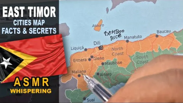
Searches for Timor-Leste regions, Timor-Leste provinces, or Timor-Leste states usually point toward the country's municipality map. When comparing international and local sources, the Portuguese terms can help: município means municipality, postos administrativos means administrative posts, and sucos and aldeias refer to lower community levels.
Some labels look different without representing different areas:
- Oecusse is the short municipal form commonly used in the list, while Oe-Cusse Ambeno is the fuller name associated with the special administrative region.
- Atauro is the canonical form used in the municipality list here, while Ataúro may appear in Portuguese or other official-language materials.
- Dili and Díli can reflect language or spelling conventions for the capital name; they do not create two municipalities.
Use one canonical spelling in a municipality table, then retain useful variants as search terms or aliases. The INETL spelling should take priority when a record must match current national statistical data.
How the Hierarchy Fits an Area Directory
A clear directory structure is:
- Country: Timor-Leste
- Municipality: one of the 14 first-level municipalities
- Administrative post: a subdivision of the municipality
- Suco: a community unit within the administrative post
- Aldeia: the smallest local unit within the suco
For example, an address record can follow the pattern Timor-Leste, Dili municipality, administrative post, suco, and aldeia. Dili city can be stored as the capital or locality where the directory distinguishes a place from its municipality. This keeps Dili city from becoming a second municipal entry.
For Oecusse, attach RAEOA as a special-status description to Oecusse municipality rather than creating a duplicate municipality. For Atauro, use Atauro as its own municipality rather than placing it below Dili. Former districts, generic labels such as northern region or eastern region, and duplicate child entries should be excluded from the current first-level hierarchy.
Conclusion: Municipalities Are the First-Level Units
Timor-Leste has 14 first-level municipalities: Aileu, Ainaro, Atauro, Baucau, Bobonaro, Covalima, Dili, Ermera, Lautém, Liquiçá, Manatuto, Manufahi, Oecusse, and Viqueque. Oecusse carries the RAEOA special regime, Atauro is a separate island municipality, and Dili is both a municipality and the national capital. Below them, administrative posts, sucos, and aldeias create the local hierarchy. Using these official levels and keeping source dates attached to changing counts will make maps, addresses, and area directories more accurate and easier to compare.
Select area
Create a post
Posting is free and no registration is required.