Best Time to Visit Liquica: Weather by Month

The best time to visit Liquica is generally June to October. Liquica sits on Timor-Leste's north coast, where changes in rainfall can affect roads, trails, sea visibility, and beach plans more than changes in temperature. May and November are useful shoulder-season options for flexible travelers who want a balance between improving or declining rain and potentially quieter conditions. This guide compares the seasons and months, then explains how timing affects beach visits, swimming, snorkeling, hiking around Lake Maubara, coastal drives, heat, access, and travel costs.
At a glance: the best time to visit Liquica
For the most dependable combination of dry weather, outdoor comfort, and easier overland travel, plan for the middle of the dry season. If your schedule is flexible, the shoulder months can also work well, but they require more tolerance for changing conditions.
The best overall window is June to October
June through October is the strongest overall window for visiting Liquica. These months generally bring less rain than the wet season, lower disruption risk for outdoor plans, and more suitable conditions for walking along the coast, visiting Liquica town and Maubara, hiking in the nearby hills, and taking day trips around Lake Maubara.
Broad Timor-Leste travel guidance from Intrepid Travel also identifies May to November as the preferred travel period because of the hotter, drier conditions. For Liquica specifically, June to October is a more cautious core recommendation, while May and November are transition months rather than guaranteed dry periods.
October can be an appealing planning choice for visitors who want the later part of the dry season and a possible change from the most parched landscapes. That is a preference based on the seasonal pattern, not a promise that October will have calm seas, clear skies, or open roads every day. Historical averages describe the usual window; they do not replace conditions for the year and dates of your trip.
Choose the timing that matches your travel purpose
The best month depends on what you want to do. Dry-season months are the practical choice for beach time, swimming, snorkeling, hiking, photography, and road-based sightseeing. Culture-focused visits to Liquica town, Maubara, and coastal villages can work throughout the year, although dry weather makes walking and transport logistics easier.
| Travel purpose | Best timing | Main trade-off |
|---|---|---|
| Beach and coastal activities | June to October | More reliable weather, possible higher demand |
| Hiking and Lake Maubara | June to October | Firmer trails, but strong sun and heat |
| Culture and village visits | Year-round; May or November for flexibility | Rain can complicate walking and transport |
| Quiet or budget travel | May or November | Potentially lower demand, less predictable weather |
June through September may attract more travelers because the weather is usually more dependable, but there is no reliable Liquica-specific dataset showing how much crowds or prices change. May and November may offer better value or availability in some years, yet accommodation, drivers, and activity operators set their own rates. Compare actual local prices and availability instead of assuming that a shoulder month will always be cheaper.
Liquica climate and seasons on the Timorese north coast
Liquica's travel seasons are defined mainly by rainfall. The coast remains warm throughout the year, but the difference between a drier month and a wet month can affect trail conditions, visibility, road access, and the number of activities that fit comfortably into a day.
Dry season, wet season, and the transition months
Timor-Leste has a strongly seasonal tropical climate. The broad pattern places the drier period around May to November and the wetter monsoon period around December to April. The Japan Meteorological Agency uses this May-to-November and December-to-April framework for Timor-Leste, which is a useful starting point for planning a north-coast trip.
The boundaries are not rigid. Rainfall often begins to increase during November, remains more significant through the core wet-season months, and then decreases during March and April. Some hazard-focused guidance continues to treat May as a month with residual flood or landslide exposure, even when tourism advice describes May as the beginning of the dry season. Historical climate information from the World Bank Climate Change Knowledge Portal is useful for seeing these annual patterns, but country-level or regional averages do not represent every day in Liquica.
Rainfall changes more sharply than temperature. That is why a season that feels only slightly different thermally can have a large practical effect on roads, hiking, beach conditions, and coastal visibility. Use the season labels as planning ranges rather than as fixed dates.
How the coast, hills, and inland terrain differ
Liquica town and its coastal beach are in a low coastal setting. Maubara and Maubara Beach also sit along the north-coast corridor, while Lake Maubara and the hills behind the settlements introduce higher and more varied terrain. The coastal lowlands are generally hotter and drier than the inland slopes and higher ground.
That geographic difference matters on short day trips. A clear morning on the beach may not mean that the hills around Lake Maubara are equally clear. Higher terrain can receive more cloud or showers and may feel cooler, while water running down slopes can leave unpaved sections muddy or slippery after rain. Visibility can also change quickly between the coast and inland viewpoints.
Plan Liquica, Maubara, Lake Maubara, and the surrounding hills as related but separate climate zones. A beach-focused day may remain comfortable when an inland walk is damp, and a sunny coastal afternoon does not guarantee dry footing on a hill trail or a clear view from higher ground.
Temperature, humidity, and comfort through the year
Liquica is warm year-round rather than a destination with a cool winter. On many coastal days, daytime temperatures can reach the high-20s Celsius, while strong sun can make an exposed walk feel hotter than the air temperature suggests. Exact conditions vary by month, wind, cloud cover, and location, so a broad Celsius range should not be treated as a municipal climate normal.
The wet season is usually the more humid and oppressive part of the year. During the middle of the dry season, lower humidity can make walking and sleeping more comfortable even when afternoons remain hot. Nights on the coast are generally mild, while higher inland terrain may feel cooler in the evening without becoming a cold-weather environment.
Heat management is relevant even in the recommended months. A short coastal walk, an exposed viewpoint, and a hill excursion can feel very different when there is little shade. Treat heat, humidity, and official extreme-weather warnings as separate considerations when planning each day.
The best time for Liquica activities
Dry weather improves the odds of completing outdoor plans, but different activities respond to different conditions. Beach weather, sea visibility, trail footing, and road access should be considered separately rather than reduced to one simple good-weather label.
Beach time, swimming, and snorkeling
June through October is generally the best period for beach time at Liquica's coastal beach and at Maubara Beach. The lower average rainfall makes it easier to plan a full day outside, and there is usually less risk that a recent downpour will dominate the day's conditions.
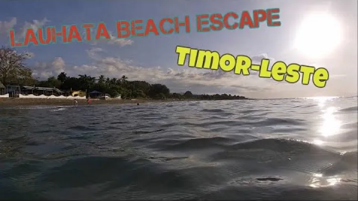
Swimming and snorkeling depend on more than sunshine. Wind, waves, sea state, cloud cover, and underwater visibility all matter. Heavy rain can reduce clarity, especially near runoff channels, streams, or river mouths, where sediment may enter the coastal water. Water temperature does not usually change as dramatically as the weather pattern, so the main timing advantage of the dry season is the greater likelihood of suitable rain, wind, and visibility conditions.
Before swimming, snorkeling, or taking a boat, ask a local marine operator or your accommodation host about the same-day sea state and visibility. A dry-season recommendation improves the odds but is not a safety clearance for entering the water. If local advice is unfavorable, keep a land-based coastal visit as the alternative.
Hiking, Lake Maubara, and scenic coastal drives
The drier part of the year is usually the most practical time for hiking around the Maubara hills and for visiting Lake Maubara. Trails and unpaved sections are more likely to have firmer footing, and lower cloud or rainfall can improve views across the coast and surrounding terrain. These conditions also make a scenic drive easier to combine with stops in Liquica, Maubara, and nearby coastal villages.
Late wet-season and early dry-season travel can have a visual advantage: hills may still look greener after the rains. The trade-off is that paths, drainage crossings, and unpaved road sections may remain damp even after the coast begins to dry. The main Dili-Liquica-Maubara coastal corridor is a useful framework for planning, but roads branching toward Lake Maubara, the hills, or smaller settlements may respond differently to the same rainfall.
Exposed walks become less comfortable as the dry-season day warms, particularly where shade is limited. Build the route around your heat tolerance and leave enough time for slower walking, water breaks, and a change of plan if the terrain is wetter than expected. Avoid assuming that a clear beach view means every inland section will have the same footing or visibility.
Culture, coastal villages, crowds, and budget travel
Liquica town, Maubara, and the coastal villages can be visited in any season. Dry conditions make it easier to walk between stops, take photographs, wait for transport, and combine several places in one day. Wet-season travel can still suit visitors whose main interest is local life and who are comfortable with a slower schedule and occasional rain.

May and November may appeal to travelers seeking fewer visitors or better value because they sit between the main wet and dry patterns. This is a possibility, not a fixed low-season rule. June to September is more likely to be the dependable activity period and may bring stronger demand for rooms, drivers, or organized outings, but Liquica does not have a published crowd or price pattern that can support exact percentages.
Budget travelers should compare real accommodation and transport availability for their dates. A lower seasonal rate is not useful if rain adds extra transfers, removes a planned activity, or makes a secondary route impractical. Flexible booking and a land-based backup plan can be more valuable than choosing a month solely because it is labeled low season.
Liquica month by month
The following guide describes the usual seasonal feel rather than a day-by-day forecast. Rainfall can arrive earlier or later than expected, and conditions can differ between Liquica's coast, Maubara, Lake Maubara, and the nearby hills.
January and February: peak wet-season conditions
January and February are generally the months most likely to bring frequent heavy showers, high humidity, cloud cover, and interruptions to outdoor plans on the north coast. Rain is not necessarily continuous every day, but intense periods can have a greater effect on a short itinerary than a monthly average suggests.
For Liquica, the practical consequences can include muddy secondary roads, local flooding, slippery trails, runoff near the coast, and a lower chance of comfortable long hikes. Beach days and snorkeling plans are also less dependable when rain, cloud, wind, or reduced water clarity affects the coast. Hills may look lush and green, which is an advantage for scenery, but the conditions are usually a poor match for a first visit focused on beaches or extensive overland exploration.
These months are best reserved for travelers with flexible schedules who accept that a road trip, hike, or marine activity may need to be replaced. They are not automatically impossible for travel, but a tightly timed itinerary carries more weather-related uncertainty.
March, April, and May: easing rain and shoulder-season choices
March is usually still wet, but the season is moving away from its most unsettled phase. Rain may remain important for roads and trails, while the coast can begin to offer longer usable periods between showers. April is a transition month: some weeks may feel increasingly dry, but the shift is not necessarily uniform across the coast and hills.

By late April and into May, dry-season conditions usually become more established. This can create a useful combination of greener landscapes, improving beach weather, and better hiking and driving prospects. Isolated heavy rain can still affect secondary routes, and May should not be described as completely dry or risk-free.
There is a difference between tourism-oriented and hazard-oriented season labels. Travel guidance may count May as part of the dry season, while hazard planning may continue to recognize residual flood or landslide exposure after the wettest months. For flexible travelers, late April and May can be a good compromise between scenery, improving conditions, and the possibility of fewer visitors than in the middle of the dry season.
June, July, and August: the most reliable dry-season stretch
June through August is the core dry-season stretch and generally the most reliable period for beach visits, hiking, scenic drives, coastal photography, and day trips around Maubara and Lake Maubara. June can offer a useful balance between dry conditions and evenings that may feel more comfortable, while July and August are often among the driest and clearest months in the broad north-coast pattern.
The trade-off is that mid-year is the period many travelers are most likely to choose. Demand for accommodation, drivers, and activities may therefore be higher than in the shoulder months, although local prices and availability vary. Do not assume that July is universally better than June or August; the best choice depends on whether you value the driest average conditions, a quieter schedule, or specific dates.
Strong sun and hot afternoons remain possible throughout this stretch. These are planning tendencies, not a promise for every week. A short-range forecast should determine the detailed timing of exposed hikes, long drives, and marine activities.
September, October, November, and December: late dry season to wet-season return
September and October are generally favorable late-dry-season months. They combine warm coastal conditions with a lower typical rain burden than the wet season, and the landscape may begin to look less dry as the monsoon transition approaches. October can be an attractive compromise for visitors who want dependable outdoor conditions without treating one month as guaranteed to be perfect.
Conditions can become less predictable later in October, depending on when the seasonal shift begins. November is a transition month, with rising heat, humidity, and shower risk, especially later in the month. It can still work well for a flexible trip, but it is a less secure choice for an itinerary built around several fixed outdoor days.
December marks the beginning of the wetter period in the broad seasonal pattern. Rain-related access problems, reduced trail comfort, and uncertainty about sea conditions become more important when deciding whether to schedule a beach day, a boat outing, or a drive beyond the main coastal route.
When to avoid or reconsider a Liquica trip
No month makes Liquica impossible for every traveler. The question is whether the likely conditions match the purpose and rigidity of your itinerary.
The wettest months and travel disruption
January and February are the main months to reconsider if your priorities are reliable beach weather, dry trails, or a tightly scheduled road itinerary. Heavy rainfall can increase the chance of flooding, erosion, landslides, muddy tracks, and delays, especially where hills drain toward coastal settlements. A hazard overview from CFE-DMHA describes Timor-Leste as exposed to extreme weather risks, with impacts made more difficult by limited resources and adaptation capacity.

Separate the main Dili-Liquica-Maubara coastal corridor from secondary roads leading toward Lake Maubara, the hills, and smaller villages. The main route may have different drainage, traffic, and maintenance conditions from an unpaved or less-used branch. Before traveling beyond the main coastal route during or after heavy rain, confirm secondary-road conditions with your accommodation provider or a local driver.
A practical go-or-no-go approach is to continue with flexible plans when local information is favorable, but to postpone a secondary-road trip when heavy rain or an official warning is active. You can still use a wet day for a shorter town or coastal plan if local conditions allow, rather than treating the entire visit as lost.
Year-to-year variability, monsoon shifts, and tropical systems
A typical dry or wet season can be shorter, longer, drier, or wetter than historical averages. El Nino and La Nina can influence regional rainfall patterns, but they should not be used as a precise forecast for Liquica or for a particular week. Their value is in explaining why a familiar seasonal pattern may not arrive on its usual schedule.
Cyclones or other tropical systems are an episodic consideration during the broader wet-season and transition period. They are not guaranteed features of a Liquica trip, and the main planning issue is usually the rain, wind, flooding, and access disruption that a weather system can produce rather than the label attached to it.
Climate normals help you choose June to October instead of the peak wet season, but they cannot predict the condition of a particular road or the weather of a particular day. When the season is unusually wet or dry, or when a developing tropical system is reported, follow current official weather and hazard updates and adjust the itinerary accordingly.
Practical planning for a Liquica stay
Good seasonal planning is simple: prepare for heat on the coast, add protection for rain and uneven ground, and leave enough flexibility for the terrain you plan to visit.
What to wear and how to plan each day
Pack lightweight, breathable clothing for the warm coastal climate, along with sun protection, comfortable walking shoes, and a quick-drying layer. A hat, sunglasses, and a reusable water bottle are useful for exposed beaches, town walks, and coastal viewpoints. Choose clothing that remains comfortable when humidity rises.
For shoulder-season or wet-season travel, add a light rain layer and footwear with good grip. This is especially useful around the Maubara hills, Lake Maubara, and unpaved areas where damp ground may remain after the coast dries. A light extra layer can also help on higher inland terrain, where evenings may feel cooler or wetter than they do in Liquica town.
Plan strenuous outdoor activity for the early morning when possible. Carry water, protect exposed skin from the sun, and keep a less exposed alternative available if heat or humidity becomes uncomfortable. Early starts are useful for both comfort and time: they leave more of the day for rest, a town visit, or a change of plan.
Climate averages versus the live forecast
Monthly climate summaries are useful for choosing June to October or a shoulder period, but they do not predict the conditions on your departure date. Direct, long-term municipal observations for Liquica and current information about smaller local roads may also be limited, so broad national or regional averages should be treated as context rather than a guarantee.
Use this short checklist:
- Review the current forecast and official weather warnings shortly before departure.
- Check conditions again before each outdoor day, especially when planning a boat trip, snorkeling, a hike, or a long coastal drive.
- If heavy rain, strong winds, or storms are forecast, move the most weather-sensitive activity to another day and keep a simpler land-based option available.
- Ask your accommodation provider, driver, or local operator about conditions that a regional forecast may not show, such as a muddy side road, a swollen crossing, or poor visibility in the hills.
No single forecast will capture every difference between Liquica's coast, Maubara, Lake Maubara, and the surrounding hills. Combining a live forecast with official warnings and local on-the-ground information gives you a more useful picture than relying on climate averages alone.
The bottom line for visiting Liquica
For most travelers, June to October is the best time to visit Liquica, with July and August often offering the driest broad seasonal pattern and June or October providing attractive alternatives. Choose May or November if you value a potentially quieter, more flexible trip and can accept transition-season showers. January and February deserve the most caution for beach-focused holidays, hiking, and fixed road itineraries. Whatever month you choose, match the plan to the coast or hills, protect yourself from heat, and use current weather, sea, and access information for the days that matter most.
Select area
Create a post
Posting is free and no registration is required.