Timor-Leste Continent and Region: Where Is It Located?
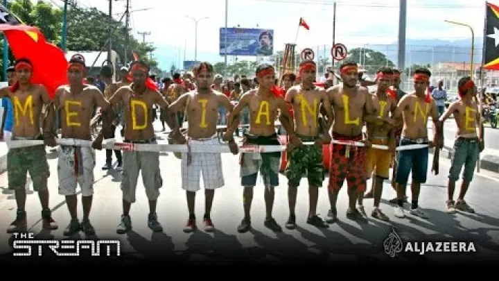
Timor-Leste is in Asia, and its geographic region is Southeast Asia. It occupies part of Timor Island at the southern edge of the Indonesian archipelago, north-west of Australia. Its closeness to Australia can make its map position seem unclear at first, but proximity to another continent does not change its usual continental classification. This guide explains where Timor-Leste is located, how its territory is arranged, and why some organizations use broader regional labels.
On a world map, look for the island chain southeast of Indonesia and north of Australia. On a country map, the key detail is that the international boundary runs across Timor Island: Indonesia is to the west, while Timor-Leste is to the east. This gives a direct answer to both “what continent is Timor-Leste in?” and “where is Timor-Leste located?” without treating nearby Australia as part of the same country or region.
The Direct Answer: Asia and Southeast Asia
The simplest answer is useful for maps, schoolwork, travel planning, and general reference: Timor-Leste is an Asian country in Southeast Asia. More detailed descriptions can add its island setting, its position in the Lesser Sunda Islands, and its maritime connection with Australia, but they do not change that basic answer.
Timor-Leste Is in Asia
Timor-Leste is part of the continent of Asia. The country is situated on Timor Island, within the southern part of the Indonesian archipelago. This island position places it in the Asian geographic setting of Southeast Asia rather than on the Australian continent.
Australia is relatively close across the Timor Sea, so Timor-Leste is often discussed alongside Australia in subjects such as maritime boundaries, trade, security, and regional cooperation. However, being near Australia is different from being geographically part of Australia or Oceania. The U.S. Department of State describes Timor-Leste as being in Southeast Asia, on the southern edge of the Indonesian archipelago and north-west of Australia.
The country was formerly widely called East Timor, and that name still appears in some older maps, books, and institutional datasets. Timor-Leste is the official short form used here. Both names point to the same country, but using Timor-Leste helps avoid confusion with the Indonesian part of the island to the west.
Its Region Is Southeast Asia
Timor-Leste’s region is Southeast Asia, which is a subregion of Asia rather than a separate continent. Southeast Asia includes both mainland countries and island-based countries. Timor-Leste belongs to the island-based part of the region because its territory lies on Timor Island and nearby islands.
On a broad map of Asia, Timor-Leste appears far to the south-east. On a closer map of Southeast Asia, it appears at the southern end of the chain of Indonesian islands. This is why descriptions such as “southern Indonesian archipelago” and “Southeast Asia” can both be accurate: one describes its immediate physical setting, while the other identifies the larger Asian subregion.
Asia-Pacific is another term that may appear in news, diplomacy, business, or development discussions. It is a broad regional expression connecting Asian and Pacific-facing countries. It is not a replacement for the direct geographic answer. For continent and subregion purposes, Timor-Leste is in Asia and Southeast Asia.
In practical terms, the labels work at different scales. “Asia” answers the continent question, “Southeast Asia” answers the regional question, and “Timor Island” gives the most useful physical map reference. If a source says “Asia-Pacific,” read it as a broader context label unless it is clearly describing a geographic subregion.
Where Timor-Leste Is on the Map
Timor-Leste is easier to locate when viewed through its island geography. Start with Indonesia’s long island chain, then look towards its south-eastern end for Timor Island. The national boundary with Indonesia and the country’s separated areas explain why a political map can look more complex than a simple outline of one island.
Timor Island and the Lesser Sunda Islands
Timor-Leste occupies the eastern part of Timor Island. Indonesia occupies the western part of the same island, so Timor Island is divided between two countries. This shared-island arrangement is an important map detail: Timor-Leste does not cover all of Timor.
Timor is at the eastern end of the Lesser Sunda Islands, a chain in the southern Indonesian archipelago. A useful west-to-east way to read a map is to follow the island chain eastward through Indonesian territory until reaching Timor. The eastern portion is Timor-Leste’s main territory, while the western portion is Indonesian territory. The EBSCO geography reference likewise places Timor-Leste on the eastern half of Timor Island in the far south of the Indonesian archipelago.
This position gives Timor-Leste one land border: its border with Indonesia on Timor Island. Its other geographic connections are across water. For a reader using an online map, turning on political borders is especially helpful because it makes the division of the island clear.
The island setting also explains why a map may show Timor-Leste close to Indonesia even though it is an independent country. The border follows the division of the island and does not mean Timor-Leste is part of Indonesia. Looking first for Timor Island, then for the international boundary, is more reliable than judging the country’s location from its distance to Australia.
Timor-Leste's Main Territory and Nearby Islands
The eastern half of Timor Island is Timor-Leste’s principal land area. The country also includes Oecusse, an exclave on the north-western side of Timor Island that is separated from the main territory by Indonesian land. An exclave is an area of a country that is physically separated from its main territory and surrounded by another country’s territory or reached through external territory.
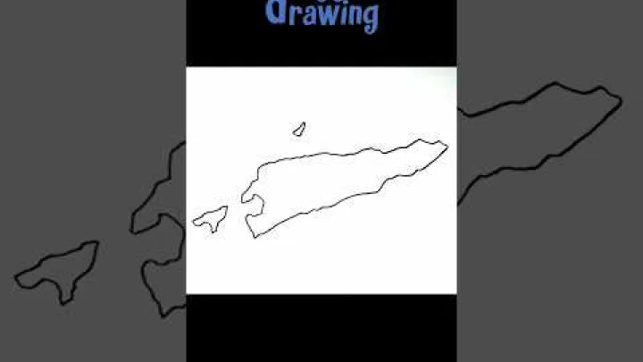
Two nearby islands are also useful map anchors. Atauro lies north of the main island across a narrow stretch of sea, while Jaco is near the eastern end of Timor. Together with Oecusse, they show that Timor-Leste has a distinctive territorial layout rather than one uninterrupted block of land.
It is therefore reasonable to describe Timor-Leste as an island country, but with an important qualification: its main island is shared with Indonesia. A basic Timor-Leste reference summarizes this arrangement as the eastern half of Timor Island, the coastal exclave of Oecusse, and associated island territory. For route planning or detailed administrative questions, use a current official map because boundaries, ports, and local access information are more specific than a general regional map.
Dili, the Capital, and the Country's Orientation
Dili, the capital of Timor-Leste, is on the north coast of the main territory. It is a practical point of reference for finding the country on a map: locate Timor Island, identify its eastern half, and look along the northern coastline for Dili.
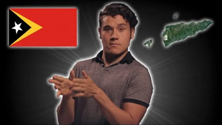
Dili’s north-coast position also helps explain the country’s orientation. Timor-Leste faces seas and maritime routes to the north and south. Australia lies to the south across the Timor Sea, not across a land border. Indonesia is the country directly connected by land on the western side of the island.
For someone asking where Dili is located in Asia, the direct answer is that it is in Southeast Asia, on the northern coast of Timor-Leste. Dili is useful as a map anchor, but it should not be mistaken for the country’s entire geographic extent: Oecusse, Atauro, Jaco, and the eastern and southern coasts lie beyond the capital area.
From Dili, the rest of the country extends east and south along Timor Island, while Oecusse is separated to the west. This is why a zoomed-out map can make the country seem scattered: the national territory includes the main eastern area, an exclave, and smaller islands. Those features affect map orientation, but not the continent or subregion answer.
Why Timor-Leste Is Sometimes Associated with Australia
Timor-Leste and Australia are nearby maritime neighbors. Their location across the Timor Sea creates strong practical and strategic links, which is why Australia often appears in explanations of Timor-Leste’s position. These links are real, but they do not alter Timor-Leste’s placement in Asia and Southeast Asia.
The Timor Sea and Australia's Northern Coast
The Timor Sea lies between Timor-Leste and Australia’s northern coast. It provides a maritime separation while also making the two countries relatively close compared with many other international neighbors. The sea is central to discussions of navigation, marine resources, border management, and bilateral relations.
Australia and Timor-Leste share a maritime boundary. The Australian Department of Foreign Affairs and Trade notes both the countries’ proximity and their shared maritime boundary. This relationship helps explain why Timor-Leste is often included in Australia-focused policy discussions and why maps of northern Australia frequently show Timor-Leste.
A maritime boundary is not the same as a continental boundary. Countries can be closely linked by sea routes, security interests, or economic activity while remaining in different continents or conventional geographic subregions. In this case, the relevant distinction is straightforward: Timor-Leste is north of Australia, across the Timor Sea, and is generally classified as Southeast Asian.
Asia, Oceania, and the Difference Between Proximity and Classification
Timor-Leste is sometimes associated with Oceania or the Pacific because it is close to Australia and may take part in wider Asia-Pacific or Pacific-facing discussions. Those labels often describe a sphere of cooperation, a strategic setting, or an area of economic interest. They do not necessarily define a country’s continent.
Three terms can be kept separate. A continent is a broad geographic division, such as Asia. A subregion is a smaller area within it, such as Southeast Asia. A functional region is a grouping created for a particular purpose, such as development analysis, diplomacy, finance, or security. Timor-Leste can be relevant to Asia-Pacific discussions while its geographic continental and subregional description remains Asia and Southeast Asia.
This distinction is useful when comparing maps. A physical or political world map will normally place Timor-Leste in Southeast Asia. A map made for Australian foreign policy, Pacific cooperation, or a development organization may group it differently to serve that map’s purpose. Such a grouping does not mean Timor-Leste has become a transcontinental country or that it is generally classified as part of Oceania.
This also explains why a database or website may place the country under a different menu heading from a geography textbook. The menu may reflect the organization’s program area, while the textbook is describing physical location. For a general location question, prioritize the geographic wording and then identify any institutional label as a separate purpose-based grouping.
Geographic and Institutional Meanings of Region
The word “region” can mean different things depending on the map or organization using it. Geographic terms describe location and physical setting. Institutional terms group countries for practical work. Understanding the purpose of a label prevents an apparent contradiction where none exists.
Geographic Subregions and Maritime Southeast Asia
Maritime Southeast Asia is a descriptive term for the island-based portion of Southeast Asia. It contrasts with mainland Southeast Asia, which includes countries located on the continental landmass of the region. The term is useful because the sea, islands, coastlines, and inter-island connections are major features of this part of Asia.
Timor-Leste fits this island-based geographic context. Its main territory is on Timor Island, it includes Atauro and Jaco, and its relationship with Indonesia and Australia is shaped partly by surrounding waters. In this sense, Maritime Southeast Asia adds detail to its location.
The broader answer remains the most important one: Timor-Leste is in Asia and Southeast Asia. Maritime Southeast Asia is a descriptive subregional label, not another continent and not necessarily a formal classification used by every government or institution. A Maritime Southeast Asia reference includes Timor-Leste among the island-based countries commonly described by this term.
Why the World Bank Uses a Broader East Asia and Pacific Region
International organizations may organize countries into regions for lending, economic analysis, development programs, or statistical reporting. These working groupings are designed for an institution’s operations, not as universal statements about continents. As a result, an organization can use a label that combines parts of Southeast Asia with Pacific economies.
The World Bank’s country and lending groups use broader regional categories, including East Asia and Pacific. This kind of framework helps the organization compare economies and manage programs across a practical operating area. It does not contradict the geographic description of Timor-Leste as an Asian country in Southeast Asia.
When reading an institutional classification, check the date and the stated purpose of that classification before treating it as a definition of a continent or geographic subregion. The World Bank explains that its country and lending groups are used for its analytical and operational categories. Read the label in that specific institutional context.
Timor-Leste's Continent and Region in One Sentence
Timor-Leste is a country in Asia, in the subregion of Southeast Asia, located mainly on the eastern half of Timor Island at the southern edge of the Indonesian archipelago and north of Australia across the Timor Sea.
For most map, travel, education, and general-reference questions, that is the complete answer. Its shared island with Indonesia, the Oecusse exclave, nearby Atauro and Jaco, and close maritime relationship with Australia add useful context without changing its core geographic classification.
Select area
Create a post
Posting is free and no registration is required.