
No direct border: Kazakhstan and Mongolia? || 5min Knowledge
A concise English-language map explanation shows why Kazakhstan and Mongolia are close geographically but separated by intervening Russian and Chinese territory.
Browse videos about Mongolia, including local walks, travel tips, daily life, and area guides.
A concise English-language map explanation shows why Kazakhstan and Mongolia are close geographically but separated by intervening Russian and Chinese territory.
![CROSSING THE RUSSIA/MONGOLIA BORDER! 🇷🇺 (Motorcycling the Globe) [S5-E15]](/sites/default/files/styles/regional_content_list_1x/public/oembed_thumbnails/2026-08/bFA7pZiLwE-j3Qo_ms4Fy0XQmfc2TC20qHdkNvgPecI.jpg.webp?itok=-I9MEBRi)
English-language travel footage follows a motorcycle crossing from Russia into Mongolia, showing the border route, crossing process, and surrounding landscape.
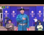
A recording of Mongolia's national anthem performed during the opening ceremony of the 2023 Naadam Festival. The stadium footage shows the anthem in the setting of a major national celebration.
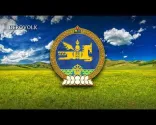
A presentation of Mongolia's current national anthem, with Mongolian lyrics and visuals including the national flag, coat of arms, and landscapes. It provides an audio reference for discussing the anthem's text.

A short vocal recording of Mongol Internationale, identified as the anthem of the Mongolian People's Republic from 1924 to 1950. English captions accompany the Mongolian lyrics.
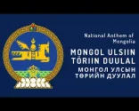
A performance of Mongolia's national anthem by the U.S. Navy Band, accompanied by images of Mongolian landscapes and national symbols. The recording demonstrates the anthem's formal ceremonial character.
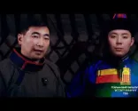
This illustrated overview of Buryat Mongolian clothing discusses distinctive hats, sleeves, robe construction, decoration, and the cultural meanings associated with different parts of the ensemble.
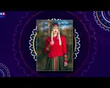
This short overview presents the main elements of a Mongolian deel outfit, including the robe, sash or belt, hat, and boots, with visual examples of how the pieces work together.

A concise introduction to the Mongolian deel, showing its wrap front, sash, long sleeves, collar, and practical design while explaining how the garment is worn and adapted for different seasons.

This short video shows a formal ceremony in Ulaanbaatar honoring Chinggis Khaan, offering visual context for the state observances associated with Mongolia’s National Pride Day.
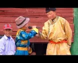
BBC footage introduces a traditional Mongolian festival through vivid scenes of Naadam’s wrestling, horse racing, and archery, while explaining how these sports connect to Mongolian culture.
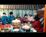
This documentary follows Mongolian families as they prepare for and celebrate Tsagaan Sar, showing traditional foods, household customs, family visits, and the festival’s cultural significance.
![[🇲🇳Mongolia] Population Pyramid & Ranking (1950-2100) #wpp2024](/sites/default/files/styles/regional_content_list_1x/public/oembed_thumbnails/2026-08/PihJngQNUt0dixhRJsPGgf7M9y-VVII82spP_mMYxJg.jpg.webp?itok=1werQJZQ)
This data visualization presents Mongolia's population trajectory from 1950 to 2100, including alternative projection scenarios that illustrate how future assumptions affect the outlook.

A population-pyramid animation shows Mongolia's demographic structure from 1950 to 2100, distinguishing historical estimates from projected future changes by age and sex.
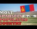
This video uses maps to explain Mongolia's exceptionally low population density, including provincial distribution and the geographic factors shaping where people live.
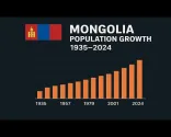
An animated bar chart traces Mongolia's population from 1935 through 2024, providing a visual overview of year-by-year changes and long-term population growth.
MNB World explores the cultural history and visual form of traditional Mongolian writing, including its distinctive vertical layout and continuing importance in Mongolia.

An English-language history of Mongolia’s alphabet changes, explaining the adoption of Cyrillic and the continuing effort to restore the traditional Mongolian script.
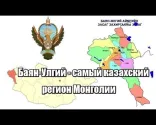
A short report from Bayan-Ölgii showing the province’s multilingual educational landscape, including schools that provide instruction in Kazakh alongside Mongolian and Tuvan.
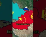
An animated map explains why Mongolia and Kazakhstan are close to one another but do not share a direct border, with Chinese territory between them.
A visual overview of the China–Mongolia border, including border landscapes and the broad frontier across the region.

A border journey from Russia into western Mongolia, showing the landscape and route around the Mongolia–Russia frontier near Ulgii.
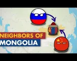
An animated geography overview showing Mongolia's two direct neighbors, Russia and China, and explaining how their borders surround the country.
A Smithsonian report from Hustai National Park showing Przewalski’s horses and the conservation work behind their return to Mongolia’s steppe.
Footage of Mongolia’s State Flag and Great White Banners being raised, illustrating the ceremonial role of the Nine White Banners in contemporary Mongolian state tradition.
An English-language visual breakdown of Mongolia’s Soyombo symbol, explaining its distinctive flame, sun, moon, and geometric forms and their cultural meanings.

A concise English-language overview of Mongolia’s State Emblem, highlighting its major visual elements and the meanings associated with the country’s sovereignty, heritage, and identity.
A concise travel guide profiling several major Mongolian cities, including Ulaanbaatar and Bayan-Ölgii, with a look at their distinct identities, attractions, and travel roles.

An English-language overview of Mongolian currency, showing tögrög banknotes and explaining their connection to the MNT currency code.

A brief guide to registering a .mn domain name in Mongolia, covering the basic requirements and registration process.

MNB World explains how foreign citizens can use online services to check residence-permit information and manage details such as address and passport data.

The Immigration Agency of Mongolia explains foreign-national registration requirements, including the responsibilities and deadlines that apply after entering Mongolia.

E-Mongolia demonstrates how foreign citizens register through the DAN 2.0 system, showing the digital steps involved in completing post-arrival registration in Mongolia.

An English comparison of Mongolia and Inner Mongolia that shows their different political identities, geographic contexts, and flag designs.

A chronological visual history of Mongolia's flags, including the socialist-era red-blue-red design, the Soyombo, and the communist star used before 1992.

A concise animated timeline showing how Mongolia's flag changed across major political periods, from the Bogd Khanate through socialist rule and later designs.

A visual breakdown of the Soyombo symbol's geometric components, including its triangles, rectangles, paired central motif, flame, sun, and moon.

A concise English explanation of the Mongolian flag's Soyombo emblem, highlighting the flame, sun, moon, and the symbolism associated with its main elements.

National Geographic recounts Temüjin’s rise as Chinggis Khaan, his unification of Mongol groups and the formation of the Mongol Empire.
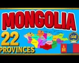
An English-language guide to Mongolia’s 21 aimags and the capital municipality, with maps and explanations of the country’s provincial structure.
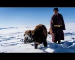
This short report examines dzud, Mongolia’s severe winter disaster, through footage and interviews with herding communities affected by extreme weather.
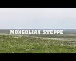
A documentary exploration of Mongolia’s open steppe, showing the landscapes, ecosystems and pastoral environments that shape the country’s physical geography.

A five-minute animated history of the Mongol Empire, explaining its rise from the East Asian steppe and its expansion across much of Eurasia.

An educational map-based overview of Mongolia, showing its location between Russia and China and highlighting Ulaanbaatar and the country's main geographic divisions.
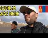
An English-language exploration of Karakorum, including the ancient capital’s archaeological remains, Erdene Zuu Monastery, museum exhibits, and historical importance.
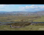
Drone footage follows the Tuul River through Ulaanbaatar, showing the capital’s valley setting, surrounding landscape, and relationship with the river.

High-quality aerial footage showing Ulaanbaatar's 3–4 district and khoroolol area, offering a concrete visual example of the capital's smaller urban subdivisions.

A visual tour of Mongolia's 21 aimags, combining maps, area information, names, and representative imagery for each provincial-level division.

A concise, map-based introduction to Mongolia's 21 aimags, Ulaanbaatar, and the country's top-level administrative structure, with narrated explanations of the provinces and their centers.

A concise look at staying in a Mongolian ger camp, including the traditional tent interior, shared experience, surrounding setting, and the basic character of a rural camp stay.

A firsthand English-language tour of Gobi Erdene Ger Camp, showing the camp setting and differences between traditional gers, cabins, and more comfortable accommodation options.

A multi-day Gobi journey featuring ger camp stays, the Flaming Cliffs, Khongoryn Els sand dunes, camel experiences, and other desert attractions.

A visual travel overview of Dalanzadgad and its surrounding streets, helping show the contrast between the town core and more peripheral desert-edge settings.

A practical journey showing the drive toward Altai Tavan Bogd National Park, including remote roads, challenging terrain, permit considerations, and the landscape on the approach.

An English-language walking tour through Olgii, with views of the town centre, main square, streets, local businesses, and the urban setting near the Altai mountains.

A short Western Mongolia travel diary showing the approach to Olgii City, including views of the central square and examples of city accommodation and facilities.

Aerial footage of the approach and landing at Ulgii Airport followed by a visual introduction to Olgii and its surrounding landscape.

A first-hand visit to Mongolia’s Golden Eagle Festival in Bayan-Ölgii, showing eagle competitions, festival activity, traditional dress, and the atmosphere of this major cultural event.

A concise English visit to Yolyn Am in Gobi Gurvansaikhan National Park, showing the gorge, rock formations, walking route, and seasonal ice landscape.

An English overview of the South Gobi route, covering Dalanzadgad, Gobi Gurvansaikhan National Park, Yolyn Am, Khongoryn Els, and Bayanzag with useful landscape and itinerary context.

A firsthand journey across the Tashanta–Tsagaannuur border between Russia and Mongolia, showing border logistics and the need to arrange onward local transport toward western Mongolia.

An English-captioned drive through western Mongolia to Ölgii, showing the terrain, road surfaces, distances, and vehicle conditions relevant to private overland travel.

An English-language travel diary covering the journey from Ulaanbaatar toward western Mongolia, including the flight experience and an overland 4x4 transfer toward Ölgii.

A road journey from Ölgii to Khovd on Route AH-4, documenting paved and rough sections, remote scenery and the practical conditions travelers may encounter when arranging a western Mongolia overland itinerary.

A short English-language news report about MIAT Mongolian Airlines resuming domestic flights to Hovd, providing useful background on the availability of regional air service.
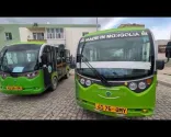
This short walking tour shows Dalanzadgad, the Gobi gateway town, and provides visual orientation for travelers arriving before joining a regional tour or arranging onward transport.

This video follows a bus trip from Ulaanbaatar to Dalanzadgad, showing the departure station, long-distance road journey, rest stops, and arrival in the Gobi region.

An English-language guide to attending Mongolia’s Golden Eagle Festival in Ölgii, covering travel logistics, accommodation, transport, and planning considerations.

A firsthand journey through Altai Tavan Bogd shows remote ger accommodation and expedition conditions, including practical cost details for staying in the park.

A firsthand arrival in Ölgii includes a stay at Travelers Guesthouse, with a look at its yurt-style rooms, facilities, and practical accommodation setup.

Footage from Hovd showing a hotel stay and shopping for groceries and everyday goods in a local store, with prices visible on screen.

A flight into Khovd followed by a look inside the Steppe Hotel, including the room, bathroom, and hotel facilities.

A practical look at booking and taking a Gobi desert tour with Explore Gobi, including the vehicle, accommodation, food, route experience, and considerations before paying for a package.

A walk through a Dalanzadgad supermarket with close-up views of local products and visible price tags, offering a practical visual reference for grocery shopping in town.

An English-language look at staying in a remote ger camp near Khongoryn Els, covering the accommodation, facilities, meals, and practical realities of a Gobi desert night.

A photography-focused journey around Olgii, Tsambagarav Mountain, and Tolbo Lake, capturing western Mongolia’s mountain scenery, lakes, Kazakh heritage, and distinctive seasonal light.

A drive through western Mongolia from Olgii toward Khyargas Lake, showing rough unpaved roads, remote routes, changing landscapes, and the uncertainty of overland travel.

Filmed near Olgii, this winter journey shows eagle hunters, snow-covered landscapes, severe cold, and the need for preparation and experienced local support in western Mongolia.

A vivid look at Kazakh eagle-hunting traditions and the Golden Eagle Festival in Bayan-Ölgii, with festival events, local culture, and the autumn landscape around western Mongolia.

A July trek through Mongolia’s Altai Mountains, showing remote trails, mountain scenery, river crossings, camping, and the practical realities of reaching the Olgii area by 4x4.

A recent travel diary through Western Mongolia, including Ölgii and Hovd, showing autumn landscapes, regional roads, local infrastructure, and the atmosphere of the shoulder season.

A firsthand road trip through Western Mongolia, including Khovd, with dry summer scenery, remote roads, changing travel conditions, and practical insights into getting around the region.

A documentary look at Kazakh nomadic families in Western Mongolia during spring migration, showing livestock movement, difficult terrain, cold conditions, and the seasonal realities of pastoral life.

This winter expedition captures frozen rivers, snow-covered landscapes, extreme cold, 4x4 travel, and the practical challenges of moving through Mongolia during harsh seasonal conditions.

A visually rich journey through Western Mongolia, traveling from the Gobi toward the Altai Mountains and passing through Khovd, with expansive mountain, desert, and rural landscapes.

A road journey from Dalanzadgad to Khongoryn Els, illustrating the distances, rough tracks, and vehicle-based logistics involved in reaching remote Gobi sites.

An English-language visual overview of Yolyn Am, Khongoryn Els, and Bayanzag, showing the contrasting canyon, dune, and fossil-landscape settings of the Gobi.

A close look at Yolyn Am in the Gobi, including its canyon landscape and local commentary about why the area becomes more spectacular from July.

Footage from Dalanzadgad and Khongoryn Els filmed in May, showing dune scenery, climbing conditions, and the physical demands of an outdoor Gobi excursion.

An English-language report on Mongolia’s yellow dust storm and blizzard alerts, showing how official weather warnings can differ from normal climate expectations.

An expedition to Asralt Khairkhan in the Khentii region, with mountain and winter-travel visuals that show how weather, terrain, and remoteness can affect road-based planning.

A journey through Khentii Province that includes arrival in and exploration of Chinggis City, along with rural roads and local landmarks. It offers useful visual context for using the city as a touring base.

An English-language travel experience showing the practical realities of camping in rural Mongolia, including remote surroundings and the difference between apparent wilderness and managed tourist sites.

A short visual introduction to an expedition into the Khan Khentii mountains, showing remote tracks, rivers, wilderness scenery, and the rugged terrain encountered on rural journeys.
An English-narrated walking tour through Choibalsan, showing streets, public spaces, buildings, and the city’s everyday atmosphere at street level.

An expedition through remote Dornod landscapes showing support vehicles, camping arrangements, long-distance movement, and the practical realities of traveling beyond Mongolia’s urban centers.

An English-language travelogue documenting the journey from Ulaanbaatar to Chinggis City, formerly Öndörkhaan, with practical on-the-ground views of arrival and the provincial capital.

An English-language account of taking a long-distance bus in Mongolia, covering boarding, crowded conditions, luggage handling, and the practical realities of an extended overland journey.

A road trip from the Ulaanbaatar area to Choibalsan, with views of the route, open Eastern Mongolian landscapes, roadside conditions, landmarks, and arrival in the city.

This concise Mongolia travel-cost guide includes a practical estimate for hiring a private vehicle and driver, helping explain how transport costs can change across different group sizes.
Posting is free and no registration is required.