Bud Dajo Hike from Jolo: Transport, Difficulty, and Safety
A Bud Dajo hike from Jolo is possible for some visitors, but it is not a normal walk-up trail where you arrive alone and follow signs to the summit. The mountain is close to Jolo town in Sulu, within the Bangsamoro Autonomous Region in Muslim Mindanao, yet the main planning issues are access, current local advice, transport, and respect for the site. This guide explains what to check before going, how Jolo works as a hiking base, what the trail is likely to feel like, and why Bud Dajo must be approached as a sacred and historical landscape as well as a mountain hike.
Bud Dajo Hike from Jolo: What to Know First
Bud Dajo is one of the most distinctive hikes in the Sulu Archipelago. It combines a volcanic cone, a crater-rim setting, local cultural meaning, and a painful historical memory. For that reason, planning should begin with coordination and context, not with a GPS track.
Quick verdict for hikers
Bud Dajo is a realistic day hike from Jolo only when access, local transport, and current safety coordination are arranged in advance. Recent hiking accounts describe Bud Dajo as a mountain of around 620 meters, with the physical effort generally more moderate than technical. A recent Bud Dajo account by Pinoy Mountaineer is useful for understanding the broad hiking character, but it should not be treated as a permanent access manual.
The main challenge is not usually the slope alone. The bigger questions are whether the hike is currently advisable, who is coordinating the movement, how the group will reach the jump-off, and what local instructions apply on the day. Exact fares, schedules, trailhead details, and permission steps can change, so treat any old blog post or social media comment as a starting point only.
If your goal is a simple independent Philippine day hike, Bud Dajo may not fit that expectation. If your goal is a carefully arranged hike with local guidance, sober historical awareness, and flexibility, it can be a meaningful part of a Jolo visit.
Why Bud Dajo is different from a normal casual day hike
Bud Dajo is not just a viewpoint. It is an extinct volcanic cone, a sacred landscape for local communities, and a place tied to the 1906 Bud Dajo massacre. The mountain’s scenic value, cultural meaning, and historical weight are inseparable.
Many hikers are used to popular trails in Luzon, Cebu, or other parts of the Philippines where they can book a guide, pay a registration fee, and start walking with minimal background checks. Bud Dajo is different. Movement may be escorted or coordinated, access may depend on local assessment, and visitors are expected to behave with restraint.
This does not mean the hike should be described with fear or drama. It means the visit requires maturity. You are entering a place where local trust matters, where instructions can change, and where the summit is not only a photo stop.
Access, Permission, and Current Safety Checks Before You Go
Before planning the trail itself, confirm whether the hike is suitable for the date you intend to visit. In Sulu, practical hiking planning is closely linked to local coordination, current conditions, and respect for local authority.
Why local coordination is part of the route
Recent hiking accounts describe Bud Dajo access as something arranged through local organizers and relevant security channels, rather than by casual independent arrival. The hiking account from Jovial Wanderer gives a recent traveler’s view of the hike and the serious historical atmosphere around the crater.
Some recent discussions of hiking in Sulu mention coordination through local security channels, including a reported 1101st Infantry Brigade coordination channel. Treat that as a detail to verify locally, not as a fixed public permit procedure. The correct contact route may change, and visitors should follow the guidance of reputable local organizers and local authorities at the time of travel.
A local organizer can help align transport, timing, group size, permission, and the current safety assessment. Do not assume that a mountain appearing on a map, or an older protected-area label, means open entry, marked trails, visitor centers, or ranger-style infrastructure.
Checks to make before booking the hike
Before committing to a Bud Dajo hike, ask direct questions. A responsible arrangement should make the access process clear enough for you to understand who is coordinating the visit and what happens if conditions change.
- Is Bud Dajo currently open or advisable for visitors on the intended date?
- Who is coordinating local access, permission, or security clearance?
- Who will accompany the group on the trail and during the road transfer?
- Where is the pickup point in Jolo town?
- What is included in the arrangement, such as transport, guide support, meals, or water?
- What is the expected return plan if rain, road conditions, or local advice changes?
- What group size is suitable for the day?
- What should visitors avoid wearing, bringing, saying, or photographing?
It is also sensible to check current official travel advisories, especially for international travelers. Advisory language can be broad, and local conditions can vary, so use it together with current local information rather than relying on only one source.
A good organizer should be able to explain the planning flow without promising that access is guaranteed. If the answer is vague, rushed, or based only on “people went there before,” treat that as a reason to pause.
When to postpone or change plans
Postpone the hike if local security advice changes, if weather is poor, if transport is uncertain, or if the organizer cannot clearly explain how the visit is coordinated. A cancellation should be treated as a safety decision, not as a problem to work around.
Build flexibility into a Jolo or Sulu itinerary. Do not make the entire trip depend on one fixed hiking morning. Weather, access instructions, group movement, and local assessments can all affect the plan.
If you are uncomfortable with the security context, or if your home country’s advisory is not compatible with your risk tolerance, choose another activity. Completing the summit is less important than respecting local guidance and returning safely.
How to Reach Jolo and Arrange Transport to Bud Dajo
Jolo town is the practical base for Bud Dajo, but reaching Jolo and reaching the trailhead are two separate planning tasks.Both should be confirmed close to departure because schedules and local conditions may change.
Reaching Jolo through Zamboanga
Zamboanga City is the main practical gateway often used for onward travel to Jolo and the wider Sulu Archipelago. Depending on current operations, travel may involve ferry services and limited air options. Jolo port and Jolo Airport are the relevant local anchors, but visitors should not assume frequent, simple, or daily tourist-style connections without checking current schedules.

The Bangsamoro Government provides useful local transport governance context for Jolo, but travelers still need current operator or terminal confirmation for actual routes, departure times, and availability.
Do not rely on old ferry timetables, outdated flight listings, third-party booking pages, or social media posts as final confirmation. Allow buffer days where possible because weather, operations, and local conditions can affect movement between Zamboanga City and Jolo.
Using Jolo town as the hiking base
Jolo town is the logical base for a Bud Dajo day hike because it concentrates transport access, accommodation options, local contacts, and administrative services. This does not mean Jolo functions like a mass-market hiking base. Hiking is still a specialized reason to visit, and arrangements are more personal and locally coordinated than in established Philippine mountain towns.
Plan Jolo as a base for organized day movement, not spontaneous self-guided mountain travel. Keep your accommodation contact and transport contact informed of your hiking schedule, especially if your group expects an early departure and a return before late afternoon.
Visitors should also understand that freedom of movement may not feel the same as in large tourist cities. Follow local advice on where to go, when to travel, and how to move between locations.
Getting from Jolo town to the Bud Dajo trailhead
Recent accounts point to pre-arranged vehicles and local coordination as the normal way to reach the Bud Dajo jump-off. The exact public transport route, trailhead barangay, and road approach are not sufficiently verified for a do-it-yourself instruction. For that reason, it is not responsible to publish a step-by-step route as if any visitor can simply copy it.
Ask the organizer to confirm the pickup point, approximate road travel time, road conditions, any courtesy-call or registration expectation, and return arrangements. Also ask whether the vehicle waits, whether the group descends by the same route, and what happens if rain makes the road or trail slower.
Avoid hiring a random tricycle or trying to find the trailhead without local approval. Even if the mountain appears close on a map, access is not only a navigation issue.
| Planning point | What is reasonably clear | What to confirm locally |
|---|---|---|
| Main base | Jolo town is the practical base. | Your pickup point and return plan. |
| Gateway | Zamboanga City is commonly used for onward travel to Jolo. | Current ferry or air options near your travel date. |
| Trailhead access | Pre-arranged local transport is the safer planning model. | Road approach, access status, and who accompanies the group. |
| Independent route | No reliable public do-it-yourself route is established here. | Whether visitors are allowed to proceed on the intended date. |
Bud Dajo Trail Route, Terrain, and Difficulty
The Bud Dajo trail is best understood as a guided local route on a volcanic cone, not as a standardized national-park trail. Expect the exact approach to depend on current local arrangements.
Route profile from lower slopes to crater rim
In broad terms, a Bud Dajo hike may involve a vehicle approach from Jolo, lower slopes where settlement or cultivation may be present, vegetated trail sections, steeper upper portions, and a crater-rim visit. The route should be described this way because no verified public official trail map is available for general visitors.
The geology helps explain the experience. The Smithsonian Global Volcanism Program identifies Bud Dajo, also written Buddajo, as a basaltic cinder cone rising above 600 meters within the Jolo Volcanic Group.
That volcanic form is part of the appeal: the hike is not only about reaching a high point but also about understanding a crater landscape. Still, do not use this description as navigation. Follow the route chosen by the local guide and stay with the group.
Difficulty level and fitness expectations
Physically, Bud Dajo is best described as a moderate guided day hike for reasonably fit beginners or beginner-to-intermediate hikers. It does not appear to require technical climbing in the usual mountaineering sense, but that does not make it effortless.
Heat, humidity, mud, recent rain, and group pacing can make a relatively low-elevation mountain feel harder. Hikers should be comfortable walking uphill for several hours, descending carefully, and following instructions without separating from the group.
Do not judge difficulty by elevation alone. A 620-meter tropical hike with access constraints can demand more planning and discipline than a higher but more established trail elsewhere. If you are new to hiking, do some shorter uphill walks before the trip and be honest about your pace.
Views, crater features, and the descent
The summit experience is centered on the crater rim, the shape of the volcanic landscape, views over Jolo Island and the sea when weather allows, and the historical atmosphere of the site. Clouds, rain, or haze can limit visibility, so do not plan the hike only as a guaranteed viewpoint.
Allow time at the rim for quiet observation. The site deserves more than a fast photo stop. If there are areas where the guide asks the group not to enter, not to photograph, or not to make noise, follow that guidance immediately.
The descent can require as much attention as the ascent. Grass, soil, roots, and mud can become slippery, especially after rain. Descend slowly, keep spacing between hikers, and stay with the group until you return to the vehicle or agreed end point.
Weather, Timing, and What to Bring
Bud Dajo is not a long expedition for most arranged groups, but the tropical climate makes timing and packing important. Plan for heat, sudden rain, and limited on-trail facilities.
Best time of day and seasonal cautions
An early morning start is usually the safest general approach. It reduces heat exposure, gives the group more daylight, and leaves more room for delays caused by road movement, courtesy calls, weather, or pacing.
Jolo has a hot, humid tropical environment. Even a moderate trail can feel strenuous when the air is still and the sun is strong. Afternoon showers are also possible, and recent rain can change the trail surface quickly.
Avoid assuming that a single “best month” guarantees ideal conditions. Check short-term local forecasts, ask the organizer about recent slope conditions, and remember that security scheduling may matter as much as weather preference.
Packing for heat, rain, mud, and sun
Pack for a half-day guided hike, but do not underpack. Bring grippy shoes, enough water, sun protection, light rain protection, quick-dry clothing, personal medicines, snacks, and a small trash bag. Protect your phone, camera, passport copy, and other documents from sudden rain.
Heavy trekking gear is usually unnecessary for a short guided ascent, but sandals with poor grip, insufficient water, and no sun protection can make the day uncomfortable or unsafe. Do not assume that shops, water refills, toilets, or shelters will be available near the trailhead unless your organizer confirms them.
Ask if there are any items you should avoid bringing. This may include drones, loud speakers, or anything that could be inappropriate at a sacred or historically sensitive site.
Clothing and behavior for a sacred site
Wear modest, practical hiking clothing that respects local norms while still allowing safe movement. Lightweight long sleeves, breathable pants, and a hat can work well for sun, brush, and cultural comfort.
Behavior matters. Avoid loud music, littering, disruptive posing, jokes around memorial or sacred areas, and photography that treats the site as a prop. If you are unsure whether a photo, path, or action is appropriate, ask the local guide first.
Responsible conduct is not a superficial checklist. Bud Dajo is a place of memory and meaning. A respectful visitor moves quietly, listens more than they speak, and accepts local boundaries without argument.
Cultural and Historical Context of Bud Dajo
A Bud Dajo hike cannot be separated from cultural and historical context. Understanding that context helps visitors behave with care and gives the landscape its deeper significance.
Bud Dajo as a Tausug sacred landscape
Bud Dajo is widely described as a sacred mountain for local communities in the Sulu Archipelago, including Tausug communities. Its meaning predates modern hiking and tourism. Visitors should not treat it as a newly discovered outdoor attraction.
It is better to think of the hike as a visit to a living cultural landscape. That means local people may have relationships with the mountain that are not visible to outsiders. Not every meaning will be explained, and visitors do not need to know every detail to behave respectfully.
Avoid simplifying Tausug culture or local religious life into stereotypes. For practical purposes, the key visitor rule is simple: follow local guidance, dress modestly, speak respectfully, and do not assume that access equals permission to do anything you want.
The 1906 massacre and why it changes the hike
Bud Dajo is associated with the First Battle of Bud Dajo in 1906, widely remembered as a massacre involving Moro men, women, and children. A commentary published by ABS-CBN News discusses Bud Dajo as a place of resistance and memory, which helps explain why the mountain carries a heavier meaning than an ordinary summit.
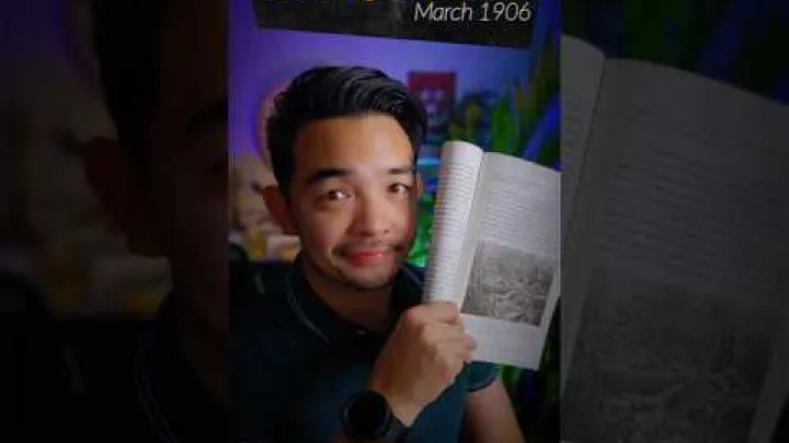
The crater geography is part of why the site became historically significant, but a hiking guide does not need to turn the visit into a battlefield analysis. What matters for visitors is that the place is linked to grief, memory, and identity.
Use quiet reflection around historical or memorial areas. Avoid graphic curiosity, insensitive photography, or treating the story as entertainment. The history changes the hike because it changes your responsibility while you are there.
Bud Dajo Compared with Other Hikes
Bud Dajo can be compared with other hikes only in a limited way. Its physical difficulty may be moderate, but its access and meaning make it different from many better-known Philippine trails.
Bud Dajo versus Bud Tumantangis
Bud Tumantangis is the main nearby Jolo hiking reference point for many hikers. It is reported as the higher peak on Jolo Island and may involve a more sustained physical climb. A separate account by Pinoy Mountaineer describes Bud Tumantangis as an ascent of Sulu’s highest peak.
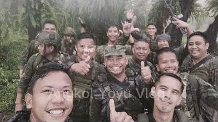
Bud Dajo is generally positioned as the shorter hike, but it is more historically and culturally charged. Bud Tumantangis may appeal more to hikers focused on physical effort and altitude, while Bud Dajo may be more compelling for those interested in landscape, memory, and context.
Neither should be treated as an ordinary walk-up trail. Both require current local coordination, and any plan to combine them should be confirmed locally rather than assumed from a map.
| Hike | General character | Planning note |
|---|---|---|
| Bud Dajo | Shorter volcanic cone with crater and strong historical meaning. | Prioritize access, conduct, and local coordination. |
| Bud Tumantangis | Higher Jolo Island peak with a more sustained climb. | Confirm guide, transport, and current access before planning. |
Where Bud Dajo fits among Philippine beginner hikes
In physical terms, Bud Dajo may sit in the beginner-to-intermediate day-hike range for a reasonably fit person. In planning terms, it is far more complex than many popular beginner hikes in the Philippines.
This distinction is important. A scenic easy walk may need little more than shoes and transport. A proper mountain hike needs pacing, weather awareness, water, and descent care. Bud Dajo adds another layer: permission, current local advice, security context, and cultural sensitivity.
Do not compare mountains only by height, distance, or the number of hours listed online. A moderate trail can still require serious preparation when the access environment is sensitive.
A realistic half-day plan from Jolo
A realistic Bud Dajo plan begins the day before the hike. Confirm access, pickup details, who will accompany the group, expected weather, and what will happen if the plan changes.
On the hiking day, the general flow may be early pickup in Jolo town, coordinated vehicle transfer to the jump-off, guided ascent, crater-rim visit, careful descent, and return to town in daylight. This is only a planning model, not a fixed schedule.
Leave buffer time for courtesy calls, checkpoints, weather, group pacing, and road delays. Do not pair Bud Dajo with too many other activities on the same day unless the local organizer says it is realistic. The most important timing goal is not reaching the rim at a certain minute; it is completing the movement safely and respectfully.
When to choose another Jolo activity instead
Choose another activity if coordination is unclear, if access is not advisable, if weather is poor, or if you are uncomfortable with the security context. Skipping the hike can be the responsible travel decision.
Jolo and Sulu may offer cultural, coastal, or heritage-focused alternatives when mountain access is not suitable, but visitors should ask current local contacts rather than relying on unsupported lists of attractions. Conditions and recommendations can change.
Do not treat cancellation as failure. In a place where local assessment matters, changing plans is part of respectful travel.
Frequently Asked Questions
Can you hike Bud Dajo independently from Jolo?
Do not plan Bud Dajo as an independent walk-up hike. Recent accounts point to local coordination, arranged transport, and current access checks. Use a reputable local organizer and follow local instructions.
How do you get from Jolo town to the Bud Dajo trailhead?
The safest planning model is pre-arranged vehicle transfer from Jolo town through a local organizer. The exact trailhead approach is not reliable enough to publish as a do-it-yourself public transport route.
Is Bud Dajo a difficult hike?
Physically, Bud Dajo is usually described as moderate rather than technical. Heat, humidity, mud, and descent conditions can make it harder, and the logistics are more complex than the trail grade.
What is the best time to hike Bud Dajo?
An early morning start is generally best because it reduces heat exposure and gives more daylight for delays. Check recent weather and trail conditions locally before going.
Why is Bud Dajo historically sensitive?
Bud Dajo is associated with the 1906 First Battle of Bud Dajo, widely remembered as a massacre involving Moro men, women, and children. Visitors should behave quietly and respectfully, especially around crater or memorial areas.
How does Bud Dajo compare with Bud Tumantangis?
Bud Dajo is generally the shorter but more historically charged hike. Bud Tumantangis is reported as the higher Jolo Island peak and may be the more sustained physical climb. Both require current local coordination.
Final Takeaways for Planning the Bud Dajo Hike
Bud Dajo can be a meaningful hike from Jolo, but it requires more than ordinary trail planning. Arrange local coordination first, confirm current access and transport, start early, bring practical gear for heat and rain, and be ready to postpone if conditions are not right.
Approach the mountain with humility. It is a volcanic cone, a sacred landscape, and a site of painful historical memory. If you treat the Bud Dajo hike as a coordinated visit rather than a casual summit chase, you will plan more safely and behave with the respect the place deserves.
Select area
Create a post
Posting is free and no registration is required.