Mount Dajo National Park Jolo: Safety, Nature, Access
Mount Dajo National Park Jolo is one of the most important nature landmarks on Jolo Island in Sulu Province, but it is not a simple leisure destination. The mountain, also known as Bud Dajo, combines volcanic landscape, cultural meaning, and painful history in a region where travel safety must be considered first. This guide explains what the place is, how it relates to Jolo town and the Sulu Archipelago, what the landscape is like, and what visitors must verify before considering any trip. It is written for readers who want accurate nature and access information without ignoring current security risk.
Start With Safety: Should You Visit Mount Dajo National Park Now?
Before thinking about trails, viewpoints, or transport, readers should treat safety as the first decision point. Mount Dajo National Park is in Sulu, and Sulu is covered by serious travel warnings from multiple official advisories.
Current Travel Advisories for Sulu and Jolo
The most important practical fact is that the Sulu Archipelago is not treated like a normal Philippine nature destination in many government travel advisories. The U.S. Department of State advises against travel to the Sulu Archipelago, including the southern Sulu Sea, due to risks including crime, terrorism, civil unrest, and kidnapping.
The United Kingdom also maintains safety and security guidance for the Philippines, and travelers should check the current country page and regional warnings before planning movement toward Sulu. The GOV.UK travel advice is useful as a second official reference because conditions can change and different governments may update advisories at different times.
A favorable hiking season, a short route from Jolo town, or a friendly local contact does not remove these risks. Official advisories should be read before travel decisions are made, not after tickets are booked.
A Practical Go or No-Go Decision for Readers
For most international leisure travelers, Mount Dajo National Park should be considered unsuitable while serious official warnings remain in place for Sulu and the Sulu Archipelago. This does not mean the mountain lacks natural or cultural value. It means that the risk environment may be beyond what ordinary visitors can assess or manage safely.
A practical decision hierarchy is simple. First, check your own government travel advisory. Second, confirm current conditions with local or regional authorities and trusted local contacts. Third, verify transport reliability and exit options. Fourth, consider weather, trail condition, and personal hiking ability.
| Decision point | What it means | Practical response |
|---|---|---|
| Official advisory | Highest-level risk signal | Do not treat the trip as normal tourism if warnings are serious. |
| Local confirmation | Current situation on the ground | Confirm with trusted local and official contacts before movement. |
| Transport and exit | Ability to arrive and leave safely | Check schedules, cancellations, communications, and backup plans. |
| Weather and trail | Hiking comfort and physical risk | Consider only after security and access are acceptable. |
Filipino travelers, researchers, journalists, locally connected visitors, and official delegations may evaluate risk differently from international holidaymakers. Even then, not going can be the responsible choice when current information is uncertain or official warnings are severe.
If Travel Continues Despite Warnings, What Must Be Verified Locally
If a traveler still has a legitimate reason to consider movement toward Jolo or Bud Dajo, all practical details should be verified close to the date of travel. Local conditions can vary by municipality, road, day, and security operation. A general statement that a place is reachable is not enough.
Items to confirm include current access to the mountain, whether a local guide or host is available, whether any permission or coordination is expected, where to stay, how to communicate, what medical support exists, and how to leave if transport is delayed. The Philippine News Agency has described tourism potential across the Bangsamoro region, but regional potential should not be confused with guaranteed access at one specific site on one specific day.
Do not assume that escorts, guides, permissions, or local transfers are always available. If any part of the plan depends on informal assurances, treat that as a warning sign and seek clearer confirmation before moving.
Location and Identity of Mount Dajo National Park
Understanding the name and location helps avoid confusion. Mount Dajo National Park is often discussed through several overlapping terms: Bud Dajo, Mount Dajo, Jolo Volcano, Jolo Island, and Sulu.
Jolo Island, Sulu Province, and the Bangsamoro Setting
Mount Dajo National Park is on Jolo Island in Sulu Province, within the Bangsamoro Autonomous Region in Muslim Mindanao. Jolo can refer to the island and also to Jolo town, the main urban center and practical local anchor for services, transport, and orientation.
For international readers, the map relationship is easiest to understand in layers. The destination is in the Philippines, in the Sulu Archipelago, on Jolo Island, near the local sphere of Jolo town. It is not a mainstream national park stop like more developed destinations in other parts of the country.
Because Sulu sits within the wider Sulu Sea and Sulu Archipelago setting, transport and security questions are regional as well as local. A route that looks short on a map may still require careful coordination.
Bud Dajo, Mount Dajo, and the National Park Name
Bud Dajo is the mountain or volcanic cone at the center of Mount Dajo National Park. Readers may also see names such as Mount Dajo, Dajo National Park, Jolo Volcano, or Bud Dahu in older or varied references. These names should not be treated as separate attractions.
In this guide, Bud Dajo refers to the mountain itself, while Mount Dajo National Park refers to the protected or park landscape associated with it. Local terminology should be respected, and anyone with a real need to visit should confirm naming, access points, and local expectations with hosts or authorities in Jolo.
National Park Status and What Visitors Should Not Assume
The words national park can create expectations that may not fit Mount Dajo. Visitors should not assume there will be a formal visitor center, staffed ranger desk, online permit system, marked interpretive trail, toilets, shops, rescue facilities, or standardized tourism services.
There is a difference between a legally or historically recognized park and a fully developed visitor-ready park. In lower-infrastructure and security-sensitive areas, access may be mediated through local authorities, community arrangements, or practical security considerations rather than through a simple public ticket office.
Because current public information about boundaries, permits, and management arrangements is limited, the safest wording is also the most practical: do not arrive expecting independent access. Confirm the current situation locally before any movement toward the mountain.
Nature and Volcanic Landscape on Bud Dajo
Bud Dajo is important not only because of its name on a map, but because of its volcanic form and its role in the Jolo landscape. Its natural value should be described carefully, without exaggerating what is known from public sources.
A Compact Cinder Cone With a Crater Summit
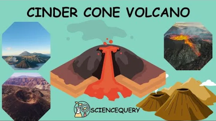
The UP Resilience Institute profiles Bud Dajo as a basaltic cinder cone rising to about 660 meters above sea level and notes its place among the mountain peaks of Jolo. A cinder cone is a volcanic hill built from loose volcanic fragments that accumulate around a vent.
In practical landscape terms, that means the mountain can have steep slopes, volcanic soils, and a crater-like summit form. Volcanic soils can support lush vegetation when moisture, shade, and land use allow it, but they can also be vulnerable to erosion when vegetation is removed.
Public descriptions of Bud Dajo sometimes differ on whether it is active, extinct, or treated as part of a broader volcanic profile. Readers should not use casual labels to assess volcanic hazard. If volcanic status matters for a project, research visit, or official activity, consult current Philippine geological or disaster-risk authorities rather than relying on travel summaries.
Forest Patches, Cultivated Slopes, and Deforestation
Mount Dajo should not be imagined as untouched wilderness. A more realistic description is a small mountain landscape with a mix of vegetation, secondary growth, cultivated slopes, and remaining forest patches. Like many small protected landscapes, it is sensitive to what happens around its edges.
Deforestation and habitat pressure are concerns often associated with small mountain areas because forest cover helps protect soil, reduce erosion, provide shade, and support wildlife. On a volcanic cone, slope stability matters for both the environment and the hiking experience.
At the same time, land use should not be discussed as if it is separate from local livelihoods. Agriculture, settlement, and community needs are part of the landscape. Responsible nature writing should recognize conservation value without simplifying the lives of people who live around the mountain.
Wildlife Value and the Limits of Available Species Data
The Sulu Archipelago has biodiversity significance, especially because island systems often support distinctive habitats and species. However, accessible park-specific wildlife data for Mount Dajo National Park is limited. It would be misleading to promise a detailed wildlife-viewing experience without stronger site-specific evidence.
Forest patches and secondary growth may provide habitat for birds and other wildlife, but visitors should keep expectations modest. The main nature interest of Bud Dajo is its volcanic form, mountain setting, vegetation, and cultural landscape, not a guaranteed list of animals to see.
Conflict, access restrictions, and limited infrastructure can also reduce the amount of public scientific information available for sensitive areas. When information is scarce, careful language is better than speculative species lists.
Cultural and Historical Respect at Bud Dajo
Bud Dajo is not only a mountain. It is a sacred and historically charged landscape in the Tausug homeland, and any discussion of visiting must include cultural respect.
A Sacred Mountain in the Tausug Homeland
Bud Dajo is culturally important to the Tausug people of Sulu. It should not be described only as a hike, viewpoint, or natural attraction. A trail can also pass through a sacred landscape, and a summit can hold meaning that is not visible to an outsider.
Respect starts with listening to local guidance. Visitors should follow local norms on clothing, speech, photography, and movement. If a local host or guide says a place should not be entered, photographed, or treated casually, that guidance should be followed without argument.
Good travel behavior in Jolo is not only about politeness. It can also affect trust, safety, and whether future visitors are welcomed or discouraged.
The 1906 Moro Crater Massacre and Why the Crater Is Not Just a Viewpoint
Bud Dajo is widely remembered for the 1906 events often called the Moro Crater Massacre. The crater is therefore not only a scenic feature. It is a place connected to historical trauma, memory, and commemoration.

Visitors should avoid treating the crater as a dramatic photo stop or adventure backdrop. If memorial spaces, markers, or local explanations are present, they should be approached quietly and respectfully. The correct attitude is closer to visiting a place of remembrance than visiting an ordinary viewpoint.
Because historical accounts can vary in detail and interpretation, travelers should be willing to learn from local historians, community voices, and responsible interpretation rather than reducing the site to a short caption.
Conduct for Visitors on a Sacred and Commemorative Landscape
Practical conduct matters. Wear modest clothing, keep noise low, ask permission before photographing people, homes, prayer spaces, memorial areas, or sensitive locations, and avoid intrusive filming. Do not play loud music, bring alcohol-centered behavior, litter, or treat local residents as part of the scenery.
Local Islamic and Tausug cultural norms should guide behavior even when the purpose of the visit is hiking. If you are unsure, ask quietly and follow the most conservative local guidance.
This is both respectful and practical. In a security-sensitive environment, behavior that attracts attention or creates misunderstanding can increase risk.
Access, Transport, and Local Arrangements
Access information for Jolo and Bud Dajo should be handled carefully. A route may exist, but that does not mean it is appropriate for independent tourism.
Reaching Jolo From Zamboanga
Zamboanga City is commonly treated as the main gateway for travel toward Jolo. Zamboanga International Airport is the larger air access point for many travelers approaching this part of the Philippines, while sea connections between Zamboanga and Jolo are commonly cited in transport summaries. The transport-summary site Rome2rio lists Zamboanga as a nearby airport gateway and references ferry service between Zamboanga and Jolo, but schedules, fares, operators, and availability must be checked directly close to departure. Use such summaries only as orientation, not as final travel confirmation.

Most importantly, transport availability is not the same as travel safety. A ferry route, ticket office, or published schedule does not override government advisories or local security conditions.
Moving From Jolo Town Toward the Mountain
Jolo town is the practical base for any local movement toward Bud Dajo. It is where travelers are more likely to find local contacts, services, and updated information. Movement outside town should depend on current local security advice and trusted arrangements.
Depending on current conditions and local arrangements, movement may involve a hired vehicle, motorcycle, tricycle, or transfer organized by a host. These possibilities should be treated as items to confirm, not as a recommendation for independent backpacker-style travel.
Do not rely only on map apps or self-navigation. In this setting, the safer question is not simply which road goes to the mountain, but whether movement is advised at all on that day and under what local arrangement.
Guides, Permissions, Security Coordination, and Official Checks
Visitors should not assume they can arrive in Jolo and hike Bud Dajo independently. In a low-infrastructure and security-sensitive area, guides, permissions, host coordination, tourism-office checks, and security advice may matter more than a printed trail description.
Before any movement, verify the following with trusted local and official contacts:
- Whether access to Bud Dajo is currently allowed or discouraged.
- Whether a local guide or host is expected.
- Whether any permission, registration, or community coordination is needed.
- Whether roads and nearby areas are considered safe at the planned time.
- Whether mobile signal, medical help, and exit transport are reliable.
- Whether weather or marine conditions could disrupt travel back to Zamboanga or elsewhere.
Rules may be less visible online than in more developed parks. That makes local verification more important, not less.
Best Season, Trail Conditions, and Hiking Preparation
Weather matters for any mountain walk in the Philippines, but for Mount Dajo it is not the first safety issue. Security, access, and local coordination come before seasonal comfort.
Weather Windows and Why Security Still Comes First
In much of the Philippines, the cooler dry months are generally more comfortable for hiking than hot or rainy periods. For Jolo and Sulu, however, a general seasonal pattern should not be treated as a tourist recommendation. Security and official advisories still come first.
Rain can make slopes muddy and slippery, reduce visibility, and disrupt sea travel. Heavy weather can also affect ferry schedules and make exit plans less reliable. Anyone with a legitimate reason to travel should check local weather, marine conditions, and advisories close to departure.
The best weather window is only useful if the trip is otherwise appropriate. Good weather does not make a high-risk destination low risk.
Trail Difficulty, Time, and What Not to Overpromise
Bud Dajo may appear compact compared with larger mountains, but short distance does not always mean easy hiking. A volcanic cone can be steep, humid, muddy after rain, and physically demanding if the route is not maintained or clearly marked.
| Factor | Likely concern | What to verify |
|---|---|---|
| Slope | Steep sections may be tiring. | Ask about the current route and required fitness. |
| Ground | Mud or loose soil after rain. | Confirm recent weather and footwear needs. |
| Trail marking | May not match developed park standards. | Confirm guide, route, and turnaround point. |
| Overall difficulty | Includes security and infrastructure, not only elevation. | Check access, communications, and exit options. |
Without current official trail timing, it is better not to promise a fixed duration. Ask local contacts about the actual route being used, the condition of the path, and whether the planned activity is suitable for your group.
Clothing, Footwear, Water, and Low-Infrastructure Preparation
If a visit is locally cleared and appropriate, prepare for tropical hiking and low infrastructure. Wear sturdy footwear with grip, modest and breathable clothing, sun protection, and rain protection. Carry enough water and basic personal supplies.
Do not rely on shops, signs, toilets, formal rescue services, or marked facilities near the route. Bring a charged phone, a backup power source if needed, and a communication plan that works with local conditions.
Keep preparation simple and respectful. Pack out all litter, avoid damaging plants, stay on locally approved paths, and do not camp unless it is clearly authorized and safe.
Conservation, Community, and Responsible Nature Interest
Mount Dajo is valuable as a natural, cultural, and historical landscape. Responsible interest means protecting that value without promoting careless travel.
Conservation Pressures in a Small Protected Landscape
Small mountain parks are vulnerable because changes near their edges can affect the whole landscape. Deforestation, cultivation pressure, erosion, and habitat fragmentation can reduce forest cover and change the experience of the mountain.
Conservation is connected to slope stability, water retention, shade, biodiversity, and local livelihoods. It should not be framed as nature versus people. The people who live around Bud Dajo are part of the landscape and its future.
Where conservation is discussed, the most respectful framing is community-aware and culturally grounded. Outside visitors should avoid blaming local communities and instead support accurate information, local leadership, and low-impact behavior.
How to Write About or Visit Mount Dajo Without Promoting Risky Tourism
Writers, bloggers, students, and nature enthusiasts should treat Mount Dajo with humility. It is not a trophy destination, a hidden paradise, or a place to promote with careless bucket-list language.
For many readers, the responsible choice may be to learn about Bud Dajo from a distance, support accurate local narratives, and wait until conditions are clearly appropriate. Interest in nature does not always require immediate travel.
A balanced view recognizes the beauty and importance of the mountain while respecting the risk. The ethical principle is simple: respect the mountain, respect the people, and respect the risk.
Frequently Asked Questions
Is Mount Dajo National Park in Jolo safe to visit?
For most international leisure travelers, it should not be treated as a normal tourist destination while serious official advisories remain in place for Sulu and the Sulu Archipelago. Check your own government advisory first and seek current local confirmation before considering any movement.
How do you get to Mount Dajo National Park from Zamboanga or Jolo town?
Zamboanga City is commonly used as a gateway toward Jolo, with sea connections often cited between Zamboanga and Jolo. From Jolo town, any movement toward Bud Dajo should be arranged through trusted local contacts and should depend on current security advice.
Do visitors need a guide or security coordination for Bud Dajo?
Visitors should not assume independent hiking is appropriate. A guide, local host, permission, tourism-office check, or security coordination may be necessary depending on current conditions, but these details must be confirmed locally.
What is the best season for hiking Mount Dajo?
Cooler dry months are generally more comfortable for hiking in much of the Philippines, but this does not override safety concerns in Sulu. Security conditions, official advisories, local access, and transport reliability matter before weather comfort.
Is Mount Dajo an active volcano?
Bud Dajo is described by the UP Resilience Institute as a basaltic cinder cone in a Philippine active volcano profile, while some public descriptions use different labels. Do not rely on casual travel summaries for volcanic-risk decisions; consult current official geological or disaster-risk authorities if this matters for your purpose.
Why is Bud Dajo historically important?
Bud Dajo is historically important because of the 1906 events commonly remembered as the Moro Crater Massacre. The crater has commemorative meaning and should be approached with solemn respect, not treated only as a viewpoint.
Conclusion: Respect the Mountain, the People, and the Risk
Mount Dajo National Park Jolo is a significant nature site, a volcanic landmark, a sacred Tausug landscape, and a place of historical memory. It deserves careful attention, but not careless promotion.
The most practical guidance is to put safety first, understand the local context, avoid assumptions about access or facilities, and treat Bud Dajo with cultural and historical respect. For many readers, learning about the mountain without visiting now may be the most responsible decision. If conditions ever make a visit appropriate, it should be planned through current official advice, trusted local coordination, and low-impact behavior.
Select area
Create a post
Posting is free and no registration is required.