Brunei Continent and Region: Where Is Brunei Located?

Brunei is in Asia, specifically in Southeast Asia. The country lies on the northern coast of the island of Borneo, where it is closely connected geographically to Malaysia and the South China Sea. This makes Brunei part of Maritime Southeast Asia as well as the broader Asian continent. Understanding these terms helps travelers, students, and international readers interpret maps and the different regional labels used by global organizations.
Brunei's Continent and Region: The Direct Answer
The shortest accurate answer is that Brunei is an Asian country in Southeast Asia. The labels become more detailed when describing its island setting, neighboring territories, or an organization’s statistical system.
Brunei Is in Asia
Brunei, officially Brunei Darussalam, is located on the continent of Asia. It is entirely within Asia and is not generally described as a transcontinental country. In other words, its territory does not extend into another continent.
For a simple school, travel, or reference answer to the question “What continent is Brunei in?”, Asia is the correct answer. More detailed descriptions add that Brunei is in Southeast Asia and on Borneo. Encyclopaedia Britannica describes Brunei as a country on Borneo in Southeast Asia, which places its local setting and continental position together.
Using the continent first is useful when comparing Brunei with countries elsewhere in the world. Saying only that Brunei is on Borneo is geographically helpful, but Borneo is an island, not a continent or a sovereign country.
Brunei Is in Southeast Asia
Within Asia, Brunei belongs to Southeast Asia. This is the region between East Asia, South Asia, and Oceania that includes countries on the Asian mainland and across nearby islands and peninsulas. In United Nations terminology, the same subregion is often written as South-Eastern Asia.
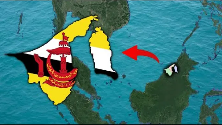
Brunei can be described even more specifically as part of Maritime Southeast Asia. This term refers to the island and coastal parts of Southeast Asia, including Borneo and many surrounding seas and islands. It is a geographic description that adds detail; it does not replace the broader and most commonly used regional name, Southeast Asia.
The United Nations country profile lists Brunei Darussalam in the South-Eastern Asia region. United Nations Data uses this spelling in its statistical profile, while maps, travel guides, and everyday writing more often use “Southeast Asia.” Both terms refer to the same broad subregion in this context.
Where Is Brunei Located on the Map?
Brunei is easiest to find by locating Borneo, one of the large islands of Southeast Asia. From there, look to the island’s northern coastline, near the Malaysian state of Sarawak and the South China Sea.
Brunei on the Island of Borneo
Brunei is located on the northern coast of Borneo. Borneo is shared politically by three countries: Brunei, Malaysia, and Indonesia. Brunei occupies a small part of the island, Malaysia controls substantial northern areas through the states of Sabah and Sarawak, and Indonesia governs the large southern and central portion commonly called Kalimantan.
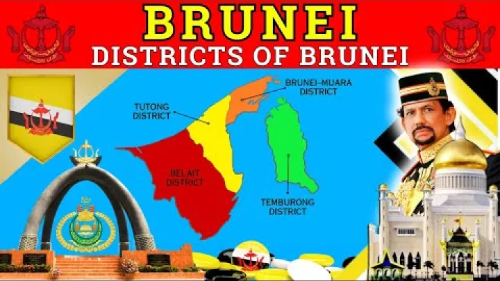
This arrangement explains why a map of Brunei may initially look unusual. Brunei is a sovereign country, but it is not the whole island of Borneo. It is surrounded on land by Malaysian territory and sits within a larger Bornean landscape shared with neighboring countries. Looking for Malaysia first, then Sarawak, is often a practical way to identify Brunei’s position on a regional map.
Borneo also clarifies Brunei’s relationship to Indonesia. Indonesia is a country that shares the island of Borneo, but Brunei does not border Indonesia directly. The two countries are connected through the wider island and Southeast Asian region rather than through a direct land boundary.
Brunei's Borders and the South China Sea
Malaysia borders Brunei on land, principally through Sarawak in East Malaysia. To the north, Brunei faces the South China Sea. Its coastal location is one reason Maritime Southeast Asia is an appropriate geographic description.
Brunei’s capital, Bandar Seri Begawan, is in the northern part of the country near the coast. It is a useful map reference for visitors and students because it identifies the main urban center within Brunei’s Borneo location. The country’s official geographic profile has listed Bandar Seri Begawan as the capital and Brunei’s land area at 5,765 square kilometres. U.S. Department of State provides these stable geographic reference details.
For basic orientation, a clear sequence is: Asia, Southeast Asia, Borneo, northern coast, Brunei. Adding Malaysia and the South China Sea makes the location easier to picture without requiring exact coordinates or detailed boundary knowledge.
Brunei Is Not a Transcontinental or Archipelagic Country
Brunei is not a transcontinental country because all of its territory is in Asia. The fact that it lies on a large island does not change its continental classification. Islands can belong to a continent or a continental region depending on their location and geographic context.
It is also best not to describe Brunei simply as an archipelagic country. An archipelagic state is generally understood as a country formed mainly by a group of islands. Brunei is instead a country located on part of one large island, Borneo, with a coastline on the South China Sea. Calling it a Southeast Asian country on Borneo is more precise and avoids confusion with countries made up of many separate islands.
This distinction matters when reading regional maps. Brunei is not separated from its neighbors by an ocean in the way some island states are; it has land borders with Malaysia. At the same time, its coastal and Borneo setting clearly places it in the maritime part of Southeast Asia.
Geographic Subregions Within Southeast Asia
Southeast Asia is a broad regional name. Geographers and scholars often use additional terms to distinguish its mainland areas from its island and coastal areas. These labels are useful for orientation, but they do not alter Brunei’s basic location in Asia and Southeast Asia.
Mainland and Maritime Southeast Asia
Mainland Southeast Asia refers to the continental portion of the region. It commonly includes countries such as Myanmar, Thailand, Laos, Cambodia, and Vietnam. These countries are connected to the larger Asian landmass through the mainland.
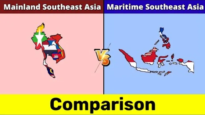
Maritime Southeast Asia refers to the island and sea-oriented portion of the region. Brunei belongs in this description because it is on Borneo and has a coast on the South China Sea. Nearby examples often associated with Maritime Southeast Asia include Indonesia, the Philippines, Malaysia’s island and coastal territories, and Singapore.
The mainland-maritime distinction is mainly a geographic and scholarly tool. It can help explain shared island environments, maritime connections, and map positions, but it is not a replacement for national borders or for the broader regional term Southeast Asia. For most everyday purposes, saying that Brunei is in Southeast Asia remains the clearest answer.
Borneo as Brunei's Local Geographic Setting
Brunei’s closest geographic setting is northern Borneo. Its immediate land relationship is with Sarawak, the Malaysian state that surrounds Brunei’s territory on land. This local context is often more useful than a broad continental label when planning a route, understanding a detailed map, or comparing nearby places.
The wider island also includes Indonesian Kalimantan. Together, Brunei, Sarawak, Sabah, and Kalimantan show that Borneo is a shared physical island rather than a single-country territory. Each area belongs to a different political administration, even though they are part of the same island environment.
Brunei’s Borneo setting adds precision to its location without changing the larger hierarchy. It remains an Asian country, a Southeast Asian country, and a country in Maritime Southeast Asia. Borneo is the local island-level description that connects all of those terms to a specific place on the map.
How Major Organizations Classify Brunei
Different institutions group countries for different purposes. A geographic classification may identify a precise subregion, while an international development institution may use a broader operational area. These labels can coexist without contradicting Brunei’s physical location.
The United Nations Classification: South-Eastern Asia
For statistical purposes, the United Nations places Brunei Darussalam in South-Eastern Asia, a subregion of Asia. This label is more specific than “Asia” and corresponds to the widely used geographic term “Southeast Asia.”
A United Nations regional classification helps organize international data in consistent groups. It does not attempt to replace every cultural, political, or local way that people identify a place. In Brunei’s case, it supports the straightforward geographic description: Brunei is in Asia, specifically Southeast Asia.
The hyphenated spelling can be useful to recognize when reading international databases. “South-Eastern Asia” may look more formal than “Southeast Asia,” but neither suggests a different continent or a different basic map location.
The World Bank Classification: East Asia and Pacific
The World Bank groups Brunei within its broader East Asia and Pacific region. This is an institutional grouping used for economic analysis, development work, and comparative data. It brings together economies from Southeast Asia, East Asia, and the Pacific for a particular operational purpose.
The World Bank’s country and lending groups include Brunei Darussalam under East Asia and Pacific. World Bank regional groupings should therefore be read as broad analytical categories rather than as a statement that Brunei is geographically in Oceania or the Pacific Islands.
This is not a conflict with the United Nations classification. The UN’s South-Eastern Asia label is more geographically specific for this question. The World Bank category is broader because it is designed to group economies for institutional analysis. When someone asks where Brunei is located, Southeast Asia is still the more precise regional answer.
ASEAN and Brunei's Political Region
Brunei’s membership in the Association of Southeast Asian Nations, commonly known as ASEAN, reinforces its political and regional connection to Southeast Asia. ASEAN is a framework for cooperation among Southeast Asian states, covering areas such as regional dialogue and cooperation.
Brunei Darussalam joined ASEAN on 7 January 1984, according to the organization’s official member-state information. ASEAN identifies Brunei among its member states, alongside other Southeast Asian countries.
ASEAN membership is a political and institutional fact, not a geographic definition on its own. Still, it aligns closely with the map-based description of Brunei as a Southeast Asian country. It also helps explain why Brunei is commonly discussed alongside Malaysia, Indonesia, Singapore, Thailand, the Philippines, and other states in the region.
Why Brunei Can Have More Than One Regional Label
A country can have several valid regional labels because the labels answer different questions. The key is to distinguish physical location from the category an institution uses for its work.
Geographic Region Versus Institutional Region
Geographic labels describe where Brunei is located. Asia is its continent. Southeast Asia is its principal subregion. Maritime Southeast Asia gives more detail about its island and coastal setting, while Borneo identifies the island on which Brunei lies.
Institutional labels serve other purposes. The United Nations uses South-Eastern Asia for statistical organization. The World Bank uses East Asia and Pacific as a broader analytical grouping. ASEAN is a political and cooperative regional organization. None of these labels cancel the others, because they are not all designed to do the same job.
| Context | Label for Brunei | Purpose |
|---|---|---|
| Continent | Asia | Broad physical location |
| Geographic subregion | Southeast Asia | Most precise everyday regional answer |
| Local setting | Maritime Southeast Asia and Borneo | Island and coastal orientation |
| United Nations | South-Eastern Asia | Statistical classification |
| World Bank | East Asia and Pacific | Broad analytical grouping |
| Political cooperation | ASEAN | Regional cooperation framework |
For travel, education, and general geography, start with the geographic hierarchy. Use the institutional label only when discussing that organization’s reports, data, programs, or membership framework.
The Clearest Way to State Brunei's Location
The clearest one-sentence answer is: Brunei is a country in Asia, specifically in Southeast Asia, on the northern coast of Borneo.
For more map detail, add that it is part of Maritime Southeast Asia, borders Malaysia, and faces the South China Sea. This wording works well for students, travelers, and readers who need a direct answer while still showing how Brunei relates to Borneo, Sarawak, Malaysia, Indonesia, and the wider Southeast Asian region.
If a database instead calls Brunei part of East Asia and Pacific, read that as a broader institutional grouping. It does not change the country’s physical location in Asia or its more specific geographic location in Southeast Asia.
Conclusion: Brunei Is in Asia and Southeast Asia
Brunei is in Asia and belongs to Southeast Asia. It is located on the northern coast of Borneo, bordered by Malaysia and facing the South China Sea. Its island setting places it in Maritime Southeast Asia, while Borneo provides the most useful local map reference.
Different organizations may use labels such as South-Eastern Asia or East Asia and Pacific for statistical or operational reasons. For the clearest geographic answer, however, Brunei is an Asian country in Southeast Asia.
Select area
Create a post
Posting is free and no registration is required.