Brunei Capital: Bandar Seri Begawan Explained
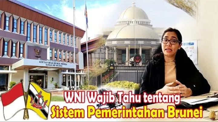
Bandar Seri Begawan is the capital of Brunei Darussalam. It is the country’s central administrative city, located on the Brunei River near Brunei Bay in northern Borneo. The capital combines national government functions with a river-based historic landscape that includes Kampong Ayer. This guide explains where the city is, how it acquired its present name, what role it plays, and why population figures for the capital can differ greatly.
What Is the Capital of Brunei?
Brunei is a small Southeast Asian nation on the island of Borneo, divided into two separate territories by Malaysia. Its capital is in the larger western part of the country, where most national institutions and major urban services are concentrated.
Bandar Seri Begawan Is Brunei's Capital
Bandar Seri Begawan is the capital of Brunei, officially known as Brunei Darussalam. It is the place associated with the national government, major public institutions, diplomatic representation, and many of the country’s best-known civic and religious landmarks. Britannica identifies Bandar Seri Begawan as Brunei’s capital and places it on the Brunei River near Brunei Bay.
The name is usually used for both the capital city and the broader urban center that visitors experience. In practical terms, however, the municipal area, nearby suburbs, river settlements, and the wider district are distinct geographic units. That difference is important when reading maps, arranging accommodation, or comparing demographic statistics.
Is the Capital Also Brunei's Largest City?
Bandar Seri Begawan is generally identified as both Brunei’s capital and its largest city. This does not mean that every published count is measuring the same area. A figure for the named city may cover a relatively compact municipal jurisdiction, while an urban-area figure can include connected residential communities beyond it.
For a simple comparison, the city is the named capital and municipal center; the wider urban area describes the built-up communities that function with it; and Brunei-Muara District is a larger administrative district containing the capital and many surrounding settlements. A statement that Bandar Seri Begawan is Brunei’s largest city is therefore best understood as a description of its national urban importance, rather than as a ranking based on an unlabeled population estimate.
Where Is Bandar Seri Begawan?
The capital’s location helps explain both its historic development and its modern character. River travel, waterfront communities, low-lying coastal surroundings, and road links across Brunei-Muara District all shape how the city is organized.
The Capital on the Brunei River and Brunei Bay
Bandar Seri Begawan stands along the Brunei River, close to the river’s mouth at Brunei Bay. It is in northern Borneo, facing the South China Sea region through the bay. The city is not simply a coastal settlement on an open shoreline: its relationship with the river is central to its layout, history, and daily visual identity.

The Brunei River separates and connects different parts of the capital area. On and across the water lies Kampong Ayer, while the mainland contains government buildings, commercial streets, neighborhoods, mosques, museums, and public facilities. Boats and bridges make the river a working geographic feature rather than only a scenic backdrop. For travelers, this means that a map view of the city is often more useful when it includes river crossings and waterfront locations.
The Capital's Position in Brunei-Muara District
Bandar Seri Begawan lies in Brunei-Muara District, the country’s principal concentration of government activity and urban development. The district is in Brunei’s northwestern area and includes the capital as well as suburban, coastal, and village communities. It should not be treated as though it were identical to the municipal city.
On a national map, the capital is in Brunei’s larger western territory. It is well placed for connections to nearby areas of Brunei-Muara District, while the country’s other districts extend south, east, and into the separate Temburong territory. This setting helps explain why official services, employment, education, and business activity are often discussed in relation to the broader capital region rather than to a narrow city-center boundary alone.
For orientation, the capital is not in Brunei’s separate Temburong territory and is not synonymous with the whole municipal district. A map of the country shows the city near the northern coast, with the Brunei River running through the urban area and Brunei Bay opening to the north. Roads connect it with nearby settlements in Brunei-Muara District, but those connected places should not automatically be labeled part of the capital city. As a result, a map label, an address, and a statistical boundary can give slightly different impressions of the same capital region.
How Bandar Seri Begawan Became Brunei's Capital
The modern capital developed from a long-established river settlement area. Its history is closely connected to Brunei’s monarchy, the Brunei River, colonial-era administration, wartime disruption, and postwar rebuilding.
Early River Settlement and the Name Brunei Town
The Brunei River area has long been a center of settlement and political life. Kampong Ayer, the extensive water settlement built along the river, remains a visible reminder that habitation, transport, trade, and community life developed on the water as well as on land. Its continued presence gives the capital a different spatial character from a city built entirely around a land-based central square or business district.
Before its current name was adopted, the capital was known as Brunei Town. Brunei Town was the former name of the place that became Bandar Seri Begawan; it should not be understood as a separate former capital elsewhere in the country. The older name still appears in historical writing and in descriptions of events from the first half of the twentieth century.
Capital Designation, Wartime Destruction, and Renaming
Historical accounts commonly identify 1920 as the year Brunei Town became the capital. The city was heavily affected during the Second World War, and postwar reconstruction contributed to the shape of the modern mainland town. These are separate events: the capital designation refers to its administrative status, while rebuilding refers to later physical development.
Brunei Town was renamed Bandar Seri Begawan in 1970, in honor of Sultan Omar Ali Saifuddien III after his abdication. When comparing historical sources, it is useful to check which event a date describes. A source may refer to the capital designation, wartime damage and rebuilding, or the later renaming, and these dates should not be used interchangeably.
What Role Does the Capital Play?
Bandar Seri Begawan is Brunei’s practical center of national administration. Its role is broader than that of a local city hall: it is where central government activity, ceremonial life, and much of the country’s diplomatic presence are concentrated.
The Executive and Administrative Center
The capital hosts key national institutions and serves as the main base for public administration. The Prime Minister’s Office is a central institutional anchor in Bandar Seri Begawan and its departments form part of the Government of Brunei Darussalam. Information published by the Prime Minister's Office of Brunei reflects its role within the national administration.
Brunei’s system may look different from the arrangements familiar to readers from countries with a separately elected president and prime minister. Sultan Hassanal Bolkiah is both head of state and prime minister, so the monarchy and executive government are closely connected. The city’s administrative importance should therefore be understood through the presence of central government offices and national institutions, not only through the location of a parliament or presidential office.
For residents, students, and business visitors, this concentration matters because official appointments, administrative processes, and formal events are often associated with the capital area. It does not mean every government service is inside the compact municipal boundary; agencies and facilities may be distributed across the wider urban area.
National, Diplomatic, Religious, and Municipal Functions
Government offices, foreign missions, hotels used for official meetings, and ceremonial venues are concentrated in and around Bandar Seri Begawan. The city also has strong religious and civic symbolism. The Sultan Omar Ali Saifuddien Mosque is one of the most recognizable national landmarks, linking the capital’s public identity with Islam and Brunei’s monarchy.
National functions are different from municipal responsibilities. At city scale, the Bandar Seri Begawan Municipal Board is associated with the legally defined municipal area and local by-laws. The Attorney General's Chambers of Brunei publishes material concerning the Municipal Boards Act and declarations relating to Bandar Seri Begawan’s municipal-board boundaries. This distinction is useful: the capital is a national center, but its local municipal jurisdiction is not automatically the same as the whole urban region.
Available material does not establish a formal legislative or judicial capital elsewhere in Brunei. It is more accurate to describe Bandar Seri Begawan as the country’s principal national and administrative center than to assume that every institution operates from one small, formally defined city core.
Population and the Size of the Capital
Population is one of the most easily misunderstood aspects of Bandar Seri Begawan. Different figures can all appear plausible because they may refer to different boundaries, different years, and different methods of defining the city.
City Proper, Urban Area, and Metropolitan District
The administrative city is the area associated with the municipal capital. Its boundary is a legal and local-government question, so it may be much smaller than the area a visitor informally calls “the city.” The wider urban area includes adjacent neighborhoods and settlements that are physically connected or closely linked to Bandar Seri Begawan through jobs, roads, services, and daily travel.
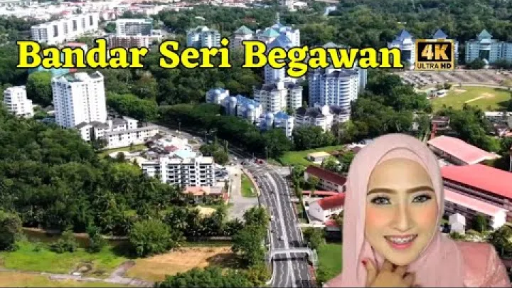
Brunei-Muara District is broader again. It contains the capital but also includes communities that are not necessarily part of the municipal city. A district population can therefore be substantially larger than a city-proper total without showing that the municipal capital itself has suddenly expanded. This is especially relevant in Brunei, where urban development is spread across a network of low-density communities rather than concentrated only in a dense downtown.
When comparing figures, first identify the geographic label. “Bandar Seri Begawan,” “urban area,” and “Brunei-Muara District” should be treated as different categories unless a statistical release explicitly defines them as the same boundary.
How to Report Population Figures Responsibly
A reliable population statement should include both a year and a geographic definition. Prefer an official statistical release that identifies whether the total covers the municipal city, an urban agglomeration, or Brunei-Muara District. A precise-looking number without those details can mislead more than it helps.
It is not sound practice to place an older estimate for the city next to a newer district count and describe both as the population of the capital. They measure different places and may reflect different collection methods. If current, clearly bounded city-level data are not available, the safer description is that Bandar Seri Begawan is Brunei’s capital and largest city, while the wider population is spread across the surrounding urban and district area.
For readers comparing maps or census releases, the safest sequence is to read the boundary first, then the year, and only then compare totals. A municipality can appear small on a map while its services support commuters and residents across adjacent communities. Conversely, a district total can make the capital seem larger than the continuously built-up area because it includes villages and less urban territory. If a source uses “metro” without defining its boundary, treat it as a broad estimate rather than a direct city-proper measurement.
This distinction has practical value. A compact administrative capital can support a much larger functional population because people living outside the municipal boundary may commute to government offices, schools, shops, health services, and workplaces in the capital region.
What Is Bandar Seri Begawan Known For?
Beyond its official role, the capital is known for a setting in which river heritage, Islamic architecture, royal symbolism, and contemporary administration sit close together. Its major landmarks help visitors understand the country’s identity as well as the city’s geography.
Kampong Ayer and the Riverine Identity of the Capital
Kampong Ayer is the historic water settlement on the Brunei River, across from much of the mainland city. It consists of homes and community facilities built above the water and connected by walkways, with boat transport forming an important link to the shore. It is part of the capital’s lived geography, not a detached attraction outside the city.
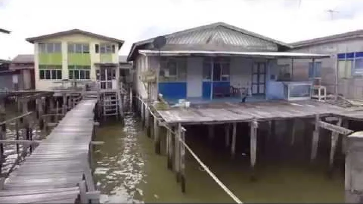
From the mainland waterfront, the settlement shows why the river has remained central to Bandar Seri Begawan. The waterway links historic communities with modern government and commercial areas, while views across the river place mosques, housing, boats, and public buildings in the same landscape. Visitors using water transport should confirm current routes, fares, access points, and weather-related conditions locally.
Mosques, Museums, and National Symbols
The Sultan Omar Ali Saifuddien Mosque is a leading symbol of Bandar Seri Begawan. Its prominent setting and distinctive architecture make it both an important place of worship and a visual expression of national identity. As with any active religious site, visitors should follow current entry guidance, dress requirements, and photography rules.
The Royal Regalia Museum is another important civic landmark, associated with Brunei’s monarchy and national narrative. Together, the museum and the mosque show that the capital is more than an administrative address: royal history, religion, public ceremony, and national memory are strongly present in the cityscape. Before planning a visit, check current opening times, access arrangements, and any visitor restrictions through local official channels.
Key Takeaways About Brunei's Capital
Bandar Seri Begawan is the capital and largest city of Brunei Darussalam. It lies on the Brunei River near Brunei Bay, within Brunei-Muara District in the country’s larger western territory. Formerly called Brunei Town, it became the capital in the early twentieth century and received its current name in 1970.
Its importance comes from its role as Brunei’s national administrative center and from its distinctive river setting. When assessing the city’s size, distinguish the municipal capital from the connected urban area and the much wider Brunei-Muara District. Kampong Ayer, the Sultan Omar Ali Saifuddien Mosque, and the Royal Regalia Museum provide useful starting points for understanding how Brunei’s history, monarchy, religion, and river life meet in its capital.
Select area
Create a post
Posting is free and no registration is required.