Brunei Administrative Divisions: The Four Districts Explained
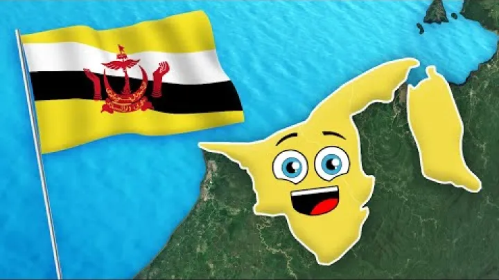
Brunei's administrative divisions are simple at the top level but more layered in practice. As of 16 August 2026, the current district count used in this overview is four: Brunei–Muara, Belait, Tutong, and Temburong. This guide explains how those districts appear on a Brunei regions map, how mukims and kampong fit below them, and why municipal areas should be treated as an overlay. It also shows how to read district statistics and organize places in a clear administrative hierarchy.
Brunei's Administrative Divisions at a Glance
For most geographic, statistical, and directory purposes, the district is Brunei's first-level administrative unit. The four districts cover the country, while mukims and kampong provide smaller levels of organization. Municipal areas serve a different urban-management purpose and should not be added to the district count.
How Many Administrative Divisions Does Brunei Have?
Brunei has four current first-level administrative divisions: Brunei–Muara, Belait, Tutong, and Temburong. This article uses 16 August 2026 as its reference date for that count, based on the current district headings shown in the Department of Economic Planning and Statistics district summary.
The official terminology to use in a geographic hierarchy is district, or daerah in Malay. The plural form is often written as daerah-daerah. English-language searches may use Brunei provinces, Brunei states, Brunei regions, or Brunei administrative divisions, but those terms do not mean that the districts are provinces or autonomous states. They are search variations for a country that is formally organized at this level through districts.
Population information can have a different reference year from the administrative count. A district total may remain four even when a population table uses a census, estimate, or another statistical series from an earlier year. Keeping the administrative count and the statistical reference period separate prevents misleading comparisons.
The Four Districts on a Brunei Map
A map-friendly overview of Brunei's four districts is shown below. The descriptions identify each district without treating cities, municipal areas, or lower-level settlements as additional districts.
| District | Map position or role | Useful local anchor |
|---|---|---|
| Brunei–Muara | Capital and main population concentration | Bandar Seri Begawan |
| Belait | Western district | Kuala Belait and Seria |
| Tutong | Central district | Tutong town |
| Temburong | Separated eastern district | The eastern district area |
Some official statistical pages write Brunei Muara without a hyphen, while English maps may use Brunei–Muara or Brunei and Muara. A directory should choose one current normalized form and retain other spellings only as helpful aliases. The important point on a district map is that all four names appear at the same administrative level.
A district map may also show mukim boundaries, kampong labels, roads, rivers, or municipal limits. These are additional layers, not evidence of additional first-level divisions. If population figures are included, the map or table should display the reference date and explain whether the numbers are district totals, estimates, or another type of data.
The Four Districts of Brunei Explained
Each district has a distinct geographic role, but the four are parts of one national administrative structure. The following profiles focus on classification and place hierarchy rather than detailed travel information.
Brunei–Muara District
Brunei–Muara is the district most closely associated with national administration and urban population concentration. Bandar Seri Begawan, the capital, is located within this district. The district also includes settlements beyond the capital's central urban area, so its administrative territory is broader than the city or municipal area alone.
This distinction is important when reading addresses and statistics. Bandar Seri Begawan can identify a city or municipal context, while Brunei–Muara identifies the wider district. A place outside the capital's municipal area can still belong to Brunei–Muara District. For a directory, store the city or locality and the district as separate fields rather than replacing one with the other.

Brunei–Muara may also appear as the largest population concentration in a district comparison. If a current population figure is added, it should come from a dated district series and should not be confused with a figure for Bandar Seri Begawan alone.
Belait District
Belait is Brunei's western district. Kuala Belait and Seria are important urban and municipal anchors for understanding its place names, but neither anchor should automatically be treated as a synonym for the whole district.
Belait is often described as having a broader and more dispersed settlement pattern than Brunei–Muara. That comparison is useful only when the figures use the same reference year and the same administrative unit. A district population total, a town population, and a municipal total answer different questions.
The Kuala Belait and Seria municipal context is also separate from Belait District as a whole. When a record refers to a town, municipal area, mukim, or district, the label should preserve that distinction. This avoids implying that a municipal boundary covers every part of Belait or that a town name describes the entire western district.
Tutong District
Tutong is the central district between Brunei–Muara and Belait. Tutong town is the main local place-name anchor for many readers, but the district extends beyond the town and should not be reduced to a single urban area.
The district includes a mixture of settlement types, which is why a generic label such as rural is not enough for administrative purposes. A place can be associated with Tutong District while having its own mukim, kampong, town, or municipal description. These levels should remain separate in a map and in a place database.

Tutong also demonstrates why municipal status must be checked independently. A reference to Tutong may mean the district, the town, or a municipal area. The legal municipal designation and boundary determine the correct municipal label; the name alone does not.
Temburong District
Temburong is Brunei's separated eastern district. Its geography is distinct from the contiguous western part of the country, a feature that is immediately visible on a Brunei administrative divisions map. The separation is geographic, not a sign that Temburong is a separate state, province, or autonomous region.
In district population comparisons, Temburong has a much smaller population total than Brunei–Muara in the available DEPS series. That comparison should always carry the series reference date and data type. A smaller population total does not change Temburong's status as one of the four first-level districts.

For a directory or map, the safest approach is to show Temburong as its own district and preserve its eastern location. Add a local administrative centre, mukim, or kampong only when the name and level have been confirmed in a current authoritative record. Transport routes and travel arrangements are separate topics and are not needed to establish the administrative hierarchy.
Mukims, Kampong, and Municipal Areas
Districts are only the first layer of Brunei's place structure. Below them are mukims and kampong, while municipal areas form a related urban-administration layer. Understanding the difference is essential for maps, addresses, official records, and location directories.
Mukims and Kampong Below the District Level
The basic territorial hierarchy can be read from large to small:
- Brunei Darussalam: the country.
- District or daerah: one of the four first-level divisions.
- Mukim: a lower-level unit commonly explained in English as a subdistrict.
- Kampong: a village or local community unit within the lower-level structure.
English translations are useful for international readers, but the Malay terms should be retained because they appear in local names and administrative records. A mukim is not equivalent to a province or state. A kampong is not equivalent to a district. In a place directory, each level should have its own field so that a village can be linked to its mukim and district without being promoted to a higher category.
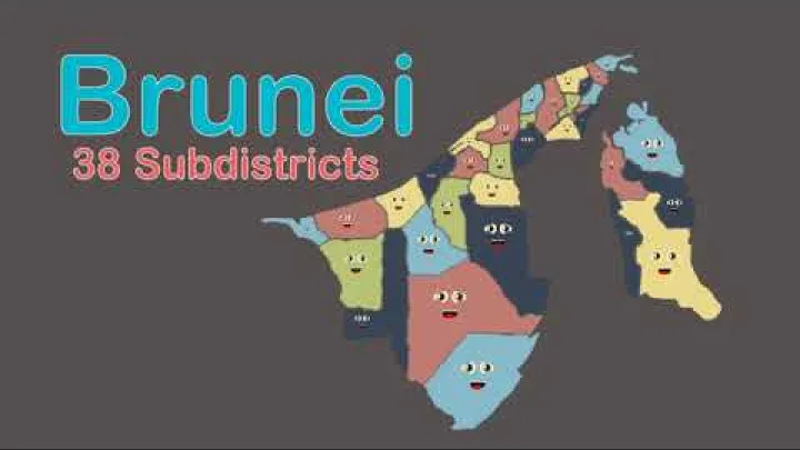
An undated reference list describes 39 mukims within the four districts. The Mukims of Brunei page is useful as a cross-check, but an undated list should not be treated as a timeless current enumeration. A directory intended to reflect the present structure should compare the list with the latest government district or place records and attach a date to the total.
A simple normalized record might therefore follow the path Brunei Darussalam, Brunei–Muara District, a verified mukim, and a verified kampong. This arrangement makes it possible to search for a village while still showing the district that contains it.
Municipal Areas Are an Overlay, Not Extra Districts
Municipal areas operate through a separate legal and administrative framework from the district–mukim–kampong hierarchy. Their purpose is related to urban administration, so a municipality can exist within a district without replacing that district or creating a fifth first-level division.
For a high-level overview, the main municipal references are the Bandar Seri Begawan municipal area, the Kuala Belait and Seria municipal area, and the Tutong municipal area. The Municipal Boards Act page provides by-law references for Kuala Belait and Seria and notes the application of Bandar Seri Begawan municipal by-laws to the Tutong Municipal Board.
The legal source is important because a town name does not by itself establish the exact municipal boundary. Before assigning a place to a municipal jurisdiction, read the current Act and relevant by-laws. Use the district field for the first-level administrative parent and the municipal field for the separate urban jurisdiction.
| Concept | What it describes | What it is not |
|---|---|---|
| District | First-level territorial division | A municipal area or village |
| Mukim | Lower-level unit within a district | A province or state |
| Kampong | Village or local community unit | A first-level district |
| Municipal area | Urban administrative jurisdiction | An additional national district |
Why Boundaries and Counts Need Careful Reading
A district boundary, mukim boundary, kampong boundary, and municipal boundary may be drawn for different administrative or statistical purposes. They can therefore appear together on a map without being interchangeable.
Bandar Seri Begawan is a useful example. It can be identified as the capital and as a municipal area, while the surrounding administrative parent is Brunei–Muara District. There is no contradiction in describing a place by both labels: the district identifies the broader first-level territory, and the municipal label identifies the relevant urban jurisdiction.
Older lists and secondary maps may also use different spellings, counts, or boundary versions. A population table may follow one statistical geography, while a municipal document follows a legal boundary. The practical rule is to record the unit, source, and date before comparing places, importing data, or building a map.
How Brunei's Administrative Divisions Are Governed
Brunei's district structure connects national administration with local territories. It does not operate as a system of provinces with separate regional governments.
District Offices and Central Administration
District offices provide territorial channels for implementing and coordinating administration across the four districts and their lower-level communities. In practical terms, the district office is the local administrative point for matters organized by district, mukim, and kampong, while major policy and national frameworks remain centralized.
The Ministry of Home Affairs is described as having responsibility connected with Brunei's administrative divisions and municipal areas. This helps explain why district administration and municipal administration are discussed together in national government information, even though they are not the same type of jurisdiction.
The structure matters for public administration, official statistics, service coordination, and communication with communities. It should not be read as evidence that districts make regional laws or operate as autonomous governments.
Local Leadership and the Limits of Local Autonomy
At the lower levels, titles such as mukim penghulu and village head identify local leadership roles. These positions can help connect communities with district and central administration through communication, representation, and implementation of public programs.
Local leadership does not make a mukim or kampong equivalent to a province. A directory should preserve these roles as community or administrative information, but should not use them to create a separate governmental tier. Details about appointment, election, or tenure should be taken from current official material rather than inferred from the title.
For international readers, the useful distinction is straightforward: districts organize first-level territory, mukims and kampong organize smaller communities, and local leaders help connect those communities with the wider administration.
Using Brunei's Divisions in Maps, Statistics, and Directories
The same hierarchy can be used for a Brunei regions map, a statistical table, or a digital place directory, provided each label is assigned to the correct level.
How to Read and Label a Brunei Regions Map
A map described as a Brunei regions map should identify Brunei–Muara, Belait, Tutong, and Temburong as the four first-level districts. The word regions may be useful for search and general description, but the map legend should state that the displayed units are districts.
Use different visual treatments when a map includes more than one layer. For example, district boundaries can use a heavier line, mukim boundaries a lighter line, and municipal areas a separate line or shading. Kampong labels should be presented as place labels rather than as equivalent boundary divisions unless the map clearly documents their boundaries.
Temburong should be shown in its separated eastern position without implying a separate national status. A reliable map should include the following information:
- A publication date or update date.
- The source or mapping authority.
- A legend that identifies the administrative level.
- Current district names with consistent spelling.
- A clear indication of whether municipal or mukim boundaries are also shown.
Compare the district labels on any map with current official names before using it for a directory or statistical presentation. An unattributed graphic may be visually clear but still omit the administrative level, use former names, or show boundaries that are not suitable for current data.
How to Use Population and Area Data Correctly
The DEPS Population Statistics page provides summary data by district, including Brunei–Muara, Belait, Tutong, and Temburong. The page can support a comparison of population patterns, but each number must be read with its heading and reference period. Do not copy a value without preserving the date and the series to which it belongs.
A census result is a count taken at a defined census reference point. An estimate is a calculated value for a period when a full census count is not being used. A projection or forecast is based on assumptions about future change. These categories should not be presented as though they were interchangeable.
Keep district figures separate from municipal or mukim figures. A city population may cover a different boundary from the surrounding district, and a mukim total may not be comparable with a municipal total. Area figures require the same care: land area, total area, and mapped administrative area may use different definitions. If the area definition or reference date is unclear, omit an exact ranking rather than presenting false precision.
For a readable comparison, place the reference year in the table heading or an immediate note. Also identify the unit, data type, and source version. This makes it clear whether a comparison describes population, land, or a legal boundary.
A Clean Administrative Hierarchy for Place Directories
A basic place hierarchy for Brunei can be organized as follows:
- Brunei Darussalam
- District or daerah
- Mukim
- Kampong
- Mukim
- District or daerah
Municipal areas should be stored as an overlay or parallel urban-jurisdiction field, not as a fifth child of the country alongside the four districts. This allows a place to have one administrative parent while also carrying a municipal association where the legal boundary applies.
For example, a record for a place in the capital could be normalized as: country, Brunei Darussalam; district, Brunei–Muara; municipality, Bandar Seri Begawan; mukim, verified local unit; kampong, verified local unit. The example shows the structure without assuming a particular mukim or kampong name.
Use current official names as the main labels. Common terms such as state, province, or region can be retained as search aliases when helpful, but they should not create duplicate administrative places or change the official type from district. Former or abolished divisions should be excluded from the current hierarchy unless the directory is specifically historical.
This separation also helps data users distinguish three different ideas: the administrative parent, the statistical unit used for a number, and the municipal overlay used for urban administration. A clean record can preserve all three without treating them as competing answers.
Conclusion: Brunei's Four-District Structure
Brunei has four first-level administrative divisions: Brunei–Muara, Belait, Tutong, and Temburong. Brunei–Muara contains the capital and main population concentration, Belait anchors the west, Tutong occupies the central part of the country, and Temburong forms the separated eastern district.
Below the districts, mukims and kampong organize smaller communities. Municipal areas associated with Bandar Seri Begawan, Kuala Belait and Seria, and Tutong form a separate urban layer rather than extra districts. Using the correct unit, current name, source, and reference date will make a Brunei map, statistical comparison, or place directory much easier to interpret.
Select area
Create a post
Posting is free and no registration is required.