Marawi Map Guide: City Layout, Routes, and Barangays
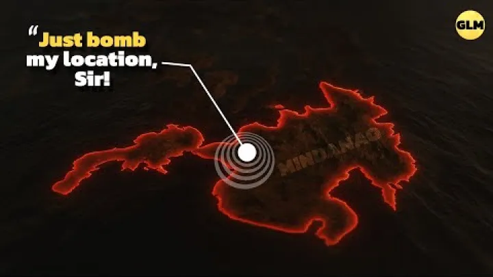
A Marawi map is most useful when it helps you understand the city at several scales: the Philippines, Mindanao, Bangsamoro, Lanao del Sur, and the local city layout. Marawi is not only a point on a regional map; it is a lakeside city with important road links, barangays, institutions, and reconstruction-related areas that need careful interpretation. This guide explains how to read a Marawi city map, how to think about routes to Marawi, and how to use landmarks such as Lake Lanao and Mindanao State University for orientation. It is written for practical planning, whether you are checking Google Maps, comparing static map images, or preparing a route through northern Mindanao.
Marawi Map Guide Overview
Before looking at roads or local landmarks, start by placing Marawi in the correct geographic frame. A Philippines map shows the country-wide position, a Mindanao map shows regional access, a Bangsamoro map shows the administrative context, and a Marawi city map shows the details needed for local movement.
Where Marawi Is in the Philippines
A Marawi map helps readers place the city in northwest-central Mindanao, within the Bangsamoro region and the province of Lanao del Sur. Marawi is the capital of Lanao del Sur and sits on the northern shore of Lake Lanao, a location summary also given by Britannica. This means the city is best understood as a highland, lakeside urban center rather than a coastal gateway.
When you zoom out, Marawi appears as part of the wider Mindanao road network. When you zoom in, the lake, the city center, barangays, and institutional areas become more important than national boundaries. For most planning, you will move between these scales: first confirm where Marawi is in the Philippines, then identify its relationship to Iligan, Cagayan de Oro, Lake Lanao, and nearby municipalities.
Lake Lanao and the Highland Setting
Lake Lanao is the clearest natural anchor on a Marawi Philippines map. Because Marawi is on the northern shore, the lake helps you understand the city’s southern orientation and gives a strong visual reference when reading a map. If you feel lost on a city map, first locate the lake, then identify where the main roads and central areas sit in relation to it.
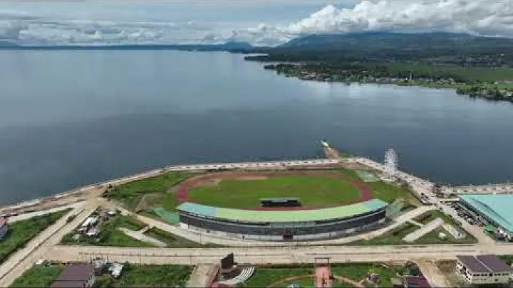
The highland setting also affects the way travelers think about routes. Roads approaching Marawi are regional connections through interior Mindanao rather than flat coastal corridors. For map use, simple directional terms are enough: lakeside, north shore, central area, road gateway, and routes outward to Iligan or other hubs.
Marawi City Map Layout
A Marawi city map should be read by layers. Start with the lake and main roads, then add the city center, barangays, institutional areas, and nearby municipalities. This approach is more reliable than trying to understand every small street at once.
City Center and Lakeshore Orientation
For first-time map users, the best method is to separate Marawi into practical orientation zones: the central urban area, the Lake Lanao side, and the routes leading outward. The city center is where many map searches begin, but the lakeshore and the road exits often explain movement better than a single central pin.
If you are using Google Maps or another digital map, zoom out before choosing a route. Identify Lake Lanao, the approximate central area, main roads, nearby municipalities, and the direction toward Iligan. If you are using a printed or static Marawi city map, look for the same features before focusing on smaller roads or barangay names.
Barangays and Local Boundaries
Barangays are the smallest local administrative units commonly used in Philippine addresses. On a map of Marawi City with barangays, they help you understand local boundaries, address locations, delivery points, and official references. Barangay names can also be useful when a street name is missing, spelled differently, or not familiar to a driver.
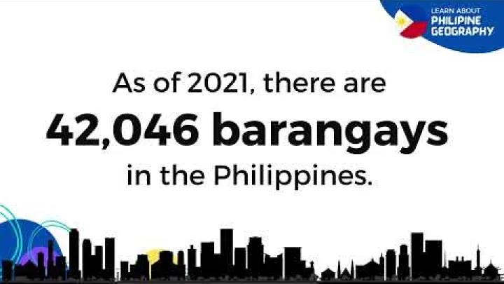
The Philippine Statistics Authority provides official barangay reference information for Marawi, including barangay names and codes. For everyday navigation, you do not need to memorize every barangay. Instead, use barangay names to confirm that a map pin, address, office, school, or residence is in the correct part of the city. When accuracy matters for legal, delivery, government, or property purposes, verify spelling and boundaries with official or local sources.
Mindanao State University and Institutional Areas
Many people search for an MSU Marawi map because Mindanao State University is one of the major orientation landmarks in the city. Large institutions like universities, government offices, hospitals, and schools can be easier to find on a map than smaller streets. They also help travelers explain destinations to local contacts or drivers.

Use MSU as a landmark for orientation, not as a substitute for current access information. If you need to visit a specific office, building, or campus area, confirm details with the institution or a local contact before traveling. A general Marawi map can show the broad location, but it may not show current entry points, temporary restrictions, or building-level directions accurately.
Routes to Marawi
Route planning for Marawi is easiest when you think in terms of gateways. Iligan is important for nearby road access, while Cagayan de Oro is useful as a wider arrival hub for travelers coming from other parts of the Philippines.

Iligan as the Nearest Road Gateway
Iligan often appears in Marawi route searches because it is one of the closest major road gateways from northern Mindanao. A traveler looking at a Marawi map will usually notice the short regional relationship between Iligan and Marawi compared with more distant cities.

Rome2Rio lists the driving distance between Marawi and Iligan at about 37 kilometers, with an estimated driving time of around 37 minutes. Treat this as a route-planning estimate, not a guarantee. Actual travel time can change because of traffic, weather, road conditions, checkpoints, stops, and the exact start and end points.
For practical planning, check the route on the day of travel and ask local contacts about current conditions. If you are arriving from a bus terminal, airport connection, or private vehicle pickup point, the useful question is not only how far Marawi is from Iligan, but where in Marawi you need to go after entering the city.
Cagayan de Oro as a Wider Arrival Hub
Cagayan de Oro is a broader regional reference point for travelers arriving from outside Lanao del Sur. It is often used as a transport and logistics hub in northern Mindanao, so it may appear in route planning even when the final destination is Marawi.

Air distance can be helpful for understanding geography, but it should not be confused with road distance. DistanceFromTo gives the straight-line distance from Marawi City to Cagayan de Oro as 66 kilometers. A road route is longer and depends on the actual road network, traffic, transfers, and local conditions.
If you arrive through Cagayan de Oro, compare current transport options before departure. Look at the route to Iligan or other transfer points, then check how the final leg to Marawi works. A direct line on a map gives orientation, but a practical route requires roads, vehicles, schedules, and local confirmation.
Long-Distance Mindanao Connections
Routes from farther Mindanao cities need more planning than the Iligan or Cagayan de Oro approach. A long-distance Marawi route may involve bus travel, private car travel, transfer points, or an overnight stop. On a map, the distance may look simple, but the actual journey depends on road condition, terrain, transport frequency, and where you are starting.

Use long-distance route maps as a planning overview rather than a final schedule. Identify the main hub closest to Marawi, then break the trip into legs. For example, a traveler coming from a distant Mindanao city should first understand the route to a northern Mindanao hub, then confirm the connection toward Iligan or Marawi. This keeps the map useful without turning it into a full transport timetable.
Tourist Map of Marawi
A tourist map of Marawi should be read with care. The city has natural, cultural, religious, educational, and reconstruction-related points of interest, but current access and local guidance matter. Do not assume that every visible map pin is open or suitable for casual visiting.

Lake Lanao Viewpoints and Natural Stops
Lake Lanao is the main feature that shapes a tourist map of Marawi. It gives the city its most recognizable natural setting and helps visitors understand direction, distance, and lakeside context. Even if you are not planning a specific nature stop, the lake is the landmark that makes the city’s geography easier to read.
Plan lakeside or nature-oriented stops with local advice. Some areas may be residential, private, restricted, or difficult to access. A responsible map user should confirm whether a viewpoint or natural stop is appropriate to visit, and should avoid treating private or community spaces as open tourist areas.
Religious and Cultural Landmarks
Religious and cultural landmarks can be useful reference points on a Marawi tourist map. Mosques, churches, public buildings, cultural sites, schools, and civic spaces often appear clearly on digital maps and can help you understand the city layout.

Use respectful language and behavior around active places of worship and community spaces. Do not assume that a religious landmark is open for tourism because it appears on a map. Before visiting, check local norms, opening conditions, and whether visitors are welcome. A map can show location, but it cannot always explain cultural context.
Ground Zero and Reconstruction Context
Searches for a Marawi Ground Zero map often relate to the 2017 conflict, later rebuilding work, or historical understanding rather than ordinary sightseeing. This topic should be approached carefully. Some map references may be outdated, sensitive, or connected to reconstruction zones rather than visitor areas.

The PTNI article on PTNI discusses rebuilding efforts in Marawi, including recovery-related infrastructure projects. Use such context to understand why some areas may appear differently across older maps, news maps, and current navigation apps. Before visiting any reconstruction-related or historically sensitive area, check current local guidance and avoid assuming unrestricted access.
Where to Stay and Base Yourself
Choosing where to stay is a map-based decision. Instead of asking for the single best area, compare your planned stops, arrival route, local contacts, transport pickup points, and comfort with daily travel.
Choosing a Base in Marawi
Staying in Marawi can make sense when your main activities are inside the city or nearby. A local base may reduce travel time to official offices, educational institutions, Lake Lanao-side areas, and central landmarks. It can also help if you need repeated access to the same barangay or institution.
Choose accommodation by proximity to your confirmed destinations, not by a vague citywide recommendation. Check whether the place is near your planned stops, whether transport can reach it easily, and whether your host or accommodation can help confirm local directions. Avoid relying only on map pins, especially for small properties or newly updated listings.
Using Iligan or Cagayan de Oro as a Regional Base
Iligan or Cagayan de Oro may be better as a regional base if you are combining Marawi with other northern Mindanao destinations, arriving late, or managing onward travel. Iligan is the closer road gateway, while Cagayan de Oro is more useful for wider regional connections and longer itineraries.
A regional base can add travel time to Marawi, so compare the trade-off carefully. If your purpose is a short visit or an official appointment in Marawi, staying closer may be more efficient. If your purpose is a wider Mindanao itinerary, a larger hub may offer more flexibility. Check current accommodation, transport, and route conditions before deciding.
How to Move Around with a Map
Local navigation in Marawi works best when you combine digital maps with landmark-based thinking. Street names, barangay names, institutions, and lake direction can all help you confirm where you are and where you need to go.
Short Local Trips and Landmark-Based Navigation
For short local trips, do not rely only on street names. First identify the city center, the direction of Lake Lanao, major institutions such as MSU, important roads, and your destination barangay. This gives you a practical mental map before you start moving.
If possible, confirm your destination with a local contact, driver, office, school, or accommodation staff. A digital route may show the shortest path, but local knowledge can help you avoid confusion caused by temporary changes, unclear pins, or alternate place names. Keep instructions simple: landmark, barangay, nearby institution, and exact destination.
Offline Maps, Barangay Names, and Local Verification
Save offline maps before traveling because connectivity and map detail can vary. Search terms such as Marawi City map, Marawi barangay map, MSU Marawi map, or Marawi Philippines map can help you compare different views of the same place.

Barangay names and landmark names are especially useful when map results are incomplete or inconsistent. Try alternate spellings only when needed, and verify important locations with current local information. Online map pins are helpful, but they are not always precise enough for official appointments, deliveries, or time-sensitive travel.
Suggested Map-Based Itineraries
The following itineraries are not fixed turn-by-turn routes. They are map-reading structures that help you organize time, direction, and priorities. Always check current access and local advice before finalizing stops.
Half-Day Orientation Route
For a half-day orientation, begin with a central landmark or confirmed meeting point. From there, use the map to understand the direction of Lake Lanao and the main road exits. Add one or two nearby stops that are confirmed accessible, such as an institutional area, public landmark, or lakeside context point.
The goal is not to cover every attraction. The goal is to understand the city layout: where the center is, where the lake is, which roads lead outward, and how your main destinations relate to each other. Keep the plan flexible in case weather, traffic, or access conditions change.
Full-Day City and Lake Route
A full-day Marawi route can combine city orientation, an institutional landmark area, Lake Lanao context, and cultural landmarks if they are accessible and appropriate to visit. Start with the easiest confirmed destination, then build the day around nearby areas instead of crossing the city repeatedly.
Use the map to group stops by direction. For example, avoid planning one stop near a central area, another far along a road exit, and another near the lakeside without checking travel flow. If you include reconstruction-related or sensitive areas in your research, treat them as context unless current local guidance confirms that visiting is appropriate.
Regional Marawi and Iligan Route
A regional Marawi and Iligan route helps readers understand how the two cities connect on a northern Mindanao map. Iligan can function as the road gateway, while Marawi is the inland lakeside destination. This route is useful for travelers who arrive through Iligan, need to connect onward, or want to understand the practical relationship between the two cities.
Keep the plan focused on travel flow. Confirm your starting point in Iligan, the route toward Marawi, your first destination in Marawi, and your return or onward plan. Do not assume that a short map distance means every schedule will be simple. Time can vary, so leave room for traffic, stops, and local route advice.
Conclusion: Reading the Marawi Map Practically
The most useful way to read a Marawi map is to move from large scale to small scale. First locate Marawi within Mindanao, Bangsamoro, and Lanao del Sur. Then use Lake Lanao, the city center, barangays, MSU, main roads, and nearby gateways such as Iligan and Cagayan de Oro to understand movement.
For travel planning, combine digital maps with current local verification. Save offline maps, confirm barangay names and landmarks, and avoid assuming that every pin or route is fully current. With this practical approach, a Marawi city map becomes more than a location tool; it becomes a guide to orientation, route planning, and respectful movement through the city.
Select area
Create a post
Posting is free and no registration is required.