Hong Kong Administrative Divisions: 18 Districts Explained

Understanding Hong Kong administrative divisions is easier when its status, broad areas, and districts are kept separate. Hong Kong is a Special Administrative Region of the People's Republic of China, not a province or state. Internally, the practical structure used for local administration, statistics, maps, and directories consists of Hong Kong Island, Kowloon, the New Territories, and 18 districts. This guide explains the hierarchy, lists every current district with its Traditional Chinese name, and shows how to read a Hong Kong regions map correctly.
Hong Kong's Administrative Status and Correct Terminology
The most important classification question is whether Hong Kong should be treated as a state, province, or region in the ordinary national sense. The answer is no for its internal administrative structure. The correct high-level name is Hong Kong Special Administrative Region, commonly shortened to Hong Kong SAR.
Why Hong Kong Does Not Have States or Provinces
Hong Kong does not have states, provinces, capital districts, or autonomous regions inside its own administrative structure. It is a Special Administrative Region of the People's Republic of China, with a distinct government structure described by the Hong Kong Government. The GovHK government structure page uses the official Hong Kong Special Administrative Region terminology.
This distinction matters when completing an address, building a location directory, or comparing administrative divisions across countries. Do not add an invented Hong Kong province or state between Hong Kong SAR and a district. In a database, Hong Kong SAR can be the parent territory, while the district is a separate lower-level field.
Searches such as Hong Kong states, Hong Kong provinces, and does Hong Kong have states usually reflect classification confusion. They do not identify official Hong Kong units. The answer to each is that Hong Kong uses the Special Administrative Region category at the territory level and districts for its main internal administrative framework.
How Hong Kong, the Three Areas, and the Districts Fit Together
A practical hierarchy is Hong Kong SAR at the parent level, followed by three broad geographic and historical groupings, and then 18 districts. The three groupings are Hong Kong Island, Kowloon, and the New Territories. They help people understand location, but they are not separate provincial governments or autonomous regions.
| Level | Name | Practical meaning |
|---|---|---|
| Parent | Hong Kong SAR | Special administrative status |
| Broad area | Hong Kong Island 香港島; Kowloon 九龍; New Territories 新界 | Geographic and historical grouping |
| District | 18 current districts | District-level administration and statistical geography |
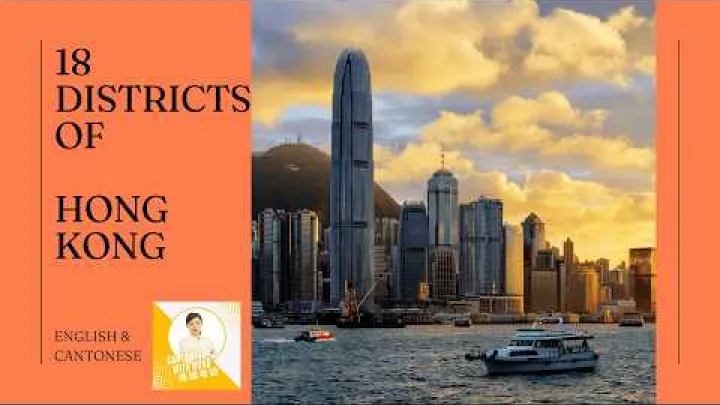
As of August 2026, Hong Kong has 18 districts: four on Hong Kong Island, five in Kowloon, and nine in the New Territories. The three-area grouping therefore works as a useful map and directory layer, while the district is the more precise current unit. The following sections use the official English district names and provide Traditional Chinese names for local identification.
The 18 Districts of Hong Kong
The 18 districts are listed below under the three broad areas. Each district is a current district-level unit, even though districts differ greatly in size, density, land use, and settlement pattern. The short descriptions are for orientation and are not intended to replace an official boundary map.
Hong Kong Island Districts
Hong Kong Island has four districts. They cover the central, eastern, southern, and Wan Chai areas of the island and include dense urban locations as well as coastal and less-developed settings.
- Central and Western District 中西區: The central and western part of Hong Kong Island, including the territory's principal central urban area and established western communities.
- Eastern District 東區: The eastern part of Hong Kong Island, with dense urban residential and commercial areas along the northern and eastern side.
- Southern District 南區: The southern part of Hong Kong Island, combining urban communities with coastal and less densely developed areas.
- Wan Chai District 灣仔區: A central and northern Hong Kong Island district with established urban, commercial, residential, and waterfront areas.
Hong Kong Island is a broad area, not an additional district. For example, Central is a well-known place name within the wider Central and Western District, while Wan Chai is both a district name and a familiar local area name. A directory should identify the administrative level clearly.
Kowloon Districts
Kowloon has five districts. This broad area is highly urbanized, but its districts still have different combinations of residential, commercial, industrial, institutional, and redevelopment land uses.
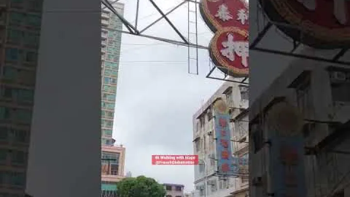
- Kowloon City District 九龍城區: A central and eastern Kowloon district with established residential communities and mixed urban land uses.
- Yau Tsim Mong District 油尖旺區: A southern Kowloon district known administratively for dense commercial, residential, and transport-oriented urban areas.
- Sham Shui Po District 深水埗區: A western Kowloon district containing established dense urban communities and mixed residential and commercial areas.
- Wong Tai Sin District 黃大仙區: A northeastern Kowloon district with established residential communities and upland surroundings.
- Kwun Tong District 觀塘區: An eastern Kowloon district with dense residential and commercial areas alongside industrial and redevelopment land uses.
Neighborhoods such as Mong Kok, Sham Shui Po, and Kwun Tong are not extra administrative levels. Some are closely associated with a district name, while others are local place names used within a district. The five-district Kowloon grouping is the practical current framework for the list in this article.
New Territories Districts
The New Territories grouping contains nine districts. It includes major new towns, rural and village areas, northern border communities, coastal settings, port and logistics zones, and outlying islands. The variety of landscapes does not change the fact that all nine are current district-level units.

- Tai Po District 大埔區: A northeastern New Territories district with new-town areas and rural surroundings.
- Tuen Mun District 屯門區: A western New Territories district with new-town, coastal, and rural settings.
- North District 北區: The northern border-area district, containing both new-town communities and rural areas.
- Sai Kung District 西貢區: An eastern New Territories district with coastal and rural areas alongside established new-town communities.
- Sha Tin District 沙田區: A northeastern district centered on a major new-town and dense residential area in a valley setting.
- Tsuen Wan District 荃灣區: A western New Territories district with an established urban area and surrounding uplands.
- Kwai Tsing District 葵青區: A western New Territories district with dense urban communities and important port and logistics land uses.
- Islands District 離島區: The district covering outlying-island communities and other island areas with varied settlement patterns.
- Yuen Long District 元朗區: A northwestern New Territories district containing new towns, villages, and open or rural land.
The New Territories is therefore not a single district and should not be used as a substitute for a more precise district name. A location described only as being in the New Territories still needs a district, such as Tai Po, Tuen Mun, North, or Yuen Long, when a directory or dataset requires district-level detail.
District Councils, Statistics, and Local Administration
The 18-district framework has more than a map function. It is also used in local governance and in the organization of population and socio-economic information. These uses are related, but a district boundary should not automatically be treated as identical to every other boundary shown on a government or commercial map.
District Councils as Local Consultative Bodies
Each of Hong Kong's 18 districts has a district council within the local governance framework. The Home Affairs Department describes the district governance system and provides information about the 18 district councils.
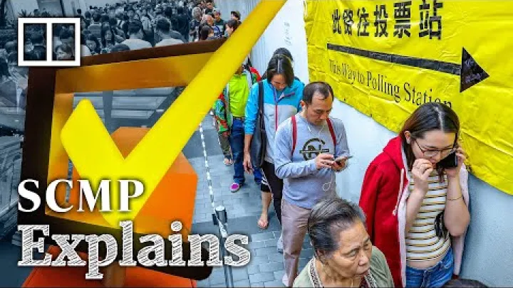
District councils are local consultative bodies concerned with district affairs. Their work can include discussion of community facilities, local environmental matters, community needs, and other issues that affect people in a district. They provide a channel for local views and communication between communities and government departments.
A district council should not be described as an autonomous provincial or municipal government. The existence of 18 district councils does not mean that Hong Kong is divided into 18 separate states or provinces. Territory-wide executive, legislative, and judicial institutions remain distinct from district-level consultation. This difference is important for students, researchers, and directory designers who may otherwise treat the word council as evidence of a separate government tier.
For practical writing, use terms such as district, district council, and district governance accurately. Avoid claiming that a district council has the same constitutional status as a provincial legislature or a city government in another country.
Districts as Statistical Units
The districts are also useful statistical units. The Census and Statistics Department publishes population, household, and socio-economic information analyzed by District Council district. Its material includes information on the socio-economic characteristics of the land-based non-institutional population at district level. The Census and Statistics Department is therefore an important reference when district-level comparisons are needed.
Using districts allows a report to compare places within a consistent administrative framework. A population table, household profile, or socio-economic indicator can be organized by Central and Western, Sha Tin, Yuen Long, or another district rather than by informal neighborhood names.
However, a district is not automatically the same as a neighborhood, planning unit, electoral boundary, police region, or service catchment. A neighborhood may be only part of a district, and a functional service area may cross district boundaries. Planning data can also use its own boundary definitions. When presenting a statistic, identify the dataset, the boundary type, and the reference date. Do not combine census, planning, and service data as though they all describe exactly the same geography.
Hong Kong Regions Map and Area Hierarchy
A Hong Kong regions map can answer several different questions. It may show the three broad areas, the 18 districts, transport or planning zones, or another functional geography. Before using a map for an address, statistical comparison, or area directory, first identify which of these questions the map is designed to answer.
A Practical Hierarchy for Maps and Location Directories
For a location directory, the cleanest structure is a parent-child hierarchy with no province or state layer inserted between Hong Kong and its districts:
- Parent territory: Hong Kong Special Administrative Region, or Hong Kong SAR.
- Broad area: Hong Kong Island, Kowloon, or the New Territories.
- District: One of the 18 current districts listed in this article.
- Local place: A neighborhood, village, estate, street, or other place name, if the directory needs that additional detail.
For example, a location record might be organized as Hong Kong SAR, Kowloon, Yau Tsim Mong District, followed by a neighborhood or street. The example uses the broad area as an organizational group and the district as the official administrative label.
Alternate search terms should be treated as explanatory aliases, not as duplicate administrative units. Hong Kong Island is not a district, the New Territories is not a single district, and Mong Kok is not a separate district. If a form has a field called state, province, or region, follow the form's instructions and do not assume that the field represents an official Hong Kong division. Where possible, use a territory or special administrative region field and record the district separately.
How to Read a Hong Kong Regions Map
The official Home Affairs Department My Districts page is a useful primary visual reference for the three broad areas and their 18 districts. It can help confirm the basic placement and grouping of a district, but every map should still be read with its legend and boundary description.
A displayed line may represent a District Council boundary, a planning data district, a service region, or another functional layer. These categories are not interchangeable. A colored region on a map is not automatically a province, state, or separately governed territory. The map publisher may also use a date or boundary version that differs from the one used by a statistical report or directory.
Use this short checklist when reading or adding a Hong Kong regions map:
- Identify the publisher or government department.
- Check the map date or boundary version.
- Read the legend to determine whether the lines show districts, planning areas, service regions, or another geography.
- Compare the displayed names with the official 18-district list.
- Place a plain-text district list beside the map so names remain accessible, searchable, and easier to translate.
In most general searches, Hong Kong regions map means a map of Hong Kong Island, Kowloon, and the New Territories, a map of the 18 districts, or both. It does not normally mean a map of Hong Kong provinces or states.
Names, Historical Labels, and Current Divisions
Hong Kong place names appear in English, Traditional Chinese, and many informal local forms. Clear naming is especially important when a directory serves both international readers and people who use local maps, government pages, or Chinese-language addresses.
Use Official English and Chinese Names
Use the official English district name together with its Traditional Chinese name at the first listing. This article uses forms such as Central and Western District 中西區, Sha Tin District 沙田區, and Islands District 離島區. The Chinese name helps readers match an English entry to local signs, addresses, government pages, and maps.
The administrative level should be stated explicitly. A neighborhood or commercial area may be widely known internationally but still not be a district. For example, a directory can describe Mong Kok as a local place in Yau Tsim Mong District rather than creating a separate Mong Kok District entry. Similarly, Central is a familiar urban area associated with Central and Western District, but it is not one of the 18 district names.
Preserve official spelling, capitalization, and word order. Do not create several English labels for one district simply because different websites shorten the name. A practical directory can store the official English name as the main label, the Traditional Chinese name as a local-language label, and informal place names as explanatory aliases.
Current Districts Versus Historical or Informal Labels
The main list should contain only the current 18 districts. This article presents the list as an August 2026 snapshot: four districts on Hong Kong Island, five in Kowloon, and nine in the New Territories. A document created for another date may use different terminology, so its date and administrative definition should be read carefully.
Terms such as New Kowloon may appear in historical, land, or statutory contexts. They should be labeled as historical or contextual terms, not added as a nineteenth district. Treaty-era area names and older boundary descriptions likewise explain past arrangements or legal contexts; they do not replace the current 18-district list.
Other labels can also look administrative without being current districts. Police regions, planning districts, electoral areas, service catchments, neighborhood names, and generic labels such as northern Hong Kong are designed for particular purposes. If one appears on a map or document, identify that boundary type instead of presenting it as a current first-level administrative division.
For a current form, map, or directory, compare the district names with the latest Home Affairs Department district information. Keep the official district name as the main entry and place historical or informal names in a separate explanatory field.
Key Takeaways About Hong Kong Administrative Divisions
- Hong Kong is a Special Administrative Region of the People's Republic of China, not an internally divided system of states or provinces.
- The practical hierarchy is Hong Kong SAR, followed by Hong Kong Island, Kowloon, or the New Territories, followed by one of 18 districts.
- The current district count is four districts on Hong Kong Island, five in Kowloon, and nine in the New Territories.
- District councils support local consultation, while the Census and Statistics Department uses District Council districts for many population and socio-economic analyses.
- A Hong Kong regions map should always be read together with its publisher, date, legend, and boundary type.
For international readers, the simplest accurate description is Hong Kong SAR with a three-area grouping and 18 current districts. Use the bilingual district names for identification, keep neighborhoods separate from districts, and do not insert a state or province layer that does not exist in Hong Kong's administrative structure.
Select area
Create a post
Posting is free and no registration is required.