Hong Kong Major Cities: Districts and New Towns Explained
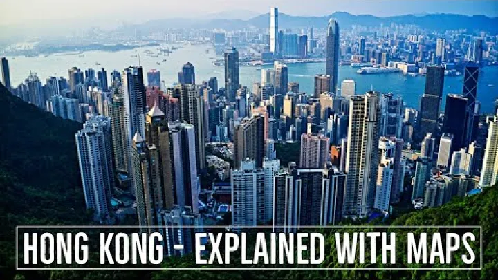
People searching for Hong Kong major cities often expect a conventional ranking. Hong Kong works differently: it is one highly integrated city-region whose urban life is organised through districts, neighbourhoods and planned new towns. This guide separates those geographic levels, then compares the main centres by resident population, administrative importance, employment, culture and travel role. It also explains why Central, Kowloon, Sha Tin and other familiar names can all be important without being separate incorporated cities.
What Counts as a Major City in Hong Kong?
To create a useful list of cities in Hong Kong, it is necessary to define what each place is first. The territory includes dense urban districts, planned new towns, older market centres and smaller neighbourhoods that serve very different functions.
Hong Kong Has No Separate Incorporated Cities
Hong Kong is a special administrative region with one integrated territorial government. Its internal geography is organised through broad areas, administrative districts, planned new towns and smaller local units rather than through a set of autonomous municipal cities. A district may have an important local identity, but it should not automatically be described as a separate city with its own city government.
The names also operate at different levels. Hong Kong Island and Kowloon are broad geographic areas. Central is an urban node within the Central and Western District, while Admiralty is a closely connected area with a strong government and business role. Sha Tin can refer to a local area, a new town or the wider Sha Tin District, depending on the source. In this article, the term urban centre is used for a significant built-up or planned area, while the administrative label is stated wherever it matters.
A Functional Definition of Hong Kong's Major Urban Centres
A major urban centre in Hong Kong is best identified through several measures rather than a single population number. The main factors are resident population, recognised planning status, concentration of employment and services, transport importance, historical identity, cultural visibility and usefulness to visitors or residents.
This approach includes large districts such as Yau Tsim Mong and Kwun Tong, planned centres such as Sha Tin and Tseung Kwan O, and important nodes such as Central and Admiralty. It does not treat an attraction, beach, park, island, province, metropolitan area or nearby mainland city as a standalone Hong Kong city. Neighbourhoods such as Tsim Sha Tsui, Mong Kok, Causeway Bay, North Point and Quarry Bay are included as parts of larger urban areas, not as independent municipalities.
The official DATA.GOV.HK new-town dataset is useful because it provides an official planning boundary and a comparable 2021 population reference for people living in the new towns. That makes it more reliable for this purpose than informal travel lists that mix neighbourhoods, districts and attractions.
The Administrative Capital Area Is Not the Same as the Largest Population Centre
Central and Admiralty form Hong Kong's main government, financial and institutional core. Government offices, major businesses and important civic functions are concentrated there, so the area is often treated as Hong Kong's practical capital area. It is not, however, a separate capital municipality.
The largest administrative district, the largest new town and the largest continuous city-region are different things. A district may contain several built-up communities and rural areas. A new town follows a planning boundary that may not match a district. The wider Hong Kong city-region includes many districts and centres that are physically and economically connected. For that reason, a population-based answer to the question of the biggest cities in Hong Kong must always identify the geographic unit and year.
Resident population also measures something different from political or economic importance. Central may have a smaller permanent residential base than a large New Territories district, while still having a much greater concentration of offices and government activity. The 2021 Population Census district profiles provide the appropriate administrative framework for making that distinction.
Hong Kong Major Cities at a Glance
The following shortlist is a functional map rather than a strict league table. It groups the main urban centres by their geographic unit and role, while keeping district statistics separate from new-town statistics.
A Functional Shortlist of Hong Kong's Major Urban Centres
Where a place is a neighbourhood or urban node, the table identifies the wider district. Where it is a planned new town, the table identifies the new-town basis. A 2021 reference is preferred for comparable official population work, but the table does not insert figures when the boundaries are not equivalent.
| Urban centre | Geographic unit | Population basis | Principal role |
|---|---|---|---|
| Central and Admiralty | Urban nodes in Central and Western District | Wider district profile | Government and finance |
| Wan Chai and eastern harbour corridor | Wan Chai and Eastern District areas | District profiles | Business and residential |
| Southern District | Administrative district | District profile | Coastal and residential |
| Yau Tsim Mong | Administrative district | District profile | Retail, visitors and culture |
| Kwun Tong | Administrative district | District profile | Dense residential and services |
| Sham Shui Po | Administrative district | District profile | Established local commerce |
| Kowloon City and Wong Tai Sin | Administrative districts | Separate district profiles | Residential and historic communities |
| Tsuen Wan | New town and district-related area | Separate new-town and district data | Western urban corridor |
| Sha Tin and Ma On Shan | New town and Sha Tin District | Separate new-town and district data | Large planned centre |
| Tuen Mun | New town and district | Separate new-town and district data | Western urban centre |
| Yuen Long | Established town and planning area | Town, new-town or district basis | Market and service centre |
| Tin Shui Wai | Planned new town in Yuen Long District | New-town data | Planned residential centre |
| Tseung Kwan O | New town in Sai Kung District | New-town data | Eastern planned centre |
| Tai Po | New town and Tai Po District | Separate new-town and district data | Northern service centre |
| Fanling and Sheung Shui | Paired northern new towns | New-town or North District basis | Residential and border corridor |
| Tung Chung | New town on Lantau | New-town data | Gateway and emerging centre |
This structure explains why there is no universally correct single ranking of Hong Kong cities. A district comparison highlights resident communities, while a new-town comparison highlights planned urban development. A travel comparison may instead emphasise Central, Tsim Sha Tsui, Mong Kok or Tung Chung because of their functions and visibility.
Hong Kong Island: The Political and Financial Core
Hong Kong Island contains the territory's most recognisable government and business corridor, as well as established residential and coastal districts. Its urban pattern changes considerably from the dense northern harbour edge to the less continuous development of the south.
Central, Admiralty, and the Historic Victoria Area
Central and Admiralty are the key urban nodes of the Central and Western District. Central is strongly associated with finance, corporate offices, retail and major commercial streets. Admiralty extends that core with government, institutional and business functions. Together, they form the clearest administrative and economic centre in Hong Kong, even though neither is a separate city government.
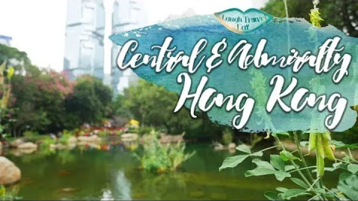
The historic City of Victoria belongs to an earlier legal and urban framework. It is useful for understanding the development of the northern Hong Kong Island corridor, but it is not a current independent municipality or a separate entry in a modern Hong Kong city list. The present-day analysis should therefore use the Central and Western District for administrative data and Central or Admiralty as urban nodes.
A modest resident population does not make the area unimportant. Central and Admiralty attract a large concentration of workers, institutions and visitors during the day. That employment and civic role should be described separately from the number of people who live within the wider district.
Wan Chai and the Eastern Harbour Corridor
Wan Chai is a mixed commercial and residential district east of Central. It forms part of the continuous northern harbour corridor and includes a combination of offices, housing, local services and visitor-oriented areas. It is more than a single destination, but it is also not a separate incorporated city.
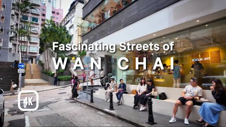
Causeway Bay is a major local urban node associated with Wan Chai District. Farther east, North Point and Quarry Bay are neighbourhood-level centres within the Eastern District. They can be useful names for describing shopping, housing or business areas, but population comparisons should use the relevant district profile rather than treating each neighbourhood as a city-proper unit.
The contrast with Central is functional. Central and Admiralty have a particularly strong government and employment identity, while Wan Chai and the Eastern District combine substantial residential life with commercial activity. The full Hong Kong Island corridor is therefore best understood as a connected series of urban nodes rather than a row of independent cities.
Southern District and Hong Kong Island's Coastal Urban Edge
Southern District is an important administrative district, but its built-up pattern is less continuous than the harbour-facing north. It combines residential communities, coastal settlements, local commercial areas and recreational settings.
Aberdeen, Ap Lei Chau and Stanley are useful examples of this variety. They are local areas within Southern District, not separate major cities. Their importance comes from the district's coastal identity and the way urban communities meet the island's less densely built southern edge.
Southern District should therefore be compared by its overall administrative and functional role. A prominent waterfront, market, beach or visitor location does not by itself create a separate city population or municipality. This distinction keeps the focus on the district rather than on individual attractions.
Kowloon: Hong Kong's Dense Peninsula Urban Centre
Kowloon is a broad geographic area containing several administrative districts and a dense, largely continuous urban environment. Its main centres combine high residential intensity with retail, culture, services, business and visitor activity.
Yau Tsim Mong: Tsim Sha Tsui, Mong Kok, and the Visitor Core
Yau Tsim Mong is one of the most visible urban districts in Hong Kong. It includes the major local areas of Tsim Sha Tsui, Mong Kok and Yau Ma Tei, each with a distinct character within the wider district. Tsim Sha Tsui is strongly associated with the harbour-facing visitor and hotel corridor, while Mong Kok is known for dense local commerce and street-level activity.

The district matters for several reasons at once: people live there, businesses operate there, visitors stay there and cultural venues and retail areas draw activity from across the territory. These functions make Yau Tsim Mong a major urban component, but they do not turn Tsim Sha Tsui or Mong Kok into independent municipalities. The appropriate population unit for an administrative comparison is the Yau Tsim Mong District profile.
For current visitor-facing information about areas and experiences in Hong Kong, the Hong Kong Tourism Board is more appropriate than relying on old rankings or informal claims about visitor volumes. Travel visibility and resident population should remain separate measures.
Kwun Tong and Sham Shui Po: Large Established Urban Districts
Kwun Tong and Sham Shui Po are major urban components because of their resident communities, dense housing, local services and established built-up character. They demonstrate why a list of Hong Kong's largest cities should not focus only on famous visitor districts.
Kwun Tong is associated with the industrial development history of eastern Kowloon and with a changing mix of business, commercial and residential activity. Sham Shui Po has an older, mixed urban fabric with neighbourhood commerce and long-established residential communities. These descriptions identify different urban roles without requiring unsupported claims about income, employment totals or redevelopment outcomes.
Each district should be kept as a separate population unit. Combining them into one Kowloon figure would obscure their different administrative identities, while dividing them into every local neighbourhood would create a list of areas rather than a list of major urban centres.
Kowloon City and Wong Tai Sin: Historic and Residential Urban Communities
Kowloon City and Wong Tai Sin are established administrative districts within the dense Kowloon urban area. Their importance is mainly residential and local, with community services, commercial streets and historic layers that contribute to Kowloon's wider identity.
The former Kowloon Walled City is relevant as historical context, but it is not a current city candidate or a modern population unit. Historical estimates connected with the Walled City should not be inserted into a present-day ranking of Hong Kong urban centres.
The same principle applies to heritage sites, temples, markets and redevelopment areas. They can help explain the identity of Kowloon City or Wong Tai Sin, but the population and administrative analysis belongs at district level. This produces a clearer comparison with Yau Tsim Mong, Kwun Tong and Sham Shui Po.
The Largest New Territories Urban Centres
The New Territories contain many of Hong Kong's largest planned urban centres. New towns were developed to provide housing, services and employment outside the older harbour core, so their boundaries and populations need to be read as planning measures as well as geographic descriptions.
The Hong Kong Government New Towns Fact Sheet provides a consistent official framework for understanding their development and population role.
Tsuen Wan and the Western Urban Corridor
Tsuen Wan New Town is a mature planned urban centre in the western part of the territory. It is closely associated with Tsuen Wan District and with the wider built-up corridor that includes neighbouring Kwai Chung and Tsing Yi areas. That relationship makes Tsuen Wan important beyond the boundaries of the local town centre.
Tsuen Wan combines residential communities with commercial and service functions and a history connected with industry and waterfront development. The exact population depends on the unit being measured. Tsuen Wan New Town, Tsuen Wan District and the wider western corridor do not cover exactly the same geography.
For a reliable comparison, use the official new-town figure when discussing the planning unit and the district profile when discussing the administrative unit. The two figures should be displayed or described separately, with the year and boundary stated beside each one.
Sha Tin and Ma On Shan
Sha Tin New Town and Ma On Shan form a large planned urban area associated with Sha Tin District. Sha Tin has a distinct town-centre identity and a broad range of residential and service functions, while Ma On Shan is a major component of the same wider planned urban context.
The area is significant because it represents the scale that a Hong Kong new town can reach while remaining connected to a district that includes more than the built-up town. A reference to Sha Tin may mean Sha Tin New Town, Sha Tin District or a narrower local area. Ma On Shan can also be counted separately in some descriptions and together with Sha Tin in others.
Do not present a district total and a new-town total as one city-proper count. Keep the planning boundary and administrative boundary in separate rows or paragraphs. This makes Sha Tin easier to compare with Tuen Mun, Tsuen Wan and Tseung Kwan O.
Tuen Mun: A Major Western New Town
Tuen Mun is a major western New Territories new town with a strong residential and service-centre role. Tuen Mun District is broader than Tuen Mun New Town, so the two names should not be treated as interchangeable when discussing population or planning capacity.
The town combines housing, local services, coastal settings and employment-related land uses. Its scale makes it an important entry in a Hong Kong urban-centre list, even though it is geographically distinct from the harbour core. The balance between its current resident population and its planned development history also helps explain why different sources may present different figures.
Whether Tuen Mun is called the largest new town depends on the exact year, definition and boundary used. A careful comparison should never combine the district total, the new-town total and a planned capacity figure in one ranking.
Yuen Long and Tin Shui Wai: Two Urban Centres in One District
Yuen Long and Tin Shui Wai are associated with Yuen Long District but represent different urban patterns. Yuen Long is an established market-town and service centre with a long local history. Tin Shui Wai is a later, large-scale planned residential town with a more deliberately planned layout.
The two centres should appear as separate entries when the purpose is to compare urban roles or new-town populations. A Yuen Long District total covers more than either town, while a new-town dataset may use boundaries that do not match the district. Keeping the figures separate prevents the population of one centre from being incorrectly attributed to the other.
The surrounding setting also matters. Dense urban development exists alongside rural land and wetland landscapes in the wider Yuen Long area. Those natural areas may be important for culture, ecology or travel, but they are not additional cities. They should remain part of the context for Yuen Long or Tin Shui Wai.
Other Major New Towns and Northern Centres
Several other planned centres are smaller than the leading New Territories urban areas but remain important because of their residential scale, local services, northern location or gateway role. Their significance cannot be measured by resident population alone.
Tseung Kwan O: A Planned Eastern Harbour New Town
Tseung Kwan O is a planned new town within Sai Kung District. It has a modern residential and service-centre identity and includes local areas such as Hang Hau, Po Lam, LOHAS Park and Tiu Keng Leng. These names describe components of the wider new town, not separate cities.
Its observed population, planned capacity and share of the wider Sai Kung District are different measures. Planned capacity describes what an area is designed or expected to accommodate; it is not a count of current residents. The same distinction applies when a new development phase changes the apparent scale of a town.
Tseung Kwan O is therefore best compared with other planned new towns using the official new-town boundary and population dataset. It can be described as a major eastern planned centre without forcing it into a city-proper ranking.
Tai Po: A Northern New Town and Established Town Centre
Tai Po combines a planned new town with an established local centre in the northern New Territories. It has a residential and service role and provides an urban focus within a district that also contains extensive areas outside the built-up town.
Tai Po is generally smaller in population scale than the leading new towns, but it remains significant for understanding the distribution of urban communities beyond Kowloon and Hong Kong Island. The name may refer to Tai Po New Town, the Tai Po town area or the wider Tai Po District.
Current population and planned capacity should be treated as separate data points. If a source uses a planning figure while another uses a census district figure, the difference should be explained rather than used to imply population growth or decline without comparable boundaries.
Fanling and Sheung Shui: Northern New Towns
Fanling and Sheung Shui are commonly treated as a paired northern urban centre associated with North District. They provide residential and local service functions and have importance because of their position in the northern border corridor.
The focus should remain on Hong Kong territory. Shenzhen and other cities in Guangdong may be relevant in a regional discussion, but they are not entries in a list of Hong Kong cities. Similarly, villages and rural areas around Fanling and Sheung Shui should not be added as separate urban centres simply because they have distinct local names.
Population comparisons must identify whether the figure covers the paired new-town area, North District or another planning boundary. A paired town description can be useful for readers, but it should not conceal the geographic unit behind the number.
Tung Chung: A Smaller Gateway Urban Centre
Tung Chung is an officially recognised new town on Lantau and an important gateway-oriented urban centre. It is smaller than the leading population centres, but its significance comes from its relationship with the airport area, wider Lantau development and the western gateway context.
The town has developed in phases, and official planning material distinguishes earlier targets from later development capacity. Those planning figures should not be presented as a current resident population. Tung Chung is best described as a smaller or emerging centre rather than as one of Hong Kong's largest cities.
Its gateway role also needs to be kept distinct from the surrounding island and airport-related facilities. Lantau is an island and geographic setting, not an additional city. Tung Chung is the urban-centre entry; nearby infrastructure, natural areas and visitor sites are supporting context.
How to Compare These Urban Centres
A useful comparison separates measurement from interpretation. Population answers where people live, while administrative, economic, transport, cultural and travel measures explain why a place matters.
District Population, New-Town Population, and Urban-Agglomeration Measures
A district population counts residents within an administrative district. That boundary may include several urban centres, villages, undeveloped land or rural areas. It is the correct measure for comparing Hong Kong's administrative districts, but it is not automatically the population of a single city.
A new-town population counts residents within a planning boundary. A new town may sit inside one district, relate to more than one built-up area or exclude nearby communities that readers associate with it. It is the correct measure for comparing planned urban units, but it should not be substituted for the district total.
A city-proper population normally refers to residents inside a legally defined municipality. That concept does not map neatly onto Hong Kong's district and new-town system. An international urban-agglomeration or metropolitan measure is different again: it may estimate the de facto population of a contiguous built-up territory using an international statistical definition. The World Bank WDI metadata describes this kind of urban-agglomeration concept.
The safest population comparison uses one common year, such as 2021, and states the unit beside every figure. Use Census and Statistics Department district profiles for administrative comparisons and the official new-town dataset for planning-unit comparisons. Keep observed population, planned capacity, district totals, new-town totals and metropolitan estimates in separate columns or sections. If no fully comparable series exists, a cautious role-based shortlist is more informative than a false ranking.
Administrative, Economic, and Transport Significance
Urban centres can be compared across several separate dimensions. Central and Admiralty lead in government, finance and institutional concentration. Kowloon districts such as Yau Tsim Mong, Kwun Tong and Sham Shui Po are important for dense residential life, retail, services and established urban communities. Large New Territories towns such as Sha Tin, Tuen Mun and Tsuen Wan have major residential and service roles, while places such as Yuen Long and Tai Po provide local centres beyond the harbour core.
Transport significance is another dimension, but it should not replace population or administrative status. A location may be important because it connects surrounding communities, serves as a town centre or provides access to a major corridor. That does not mean the place is a separate city or has the largest resident population.
For a current journey, check official transport maps, operator information, interchange details, fares and service notices at the time of travel. Routes, station arrangements, travel times and service conditions can change. Broad role labels are suitable for a general city comparison; exact route and timetable claims require current transport information.
Cultural and Travel Significance Without Turning Attractions into Cities
Travel visibility is not the same as city status. Central, Tsim Sha Tsui, Mong Kok and Sha Tin may be highly recognisable because of their urban character, shopping, offices, cultural venues or visitor activity. Their attractions remain nested within the relevant district or urban centre.
This distinction also helps with cultural comparison. Older urban areas can be understood through historic street patterns and local commerce. Planned towns can be understood through their town centres, housing and public services. Northern communities and coastal areas show different relationships between urban development, rural land and surrounding landscapes.
There is no single best city in Hong Kong for every traveller. A visitor interested in business, shopping, street life, museums, heritage, waterfront settings or access to nature may choose a different base. The attraction, park, market, museum, wetland or heritage site supports the role of its district; it does not become a separate city entry.
Choosing a Hong Kong Urban Centre by Purpose
The most useful choice depends on what you need from an area. A short visit, a business stay, study, relocation or daily life can each produce a different answer to the question of which Hong Kong urban centre is best.
Comparing Hong Kong's Core Areas for a First Visit
The Hong Kong Island core is the clearest choice for readers interested in government, finance, major commercial activity and the visual identity of the central harbour corridor. Central and Admiralty are urban nodes within Central and Western District, not separate cities, but they are useful area descriptions for planning a visit.
Tsim Sha Tsui offers a different experience within Yau Tsim Mong. It is a prominent harbour-facing and visitor-oriented area, while Mong Kok provides a denser local shopping and street-life setting. Both are neighbourhood-level parts of a larger district. A reader who wants a more spacious planned-town environment or a base near the New Territories may instead consider an established centre such as Sha Tin, Tuen Mun or Yuen Long, depending on the purpose of the trip.
These choices should be made by matching area function to interests rather than by treating every famous name as a city. Business centrality, local commerce, cultural activity, waterfront access and proximity to a chosen destination are more useful decision points than a single overall ranking.
Choosing a Centre for Business, Study, or Daily Urban Life
For business, the Central and Admiralty employment core may be the most relevant geographic reference. For study or daily life, the best centre depends on the location of the workplace, institution, housing, services and preferred urban environment. Kowloon's established districts offer dense local communities and extensive commercial activity, while planned New Territories towns provide large residential settings with their own town centres and services.
Remote workers and relocating professionals should distinguish the location of an office or institution from the name of the wider district. A listing that says Kowloon, Sha Tin or Tseung Kwan O may still cover several different neighbourhoods and housing environments. Population size alone cannot show whether a particular area fits a person's daily needs.
For relocation decisions, treat housing availability, service provision, current access and commuting conditions as separate questions. They can change over time and vary within the same district or new town. The city-centre classification is useful for orientation, but it is not a substitute for checking a specific address.
Choosing Urban Centres for Heritage, Culture, and Nature
Older urban areas, planned town centres, northern communities and coastal or green-edge settings offer different experiences. Yuen Long can illustrate an established local centre, while Tin Shui Wai represents a later planned residential town. Sha Tin shows the scale of a major inland new town, Tuen Mun combines urban and coastal roles, and Tung Chung connects a smaller new town with a gateway and island setting.
Southern District offers another contrast through its coastal communities and less continuous urban pattern. These places are useful for comparing how development meets surrounding landscapes. Wetlands, parks, beaches, heritage sites and museums should remain supporting features of the relevant district or centre rather than being listed as cities.
When planning a cultural or nature-focused visit, check current opening hours, access arrangements and venue information for any specific site. The broader urban identity of a district is relatively stable, but individual facilities, exhibitions and access conditions can change. This approach keeps the article focused on urban centres while still helping readers choose an area by experience.
Conclusion: Hong Kong as One Integrated City-Region
The best answer to the question of Hong Kong's major cities is not a simple list of legally separate municipalities. Hong Kong is one integrated city-region made up of administrative districts, dense urban nodes and planned new towns. Central and Admiralty define the government and financial core; Kowloon's districts provide dense residential, commercial and cultural activity; and centres such as Tsuen Wan, Sha Tin, Tuen Mun, Yuen Long, Tseung Kwan O, Tai Po, Fanling, Sheung Shui and Tung Chung extend the urban system across the New Territories.
For population comparisons, always name the unit and year. For practical choices, compare each centre by its administrative, economic, cultural, travel and daily-life role. That gives a more accurate picture of Hong Kong than forcing every familiar place name into the category of a separate city.
Select area
Create a post
Posting is free and no registration is required.