Singapore Major Cities: List, Population & Urban Centres

Searching for Singapore major cities can be confusing because Singapore is not organised like a large country with many separate municipalities. It is a city-state: Singapore is both a sovereign country and a single, highly urbanised national city. The useful answer is therefore a guide to its major urban centres, including large planning areas, new towns, regional centres, and the central business district. This guide explains how to compare them by resident population and by their administrative, economic, cultural, and travel roles.
Is Singapore a Country of Multiple Cities?
The short answer is no, not in the usual international sense. Singapore has many recognisable urban places, but names such as Tampines, Bedok, Woodlands, and Hougang refer to parts of one city-state rather than separate incorporated cities. Understanding that distinction makes a Singapore cities list much more accurate and useful.
Singapore Is a City-State
Singapore is a sovereign state whose territory is overwhelmingly urban. In everyday language, people may call it a city and a country at the same time because both descriptions are useful. The city-state model means that national government, city-scale infrastructure, and land-use planning operate across the same compact territory.
This differs from a country that has a capital city, several independent municipalities, and a network of separate provincial cities. Singapore does not need a conventional list of legally separate cities to describe where people live and work. Instead, residents commonly identify places by planning area, new town, estate, district, or neighbourhood.
For a practical comparison, it is best to call Tampines, Bedok, Jurong West, Woodlands, and similar places major urban centres. This wording recognises their large populations and distinct local functions without suggesting that each is an independent municipality. It also helps international readers interpret maps, housing listings, school locations, and workplace addresses more accurately.
Why Singapore's Capital and Largest City Overlap
Singapore is the national capital and the country’s dominant urban entity. UN Data lists Singapore as the capital and reports a 2025 national population of about 5.87 million, while its capital-city figure is almost the same. The near overlap reflects the city-state structure, not the existence of a separate capital municipality inside a larger national urban system.
This is important when reading population rankings. A national population figure describes all people in Singapore under that dataset’s definition. A planning-area figure describes only residents within a smaller internal boundary. Neither should be presented as though it were the population of a second national city.
The central area also should not be confused with all of Singapore. The Downtown Core is a central planning area with an outsized business and visitor role, while Central Singapore can be used more broadly for the central part of the island. Both sit within the same city-state. A large residential area such as Tampines may have more residents than the Downtown Core, but that does not make it a larger city.
What the Search Term Means in Local Context
Terms such as “largest cities in Singapore,” “biggest cities in Singapore,” and “cities in Singapore” are usually requests for a clear orientation to the island’s most important populated places. The most useful local answer is a list of major planning areas and new towns, paired with an explanation of what each place does.
Planning areas provide a consistent geographic framework for population analysis. New towns describe major residential environments developed around homes, shops, schools, parks, and transport links. Regional centres add another layer: they are places intended to bring jobs and services closer to residents outside the traditional central business district.
Not every familiar place name belongs in a cities list. Marina Bay, Orchard Road, Chinatown, Little India, East Coast Park, Sentosa, and Jurong Lake District are important districts, destinations, islands, parks, or development areas, but they are not separate cities. Keeping these categories separate makes the list clearer for visitors, students, and people considering relocation.
How to Compare Singapore's Major Urban Centres
A population ranking is useful, but it is only one way to understand urban importance in Singapore. Internal boundaries serve planning purposes, and each area may combine homes with workplaces, roads, green space, institutions, or industry. A good comparison starts with the geographic unit and then considers the role that location plays.
Planning Areas, New Towns, and Subzones
Singapore’s planning framework uses planning areas and smaller subzones to organise land use and population data. A planning area can include several neighbourhoods and may contain very different land uses. Bedok, for example, is a planning area, while its local identity includes residential estates, commercial spaces, community facilities, and areas associated with the wider east coast.
A new town is a more everyday term for a substantial residential urban area. It often has a town centre, public housing estates, schools, markets, places of worship, parks, and transport connections. Tampines, Punggol, Sengkang, Ang Mo Kio, Choa Chu Kang, and Toa Payoh are widely recognised through this town-based lens. New-town boundaries and planning-area boundaries may overlap closely, but the terms do not always mean precisely the same thing.
A simple hierarchy helps put local names in context:
- Country and capital: Singapore, the city-state.
- Region: broad areas such as Central, East, North, North-East, and West.
- Planning area: an official unit used for land-use planning and statistical analysis.
- New town or town: a large residential centre recognised in daily life.
- Subzone or neighbourhood: a smaller area within a planning area.
Regional centres are different again. Tampines Regional Centre and Woodlands Regional Centre are strategic employment and service hubs, not independent cities. The URA Master Plan is the statutory land-use framework that guides Singapore’s medium-term development. It is the appropriate reference for interpreting planning designations and changing development context.
Resident Population versus Total Population
For comparisons between planning areas, resident population is the most useful common measure when the dataset uses that definition. In Singapore statistics, residents generally refer to citizens and permanent residents, rather than all people physically present in an area. This differs from Singapore’s total population, which includes non-residents.
The official Census of Population 2020 dataset on data.gov.sg provides resident population by planning area and subzone. Because it is a census dataset, it is valuable for comparing the relative residential scale of places using the same reference year and definition. It should not be mixed casually with a later national estimate, a daytime workforce count, or a broader metropolitan figure.
Population can also appear different because boundaries are different. A planning area may include industrial land, reservoirs, transport corridors, or parks in addition to homes. Conversely, a widely used town name may refer informally to an area extending beyond one statistical boundary. For this reason, an exact-looking figure does not always settle every local comparison.
When using a Singapore cities list, read each figure with four questions in mind: What geographic unit is being counted? Is the number for residents or total population? What is the reference year? Does the comparison use the same definition for every row? These questions prevent misleading comparisons between a planning area, a city-state, and a central business district.
Why Population Alone Does Not Define Importance
A major urban centre may matter because many people live there, but population is not its only role. The Downtown Core has a comparatively limited residential footprint yet concentrates national institutions, finance, offices, hotels, cultural venues, and visitor services. A large heartland town may have far more residents while functioning mainly as a residential and community centre.
A broader comparison considers five factors: population, administrative importance, economic function, cultural identity, and travel significance. This approach explains why Tampines matters as an eastern regional centre, why Woodlands matters as a northern gateway, and why Toa Payoh remains notable as a mature and historically important new town.
It also avoids a misleading single “best city” ranking. The most suitable place depends on the question. Someone comparing housing catchments may prioritise resident population. A business traveller may focus on the Downtown Core, Orchard Road, or a regional business hub. A visitor seeking everyday neighbourhood life may prefer a heartland town with markets, hawker food, parks, and local services.
Largest Urban Centres in Singapore by Resident Population
The centres below are best understood as major planning areas and towns, not standalone cities. They are commonly included in population-oriented discussions because they contain substantial residential communities. Census-based resident data provide the most consistent basis for comparison, while the descriptions below explain why the locations matter beyond their position in a list.
Tampines
Tampines is one of Singapore’s largest planning areas and a major eastern urban hub. Its scale comes from extensive residential estates as well as a concentration of shopping, education, community facilities, and services. The area is especially significant because Tampines Regional Centre gives the east a substantial commercial and employment focus outside the central business district.

For residents, Tampines can feel relatively self-contained: daily needs, public amenities, schools, and retail options are available within the wider town environment. For employers and commuters, its regional-centre role helps explain why it carries importance beyond its residential population. This is a useful example of Singapore’s effort to distribute services and workplaces across the island.
Tampines is not an independent city. Its population should be described as the resident population within the relevant planning-area boundary and census year, rather than as a city-proper total. That distinction is especially important when comparing it with Singapore’s national population or with the much smaller but economically powerful Downtown Core.
Bedok
Bedok is a large, mature eastern planning area with a long-established residential character. It is known for dense neighbourhoods, town-centre services, schools, food options, and local commercial activity. Its enduring importance comes from the size of its resident community and from its role as an everyday service centre for the east.
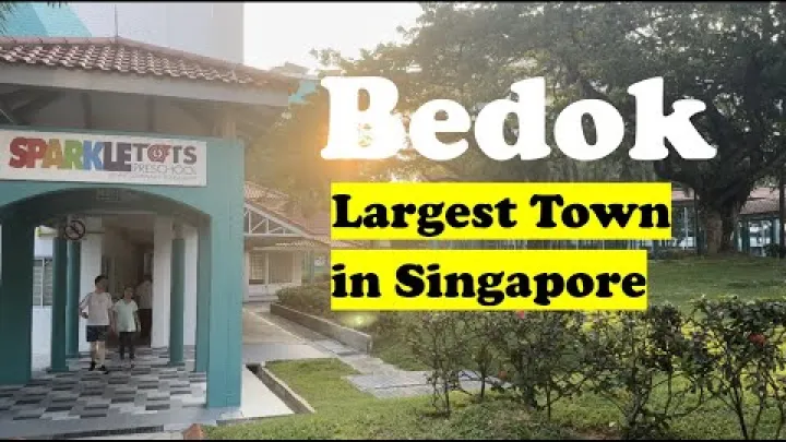
The planning area contains varied subzones, so “Bedok” can mean different things in conversation: a town centre, an estate, an MRT-area reference, or the broader planning geography. This is why a population number should always be tied to the planning-area boundary rather than assumed to cover every place that people casually associate with Bedok.
Bedok also offers access toward east-coast recreation, but nearby beaches and parks should be treated as destinations rather than proof of separate city status. For a newcomer, Bedok is most useful to understand as a mature heartland environment with established amenities and a strong local residential identity.
Jurong West
Jurong West is a major western residential planning area. It contains dense housing and local amenities and is closely connected to the broader western employment landscape, including industrial, educational, and commercial activity associated with the wider Jurong area. This relationship gives Jurong West importance beyond its function as a place where many people live.
![Preview image for the video "Pioneer Neighbourhood Tour - Jurong West~ Singapore Walking Tours [4K]~ Singapore Walking Tours [4K]".](/sites/default/files/styles/media_720x405/public/oembed_thumbnails/2026-07/tSE7_uH_ZR2f9TGBKbm2R_MgSuCFG__3Wz0dN3kn7go.jpg.webp?itok=-1YNWwJT "Preview image for the video \"Pioneer Neighbourhood Tour - Jurong West~ Singapore Walking Tours [4K]~ Singapore Walking Tours [4K]\".")
Names in the west require care. Jurong West is not the same as Jurong East, and neither should be used as a substitute for the entire Jurong area. Jurong Lake District is a separate development concept, while “Jurong Town” may be used in industrial or historical contexts. Each name can be relevant, but they refer to different geographies and functions.
For population comparisons, Jurong West should be measured only against planning areas using the same boundary type and reference year. For relocation or work decisions, it is more helpful to consider the relationship between the residential town, nearby employment zones, and the particular destination of a commute than to rely on a broad west-side label.
Woodlands
Woodlands is a large northern planning area with extensive residential neighbourhoods, commercial facilities, schools, and transport links. It is also a key gateway toward Johor Bahru in Malaysia, which gives it cross-border and regional relevance that many other residential towns do not have.
Woodlands Regional Centre has a strategic economic role. The URA describes it as the economic hub of Singapore’s Northern Gateway, with links to the rest of Singapore and Johor. This role helps explain why Woodlands belongs in a guide to major urban centres even when a reader is not comparing population alone.
Woodlands is still a planning area and regional centre within Singapore, not a separate municipality. Its current residential, commercial, and transport functions should be distinguished from projects that are still being developed. For cross-border commuters or travellers, the practical value of its location depends on current border, transport, and access arrangements.
Hougang
Hougang is a large planning area in the North-East Region with a strongly residential character. Mature housing, schools, parks, shops, and community facilities make it a significant heartland centre. Its importance is primarily rooted in the scale and continuity of daily neighbourhood life rather than in a regional-centre designation.
The area illustrates why a Singapore cities list should not focus only on office districts and visitor landmarks. Large numbers of people experience Singapore through towns such as Hougang, where local services, food places, recreation spaces, and community institutions are central to everyday routines.
Hougang has a diverse resident population, as do urban areas across Singapore. Census data can describe residents within defined boundaries, but demographic statistics should be read as area-wide information rather than as a claim that any one community exclusively defines the town. For visitors, Hougang is better approached as a lived-in residential area than as a conventional tourist centre.
Other Large Towns: Punggol, Yishun, Sengkang, Ang Mo Kio, Choa Chu Kang, and Toa Payoh
Several other towns broaden the picture of Singapore’s distributed urban structure. Their relative population scale can be compared through the same resident-population dataset, but their value is easier to understand through their different stages of development and local roles.
| Urban centre | General character | Why it matters |
|---|---|---|
| Punggol | Newer north-eastern town | Waterfront-oriented growth and family housing |
| Yishun | Northern residential anchor | Established services for northern communities |
| Sengkang | Large new town | Major North-East residential concentration |
| Ang Mo Kio | Mature town | Long-established homes, services, and transport access |
| Choa Chu Kang | Western residential centre | Dense housing and everyday local amenities |
| Toa Payoh | Historic mature new town | Central location and enduring town identity |
Punggol is often associated with a newer, waterfront-oriented town environment. Sengkang is another large North-East residential centre, while Yishun serves as an established northern anchor. Ang Mo Kio and Toa Payoh represent mature new-town environments with long-developed services and strong local recognition. Choa Chu Kang is an important western residential centre.
These are distinct places, even when they are geographically near one another or connected by the same transport corridor. A list should not merge planning areas simply to create a broader label. The most reliable approach is to name the specific town or planning area, state the reference year if population is included, and explain the role readers are likely to encounter.
Major Centres by Economic, Cultural, and Travel Significance
Singapore’s most important places cannot be identified by resident population alone. The city-state’s compact geography allows business districts, cultural precincts, residential towns, and regional employment hubs to interact closely. The following centres show how national significance can be concentrated in areas with very different populations and land uses.
Central Singapore: Capital, Business, and Cultural Core
Central Singapore is the country’s principal political, business, financial, cultural, and visitor-facing area. Within it, the Downtown Core is especially important for offices, financial services, major hotels, national institutions, and high-profile public spaces. Its importance comes from activity and function rather than the number of residents inside its boundary.
The central area also contains or connects closely with well-known districts such as the Civic District, Orchard Road, Chinatown, Little India, Kampong Glam, and Marina Bay. These names are valuable for planning a visit or choosing an accommodation area, but they are districts or destinations within Singapore, not separate cities.
For business visitors, the central core is usually the clearest reference point. For students and new residents, it provides access to jobs, cultural institutions, retail, and transport, although it may not reflect the quieter residential patterns of larger heartland towns. Central Singapore is therefore essential to a major-cities guide even though it does not function as a separate city from the rest of the country.
Regional Centres and Economic Hubs
Singapore’s planning approach seeks to bring jobs, services, housing, and amenities closer together in more than one part of the island. This decentralisation reduces the need for every activity to be concentrated in the Downtown Core and supports a more polycentric urban pattern.
Tampines Regional Centre is the clearest eastern example, combining commercial and service functions with a large residential catchment. Woodlands Regional Centre plays a northern gateway role. In the west, the wider Jurong development area has major employment and growth significance, though readers should distinguish the existing functions of Jurong West and Jurong East from the evolving plans associated with Jurong Lake District.
Economic importance can therefore belong to an area with fewer residents than a large town. The key question is not simply “Which city is biggest?” but “What role does this urban centre perform?” The planning framework recognises that offices, education, industry, logistics, public services, and homes do not need to be concentrated in one central district.
Heartland Towns and Everyday Cultural Life
Heartland towns are where much of Singapore’s everyday life takes place. They bring together homes, markets, hawker centres, community clubs, schools, healthcare services, parks, sports spaces, religious sites, and neighbourhood shops. For people staying longer than a few days, these places offer a more direct view of daily routines than the central visitor zone alone.
Bedok and Hougang illustrate mature, established town environments. Ang Mo Kio and Toa Payoh are also strongly associated with long-standing new-town life, while Punggol presents a newer residential environment. Each has its own mix of housing age, public spaces, local retail, and nearby recreation, rather than a single uniform character.
Singapore’s multi-ethnic national character is expressed across these towns through shared public life, food, community events, and religious and cultural institutions. It is more accurate to see this diversity as part of the city-state as a whole than to assign an exclusive cultural identity to any one planning area. For visitors, heartland exploration works best as an opportunity to experience local daily life, not as a search for a separate city within Singapore.
How to Use a Singapore Cities List
A well-structured list is a tool, not just a ranking. It can help readers compare residential scale, understand business geography, select a suitable base, or identify places to explore beyond central landmarks. The right urban centre depends on the purpose of the search.
Choosing an Urban Centre for Population, Business, or Travel
Use planning areas when the goal is population comparison. Their boundaries and census data create a clearer basis than informal town names or tourism districts. Tampines, Bedok, Jurong West, Woodlands, and Hougang are particularly useful examples because they show the scale of Singapore’s major residential centres.
For business context, start with the Downtown Core and then consider regional centres. Central Singapore remains the principal national business environment, while Tampines and Woodlands show how employment and services are distributed outside the core. The wider Jurong area is relevant for western employment and development context, but a specific office, campus, or industrial destination matters more than a broad area name.
For travel, central districts are usually convenient for landmark sightseeing, major hotels, and a first visit. Heartland towns are more useful for people who want local food, parks, markets, and a residential perspective. The most populous town is not automatically the best visitor base, and the most important employment centre is not necessarily the most interesting place for a short stay.
| Purpose | Best starting point | What to compare |
|---|---|---|
| Population research | Planning areas | Resident definition, boundary, and year |
| Business context | Downtown Core and regional centres | Industry, office location, and commute |
| Everyday local experience | Heartland towns | Markets, food, parks, and neighbourhood setting |
| Short visitor stay | Central districts | Proximity to planned activities and accommodation |
How to Keep a Singapore Cities List Accurate and Useful
Use the name of the geographic unit precisely. Say “Woodlands planning area,” “Tampines Regional Centre,” or “Downtown Core” when that is what the evidence describes. Do not use these terms interchangeably, and do not turn districts, islands, attractions, or development projects into cities.
For every population comparison, record the reference year, source, and population definition. Resident figures from the 2020 census are comparable within that dataset, but they should not be treated as current totals without qualification. National totals and non-resident counts answer different questions. Planning boundaries and designations also evolve as Singapore’s development changes.
For current land-use context, consult the URA Master Plan and the relevant official pages for the particular area. For population research, use official datasets that identify the geographic unit and reference period. This approach keeps a Singapore cities list useful for readers while respecting the difference between a practical local place name and formal city status.
Conclusion: Understanding Singapore's Major Cities
Singapore has one national city-state, not a conventional collection of separate cities. Its major urban centres are best understood through planning areas, new towns, regional centres, and the central business core. Tampines, Bedok, Jurong West, Woodlands, Hougang, Punggol, Sengkang, Yishun, Ang Mo Kio, Choa Chu Kang, and Toa Payoh show the scale and variety of residential Singapore, while Central Singapore remains the national economic and cultural core.
When comparing these places, use consistent resident-population data and look beyond numbers alone. Their importance comes from the combination of homes, jobs, services, transport, culture, and everyday life that makes Singapore function as a connected city-state.
Select area
Create a post
Posting is free and no registration is required.