Singapore Administrative Divisions: 5 Regions, 55 Planning Areas
Singapore administrative divisions can seem confusing because the country uses several geographic systems for different purposes. Singapore has no states or provinces in the usual political sense, but it does have official planning regions, planning areas, subzones, community districts, electoral divisions, and address-based systems. For most general maps and area listings, the Urban Redevelopment Authority planning framework is the clearest starting point. This guide explains how the systems relate, which one to use for a specific question, and where to find reliable Singapore boundary maps.
What Singapore's Administrative Divisions Mean
Singapore is a compact city-state, so its internal geography is organized mainly by function rather than by separate layers of local government. A name that appears on a map may describe a planning area, a housing town, a constituency, a community district, a postal district, or simply a familiar neighborhood. Understanding the purpose behind the name is more useful than assuming every boundary has the same status.
Singapore Has No States or Provinces
Singapore is a unitary city-state. It does not have states, provinces, or autonomous regional governments comparable to those in larger federal or decentralized countries. National institutions, ministries, and statutory boards carry out many responsibilities that provincial, state, county, or municipal authorities perform elsewhere. The Commonwealth Local Government Forum describes Singapore as a parliamentary republic without a conventional local-government tier.
In everyday use, people may still speak of a part of Singapore as a region, district, town, estate, or neighborhood. These words are useful location descriptions, but they do not create independent governments with their own legislatures, general tax powers, or provincial autonomy. The five planning regions are the closest broad geographic reference when someone asks for the major regions of Singapore.
This does not mean Singapore has no local administration or geographic organization. Instead, agencies use purpose-specific frameworks. Urban planning uses planning regions and planning areas; community programmes use Community Development Council districts; parliamentary representation uses constituencies; and land and mail systems use their own references.
Three Ways to Read Singapore's Internal Geography
It helps to read Singapore's internal geography through three separate lenses. The first is urban planning and statistics: URA planning regions, planning areas, and subzones organize land-use planning and many official geographic datasets. This is the most useful framework for a broad list of Singapore areas.
The second lens is community services and elections. Community Development Council districts support community programmes, while electoral divisions determine parliamentary representation. The third lens is land and address administration, which includes survey references, postal districts, street addresses, and six-digit postal codes.
These systems overlap geographically, but they do not form one single hierarchy. A home can be in a URA planning area, served by a particular CDC district, located in an electoral constituency, and identified by a postal code at the same time. Each answer is valid only when matched to the question being asked.
The Five URA Planning Regions
For broad geographic orientation, Singapore is commonly divided into five URA planning regions. The current Master Plan 2025 planning-area boundary dataset provides the relevant official planning context, and the regions should be understood as planning groupings rather than first-level governments.
The Five Regions at a Glance
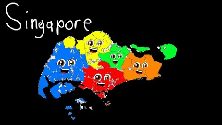
As of the Master Plan 2025 planning framework, Singapore has five planning regions: Central Region, East Region, North Region, North-East Region, and West Region. The URA Master Plan boundary data is the appropriate reference for the official planning-area framework and its current dataset context.
| Planning region | Broad location | Examples and planning role |
|---|---|---|
| Central Region | Central Singapore | Includes the central city and commercial core, including Downtown Core |
| East Region | Eastern Singapore | Includes Bedok, Tampines and Changi |
| North Region | Northern Singapore | Includes Woodlands and northern new-town and reserve landscapes |
| North-East Region | North-eastern Singapore | Includes Punggol and Sengkang |
| West Region | Western Singapore | Includes Jurong East and major industrial and employment areas |
The Central Region contains much of the main city centre, established commercial activity, and central urban districts. The East Region includes major residential and airport-facing areas. The North and North-East Regions include important new towns and growing residential areas, while the West Region includes major industrial, research, port-related, and employment landscapes. These descriptions are broad orientation only; each region contains varied land uses and communities.
A Singapore regions map is therefore useful for understanding relative location and planning context. It should not be read as a map of separate states or provinces. The boundaries organize land and development planning within one national jurisdiction.
Why the Regions Matter for Planning and Statistics
Planning regions group smaller planning areas so that housing, transport, employment, services, infrastructure, and land reserves can be considered at a broad scale. They support a more distributed urban structure rather than treating the central city as the only point of activity. Regional centres and employment areas can be planned alongside residential growth and transport connections.
Regions are also useful for high-level comparison and geographic orientation. They give readers a practical first step when locating a planning area such as Tampines, Woodlands, Punggol, or Jurong East. For detailed population or housing analysis, however, planning areas and subzones are usually more informative because they provide a finer geographic unit. SingStat publishes geographic data using planning areas and subzones through its geographical distribution data.
Do not confuse the URA regions with property-market terms such as Core Central Region, Rest of Central Region, and Outside Central Region. Those labels are used for a different market classification and are not the five-region planning hierarchy.
Singapore's 55 Planning Areas
Below the five regions are planning areas. They are the main named building blocks of Singapore's urban-planning geography and offer a more useful level of detail for an area directory, map search, or general location comparison.
Planning Areas Within the Five Regions
Under the Master Plan 2025 planning-area framework, Singapore has 55 planning areas. They sit below planning regions and are used to guide development, land use, infrastructure coordination, and geographic reporting. A planning area is not an autonomous municipality and does not have the political role of a city council or province.
The figure of 55 refers specifically to planning areas in that planning framework. It should not be added to the five regions, the five CDC districts, electoral divisions, or postal districts as though all were levels in one administrative count. For a directory or database, record the division type and the relevant dataset or Master Plan date alongside each name. This keeps a planning-area list distinct from a list of constituencies, postal districts, or informal neighborhoods.
Many planning-area names are familiar to residents and visitors. Tampines and Bedok are planning areas in the East Region. Woodlands is in the North Region. Punggol and Sengkang are in the North-East Region. Jurong East is in the West Region. Downtown Core is a planning area in the Central Region. Familiarity with these names can make a Singapore map easier to interpret, but each name remains part of a national planning framework.
The practical hierarchy is: Singapore, planning region, planning area, then subzone. This structure is especially useful where a stable parent-and-child area relationship is needed. It also avoids treating popular town names as if they were provinces.
A full list is best taken from the current official boundary layer rather than copied from an undated map or directory. Planning boundaries are part of a Master Plan framework and can be revised between plan versions.
How Planning Areas Connect to Area Listings
For a general Singapore area hierarchy, planning areas are usually the best second-level unit after the five planning regions. They are official, named, mappable, and nested within a broad regional structure. This makes them more consistent for a directory than an informal collection of neighborhood names.
Use the official English planning-area name as the main label. Common town, estate, or neighborhood names can be added as explanatory aliases where helpful. For example, Tampines can be presented clearly as a planning area within the East Region. That is more precise than describing Tampines as a Singapore state, province, or independent city.
This approach also keeps editorial labels separate from official geography. A property development may use a nearby well-known neighborhood name for convenience, while its exact location may fall in a different subzone or planning area. For data work, mapping, or comparison across sources, start with the official planning-area name and refresh names and boundaries when the relevant Master Plan framework changes.
Subzones and Neighborhood-Scale Boundaries
Subzones add detail beneath planning areas. They are useful when a planning region is too broad and a planning area still covers more territory than the question requires.
Subzones for Detailed Planning and Statistics
URA subzones are smaller planning units nested within planning areas and, in turn, within planning regions. They support detailed land-use work, neighborhood-scale mapping, infrastructure analysis, and small-area statistical reporting. A subzone can help distinguish parts of a large planning area that have different residential, commercial, industrial, or open-space characteristics.

The government data description for the Master Plan subzone dataset states that URA divides Singapore into regions, planning areas, and subzones to facilitate urban planning. The Singapore Government Data subzone boundary dataset identifies its Master Plan vintage, which matters when interpreting boundaries and counts.
Subzones are the appropriate choice for detailed geographic analysis, but they do not always match how residents describe their neighborhood. A resident may use a town name, a nearby MRT station, an estate name, or a local landmark, while an official subzone map uses a different boundary and label. Use the official unit where comparable geographic detail is needed, and use everyday names as supporting context.
Planning Areas, Towns, and Neighborhood Names
Planning areas should not be treated as identical to HDB towns, housing estates, informal neighborhoods, MRT-area references, or real-estate marketing labels. These terms often overlap and may share a name, but they serve different purposes. Sengkang, Punggol, Tampines, and Jurong East are good examples of familiar place names that can appear in several forms of local description.
A town may be a useful way to describe where someone lives. An MRT station may be the best meeting-point reference. A neighborhood label may describe local identity. None of these automatically defines the exact URA planning-area or subzone boundary. When accuracy matters for research, a location database, public data, or a map comparison, identify the planning area first and then use the more familiar label to explain it.
This distinction is also important for property information. Property-market descriptions may use broad central, city-fringe, or suburban labels that do not correspond to official planning regions. They can be useful commercial shorthand, but they should not replace the URA geography in an administrative or planning explanation.
Parallel Divisions for Community, Elections, Land, and Mail
Several parallel systems divide Singapore for specific public functions. They are important, but they should remain separate from the planning hierarchy rather than being forced into the same map or area tree.
Community Development Council Districts
Singapore has five Community Development Council districts: Central Singapore, North East, North West, South East, and South West. CDCs help connect communities, coordinate support, and strengthen social infrastructure through community programmes. Their boundaries are designed for this institutional role, not for urban land-use planning.
The CDC five districts information shows that districts group electoral constituencies. As a result, a CDC district can span areas that do not line up with a single URA region or planning area. The similar names can be misleading: North East CDC and the North-East Region are not interchangeable categories.
Use a CDC district when looking for community programmes, social support initiatives, or CDC-related services. Use a planning region or planning area when the question concerns land use, broad location, or a Singapore regions map. CDCs are functional community bodies, not autonomous municipal governments.
Electoral Divisions: SMCs and GRCs
Electoral divisions determine parliamentary representation. Singapore has two official types: Single Member Constituencies, known as SMCs, and Group Representation Constituencies, known as GRCs. An SMC elects one Member of Parliament, while a GRC elects a team of Members of Parliament. The Elections Department provides the official explanation of these two division types.
Constituency boundaries serve electoral representation, not planning administration. They can be reviewed and changed, so they are not a suitable stable hierarchy for general area listings. A person may live in a planning area within one URA region, be covered by a CDC district, and vote in an SMC or GRC with a different shape and name.
For voting, registration, or representation questions, use current Elections Department information and the relevant electoral map. For questions such as which broad part of Singapore an address belongs to, use the planning geography instead.
Survey Districts and Postal Districts
Survey districts are specialized land-reference divisions. Historical terms such as mukim and town subdivisions can appear in cadastral, land, legal, or historical material. They are not a replacement for the modern URA planning-region hierarchy and should not be presented as Singapore provinces.
Postal districts and six-digit postal codes serve address and mail administration. Numbered postal districts remain common in property and location language, but their boundaries do not necessarily match planning areas, subzones, CDC districts, or constituencies. A postal code is usually the most useful tool for finding a specific address, while a planning area is more useful for broad geographic classification.
When encountering a numbered district in a property listing or an older map, first identify whether it is postal, survey-related, commercial, or planning terminology. That simple distinction prevents a common error: assuming that every district number marks a current administrative division.
How to Find Singapore Administrative Divisions on a Map
A map can answer location questions quickly, but only when its boundary layer is identified correctly. Singapore has multiple valid map layers, and a line on one map may represent a planning area while a line on another represents an electoral or community district.
OneMap and Official Boundary Data
OneMap is Singapore's authoritative national map for searching addresses and viewing geospatial information. It is a practical starting point for finding an address, street, building, or local landmark. Official government boundary datasets can then provide the appropriate planning-area, subzone, or other overlay.
A useful sequence is to search the address first, identify the relevant planning area, and then view its planning region if a broader location is needed. If the question concerns community services or elections, consult the separate CDC or electoral layer rather than assuming the planning boundary answers it.
When comparing two maps, matching place names is not enough: check whether both maps use the same geography level and boundary date. A map labelled “Singapore regions” may show URA planning regions, while another may show a property-market classification or a simplified directional grouping. Selecting the layer before interpreting the line is especially important for addresses near a boundary.
Third-party Singapore regions maps can be helpful for orientation, but they may use old boundaries, property-market categories, or informal labels. For a current planning map, use an official URA or Singapore Government Data layer and read its title carefully before drawing conclusions from it.
How to Verify a Boundary and Its Purpose
Before relying on a Singapore boundary, use a short checklist: identify the responsible agency, read the dataset title, note its publication or update date, confirm the boundary layer, and check the stated purpose. These steps show whether the map depicts a URA planning region, planning area, subzone, CDC district, electoral division, survey reference, or postal geography.
Overlapping boundaries are normal. They do not need to coincide because they answer different public, administrative, planning, and address questions. Electoral boundaries are particularly subject to review, while planning and subzone layers may be tied to a specific Master Plan vintage. When sharing a map or making a current claim, use the latest available official layer and state its date where that detail affects the interpretation.
This method is useful for students, researchers, businesses, publishers, and anyone building a location directory. It reduces the risk of using a former division, an informal label, or a map whose boundary purpose is different from the question being answered.
A Practical Hierarchy for Singapore Area Listings
A clear hierarchy helps readers navigate Singapore without implying that planning geography is a constitutional system of states or local governments. It also makes room for other valid geographic overlays without mixing them together.
A Clear Structure for Readers and Data Users
For a broad geographic article, directory, or map index, use this structure: Singapore → planning region → planning area → subzone. Add subzones only when neighborhood-scale detail is useful. This is a practical planning and geographic structure, not a hierarchy of autonomous governments.
| Level | Example | Best use |
|---|---|---|
| Country | Singapore | National context |
| Planning region | East Region | Broad orientation |
| Planning area | Tampines | General area listings and planning context |
| Subzone | Official local subzone | Detailed mapping and statistics |
Use official region and planning-area names as primary labels. Familiar town and neighborhood names can clarify how people speak about a place, but should not replace the official label where consistency matters. Keep CDC districts, electoral constituencies, survey districts, and postal references as separate overlays because their boundaries follow different purposes.
Which Division to Use for Common Questions
| Question or task | Use this division | Best authority or tool |
|---|---|---|
| Does Singapore have states or provinces? | None; use planning regions for broad reference | URA planning framework |
| Find a broad Singapore region | Planning region | URA boundary data |
| Create a general area list | Planning area | URA planning framework |
| Compare small local areas | Subzone | URA and SingStat data |
| Find community programmes | CDC district | Community Development Council |
| Find an electoral constituency | SMC or GRC | Elections Department |
| Locate a precise address | Postal code and address | OneMap |
For searches such as Singapore states or Singapore provinces, the direct answer is that Singapore has neither. The five planning regions are the most useful broad alternative. For Singapore administrative divisions or a Singapore regions map, begin with URA regions and planning areas. The correct boundary always depends on the task, so no single map layer answers every location question.
Conclusion: Singapore's Administrative Geography in Brief
Singapore does not divide into states or provinces. Its most useful broad geographic framework is the five-region URA planning system: Central, East, North, North-East, and West. Below these are 55 planning areas and smaller subzones, which provide a clear structure for maps, area listings, planning, and statistics.
Community Development Council districts, electoral constituencies, survey references, and postal districts are also important, but each serves a separate purpose. Start with the planning hierarchy for general geography, then use the relevant specialist system for community services, elections, land matters, or an exact address.
Select area
Create a post
Posting is free and no registration is required.