Taguig Getting There: Airport, Rail and Bus Routes

Taguig getting there is not one single route because Taguig has several major districts with different access points. A trip to Bonifacio Global City can be very different from a trip to McKinley Hill, McKinley West, Arca South, FTI, or a residential barangay. This guide explains how to reach Taguig from NAIA, Clark Airport, PITX, Makati, EDSA, Manila, Quezon City, and southern Metro Manila using taxis, ride-hailing, rail, buses, jeepneys, and last-mile options. Routes, stops, and operating hours can change, so use this as a practical planning guide and confirm details close to your travel time.
Before You Choose a Route to Taguig
The best route to Taguig depends on your exact destination, arrival point, luggage, time of day, and comfort with transfers. Decide your district first, then choose the gateway and last-mile mode that fit the trip.
Identify Your Exact Taguig Destination First
Taguig is a large city, not a single arrival point. Many visitors say they are going to Taguig when they actually mean Bonifacio Global City, usually called BGC. Others need McKinley Hill, McKinley West, Arca South, FTI, or older residential areas that are not reached in the same way.
For BGC, useful reference points include Market! Market!, High Street, Uptown, and the BGC Bus stops. For trips near McKinley Hill or McKinley West, Lawton Avenue, McKinley Road, and the Venice Grand Canal area may matter more than central BGC. For southern Taguig, FTI, Arca South, C-5, and nearby SLEX or Skyway approaches may be more useful than Ayala or BGC.
Before choosing transport, save the exact building name, hotel name, gate, entrance, or nearby landmark. Large developments often have several entrances. A driver may know BGC but not the correct tower entrance, and a public transport stop may be near the district but not near your building.
Match Your Arrival Gateway to Your Budget and Comfort Level
Ninoy Aquino International Airport is the usual air gateway for Taguig because it is inside Metro Manila and relatively close by road. Clark International Airport is much farther north and usually requires a long intercity road leg before the final Metro Manila transfer. PITX and older bus terminals matter for travelers arriving by provinces or from other parts of Metro Manila.
Think of each route as a combination of components: direct car, rail, BGC Bus, city bus, jeepney, P2P bus, tricycle, walking, or short ride-hailing trip. The cheapest route is often transfer-heavy. The easiest route is usually a direct taxi, app-based ride, or pre-arranged transfer, especially if you are new to Metro Manila.
| Gateway | Best for | Common route idea | Main caution |
|---|---|---|---|
| NAIA | Most air arrivals | Taxi or ride-hailing direct to the Taguig address | Traffic, pickup rules, and terminal procedures |
| Clark Airport | Flights using Clark | P2P or road transfer to Metro Manila, then final ride to Taguig | Longer distance and schedule dependence |
| PITX | Southern Luzon and provincial bus arrivals | Terminal bus or rail connections, or direct ride-hailing | Route bays and onward services can change |
| MRT-3 Ayala | BGC-bound public transport users | Transfer at McKinley Exchange to BGC Bus | Queues, crowding, and route changes |
| FTI or Arca South area | Southern Taguig destinations | Bus, jeepney, tricycle, or short car trip from nearby road corridors | Verify the closest current stop before travel |
From NAIA to Taguig
NAIA is the most practical airport for Taguig. Road travel is usually the simplest option, but traffic can make the short map distance feel much longer, especially during peak periods, heavy rain, or major events.
Fastest Option: Taxi or Ride-Hailing From the Airport
For first-time visitors, families, business travelers, late-night arrivals, or anyone with luggage, the simplest route from NAIA to Taguig is usually an airport taxi, app-based ride-hailing service, or pre-arranged transfer. This is especially practical if your destination is a specific hotel, condominium, office tower, school, or hospital in BGC, McKinley Hill, McKinley West, Arca South, or FTI.
Use official airport pickup points, authorized taxi queues, or the pickup instructions shown in your transport app. The Manila International Airport Authority is the main official airport authority for NAIA, and travelers can check airport context and advisories through MIAA. For app-based airport rides, Grab provides airport pickup guidance that can help passengers follow terminal signs and meet drivers at the correct point.
Avoid accepting unsolicited offers from people approaching you inside or outside the terminal. If you use a taxi, confirm that it is from an authorized queue. If you use an app, match the vehicle plate, driver name, and pickup point before entering the car.
Budget Option: Public Transport With Airport-Area Transfers
Public transport from NAIA to Taguig can be possible, but it is not always simple for visitors. It may involve walking or taking a short connection to an airport-area road, then transferring toward routes that pass near Lawton Avenue, McKinley Road, C-5, FTI, or another useful Taguig approach.
This option is better for daytime travelers with light luggage, local payment readiness, and comfort asking staff or transport marshals for the current boarding point. Airport roads, terminal pickup rules, and bus or jeepney stopping patterns may change, so do not rely only on an old route description.
Before leaving the terminal, ask airport information staff, guards, or transport marshals where the current public transport boarding point is for your destination area. Use the exact district name, such as BGC, McKinley Hill, Arca South, or FTI, not only Taguig.
Hybrid Option: Airport to Ayala Then BGC Bus
A useful hybrid route for BGC-bound travelers is to take a direct ride from the airport to the Ayala or McKinley Exchange area, then use BGC Bus for the final leg into BGC when it is operating. This can reduce route confusion inside BGC and may be practical for offices, hotels, and malls near established BGC Bus stops.
This route is less ideal if your destination is McKinley Hill, McKinley West, FTI, Arca South, or a residential area far from BGC Bus stops. In those cases, a direct car from NAIA or a different road approach may be easier.
At McKinley Exchange, check the current BGC Bus route boards, terminal signs, and staff instructions before boarding. Late at night, during heavy rain, or after a long flight, a direct taxi or ride-hailing trip from the airport to your exact address is usually simpler.
From Clark and Provincial Bus Gateways to Taguig
Travelers who land at Clark or arrive by long-distance bus need to treat Taguig as the final leg of a larger trip. The key is to reach a structured Metro Manila transfer point first, then choose the best last segment.
Clark Airport via NAIA Terminal 3 and the Final Leg to Taguig
Clark International Airport is much farther from Taguig than NAIA. If your flight arrives at Clark, expect an intercity road transfer before you reach Metro Manila. There is no simple direct urban rail route from Clark Airport to Taguig that visitors can rely on as a normal city transfer.
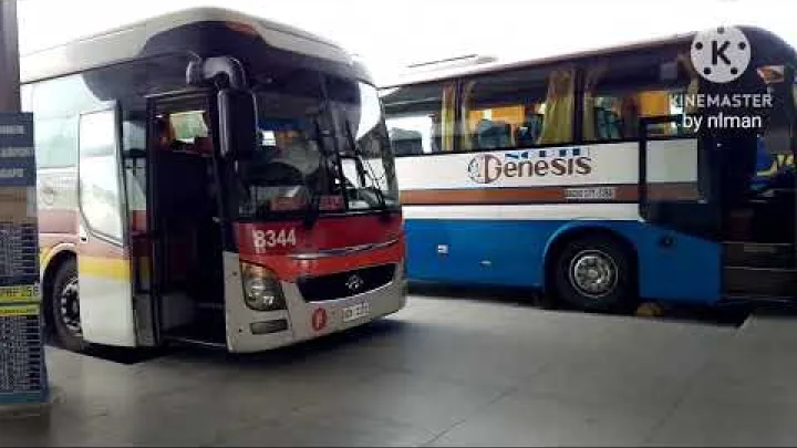
One structured public option is the Clark Airport to NAIA Terminal 3 P2P bus when schedules fit your arrival. P2P Bus PH publishes the NAIA Terminal 3 and Clark Airport schedule information, but passengers should check the current timetable close to travel time because bus operations can change.
After reaching NAIA Terminal 3, continue to Taguig by taxi, ride-hailing, or a public transport chain depending on luggage, time, and budget. If you are catching a flight, add a generous buffer because traffic, terminal procedures, and intercity travel can be unpredictable.
PITX and Southern Luzon Bus Arrivals
Paranaque Integrated Terminal Exchange, usually called PITX, is a major structured arrival point for buses from southern and southwestern routes into Metro Manila. It can be useful for travelers coming from Cavite, Batangas, parts of Laguna, and other provincial routes.

From PITX, onward choices may include terminal-based city buses, rail and bus transfers toward Ayala and BGC, or direct ride-hailing to your Taguig address. The best choice depends on your destination. BGC-bound travelers may prefer a connection toward Ayala and McKinley Exchange. Travelers going to FTI, Arca South, or southern Taguig should ask whether a closer bus or road connection is available rather than automatically going through Ayala.
Do not assume a platform or bay from an old guide is still correct. Check terminal boards and ask staff for the current route to BGC, FTI, Arca South, or the nearest major road to your destination.
Cubao, Pasay, and Older Metro Manila Bus Terminals
Older bus terminals in Cubao, Pasay, and other parts of Metro Manila can still be useful if they are close to EDSA, an MRT-3 station, or a direct road route into Taguig. The exact terminal location matters because some terminals are easier to connect from than others.
From Cubao or northern EDSA, a common structured route to BGC is MRT-3 southbound to Ayala, then BGC Bus from the McKinley Exchange area. This is usually easier with light luggage and during operating hours.
From Pasay, direct road transport may be simpler, especially if the terminal is not convenient for rail. Use a simple decision rule: use rail if you are close to an MRT station and traveling light; use a direct car if it is late, you are tired, or you are carrying large bags.
From Metro Manila to Taguig by Rail, Bus, and Jeepney
Inside Metro Manila, the most structured public approach to BGC is usually through MRT-3 Ayala and BGC Bus. Other Taguig districts may require road-based routes, jeepneys, tricycles, or short ride-hailing trips.
Makati and MRT-3 Ayala Station to BGC
Makati, especially MRT-3 Ayala Station and the McKinley Exchange Corporate Center area, is the most important public transport gateway into BGC. Many travelers use Ayala as the transfer point because it connects EDSA rail access with BGC Bus services.

BGC Bus is usually the clearest final-leg option for central BGC because the buses are branded and use designated stops. However, routes, queues, and operating hours can affect the experience. Recent local commuter updates, including discussions in Commuters PH, show why it is important to check current route boards and terminal instructions instead of relying only on an old map.
BGC Bus is most useful for BGC access. It does not automatically solve trips to every part of Taguig. If your destination is McKinley Hill, McKinley West, Arca South, FTI, or a smaller residential street, confirm whether the bus stop is close enough or plan another final segment.
Quezon City, Ortigas, and the EDSA Corridor
From Quezon City or the northern EDSA corridor, MRT-3 southbound to Ayala is often the most understandable public transport route for BGC-bound passengers. After Ayala, transfer to BGC Bus at the McKinley Exchange area and choose the route that serves your stop.
From Ortigas and Pasig-side origins, C-5 road options may be useful, especially for destinations on the eastern or southern side of Taguig. These routes depend more on traffic and current bus or jeepney patterns, so they may be less predictable for visitors than the rail-plus-BGC Bus route.
Peak hours can bring crowded MRT trains and long BGC Bus queues. Ride-hailing can be simpler because it removes transfers, but it can also become expensive or slow during congestion, rain, or surge periods.
Manila, Pasay, and the LRT-1 Connection
From Manila or parts of Pasay, a structured public route to BGC can use LRT-1 to the EDSA or Taft area, then MRT-3 to Ayala, then BGC Bus into BGC. This has several transfers, but some visitors find it easier to understand than unmarked road routes.
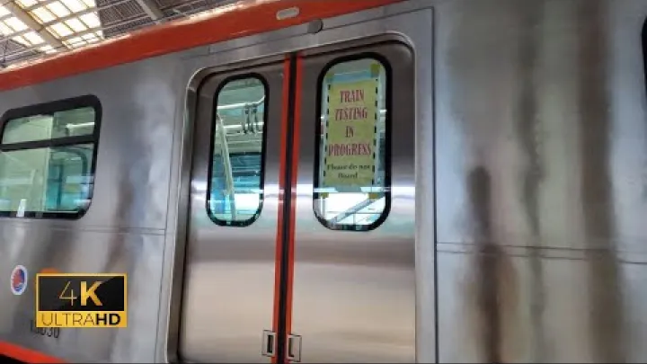
This route is best for daytime travel with light luggage. Rail stations can involve stairs, crowds, walking between lines, and limited space for large bags. If you are traveling from a hotel, port, hospital, or bus terminal with luggage, a direct taxi or ride-hailing trip may be more practical.
If your destination is not in BGC, check whether going through Ayala makes sense. For FTI, Arca South, or southern Taguig, a southern road connection may be more direct.
Southern Metro Manila, FTI, and C-5 Approaches
Travelers from Alabang, Muntinlupa, Laguna, Cavite, and nearby southern areas may approach Taguig through SLEX, Skyway, C-5, FTI, PITX-linked services, or other road routes. Do not assume that all Taguig trips must pass through Ayala.
FTI and Arca South are important anchors for southern Taguig. If your destination is near these areas, ask whether your bus, van, or jeepney can drop you near FTI, Arca South, C-5, or another closer landmark. This may be more efficient than traveling north to Makati and then returning south or east.
Southern routes are evolving, and terminal openings or route changes can affect practical access. For example, public information from Arca South describes transport terminal development, but travelers should confirm what is actually operational before relying on it for a same-day trip.
Last-Mile Travel Inside Taguig
The final kilometer is often the part that decides whether your route feels easy or stressful. Taguig has organized business districts, busy road corridors, and local neighborhoods, so match the last-mile mode to the district.
BGC: BGC Bus, Walking, and Short Ride-Hailing Trips
BGC is generally more organized than many Metro Manila districts, with wide streets, major office clusters, malls, and named avenues that help navigation. Market! Market!, Bonifacio High Street, Uptown, and BGC Bus stops are useful reference points.
Walking can work for short distances in suitable weather and during comfortable hours, but do not assume every BGC trip is easy on foot. Heat, rain, road crossings, luggage, and the exact building entrance can change the experience.
For large malls, offices, hotels, or condominiums, check the exact entrance or drop-off point. A short ride-hailing trip can be useful at night, during rain, or when carrying bags even if the distance looks short on a map.
McKinley Hill and McKinley West: Plan the Final Road Segment
McKinley Hill and McKinley West are near BGC but are not the same as central BGC. A route that works well for High Street or Market! Market! may not drop you conveniently at your McKinley destination.
Lawton Avenue, McKinley Road, and nearby access roads can matter for this final segment. If you are going to Venice Grand Canal, an office campus, a school, an embassy-related building, or a condominium, use the building name and gate or entrance, not only the district name.
When the route is unclear, use a taxi, ride-hailing trip, or a verified local public transport option for the final leg. The City Government of Taguig provides local transport context, including information related to coordinated tricycle movement in selected areas, through the City Government of Taguig.
Arca South, FTI, and Residential Taguig Areas
Arca South and FTI are useful anchors for southern Taguig and may be more relevant than BGC for many travelers. These areas can connect better with southern road corridors, local jeepneys, tricycles, or short car trips depending on the exact address.
Residential Taguig areas often require more local knowledge. Jeepneys may serve major roads, while tricycles may handle shorter neighborhood access where allowed. Coverage boundaries and rules can be local, so confirm the nearest major road, tricycle terminal, or landmark before starting the last mile.
If you are visiting a house, school, clinic, small office, or warehouse, ask your contact for the nearest landmark and the recommended drop-off point. This is more useful than relying on the city name alone.
Choosing the Best Transport Mode
No single transport mode is best for every Taguig trip. Compare speed, cost, comfort, transfer difficulty, and the need to verify current routes.
Compare Speed, Cost, Comfort, and Difficulty
Use the table below as a practical comparison. Cost and difficulty are qualitative because current fares and operating rules can vary by route, operator, time, and payment method.
| Mode | Best for | Main advantage | Main drawback | Verify |
|---|---|---|---|---|
| Taxi or ride-hailing | Airport arrivals, luggage, late nights | Door-to-door and simple | Traffic and variable cost | Pickup point and vehicle details |
| BGC Bus | BGC offices, malls, hotels | Clear BGC stops | Queues and route changes | Route board and operating hours |
| MRT plus BGC Bus | Daytime EDSA corridor trips | Structured public route | Transfers and crowding | Station access and bus route |
| City bus | Budget trips on known corridors | Lower cost | Stops may be confusing | Current route and boarding point |
| Jeepney | Local road segments | Low cost and local reach | Route signs require familiarity | Destination sign and fare method |
| P2P bus | Clark, terminal, or fixed-route trips | More structured than many road routes | Schedule dependence | Same-day timetable |
| Tricycle | Neighborhood last mile | Useful for smaller streets | Local coverage limits | Allowed area and fare practice |
If you are new to Metro Manila, the cheapest route may not be the best first route. A slightly more expensive direct ride can save time, confusion, and walking with luggage.
Choose Differently for Late Nights, Rain, Luggage, and Peak Hours
Late-night arrivals, heavy luggage, rain, mobility limitations, and first-time travel all favor direct taxi, ride-hailing, or pre-arranged transfer. These modes reduce walking between stops and remove the need to interpret route signs after a long trip.
Daytime travelers with light bags can consider rail, BGC Bus, city buses, or jeepneys. This works best when you can tolerate crowds, stairs, queues, and transfers. If you have accessibility needs, check whether your chosen stations and vehicles are manageable for you.
For flights, meetings, embassy appointments, exams, or medical visits, leave earlier than you think you need to during peak periods. Metro Manila traffic can change quickly because of rain, road works, crashes, events, and school or office schedules.
Safety, Route Verification, and Future Changes
Taguig transport is manageable when you use official pickup points, confirm your destination, and check route information close to your trip. The main problems are usually confusion, wrong drop-offs, fare misunderstandings, and unexpected route changes.
Avoid Fare, Pickup, and Wrong-Destination Problems
At airports and terminals, use official queues, app pickup points, terminal counters, or clearly marked transport areas. Be cautious with unsolicited offers, especially if the person approaches you before you have chosen a mode of transport.
Before boarding, confirm the exact destination: building name, tower, gate, entrance, street, and nearby landmark. This matters in BGC, McKinley Hill, McKinley West, Arca South, and FTI because a general district name may still leave you far from the correct door.
In crowded stations, buses, and jeepneys, keep valuables secure and avoid displaying important documents or large amounts of cash. This is normal big-city transport caution rather than a reason to avoid public transport completely.
Verify Schedules, Stops, and Construction Updates Before Traveling
Before traveling, verify same-day information through airport pages, terminal boards, operator notices, transport apps, station staff, guards, or local contacts. BGC Bus routes, city bus routes, jeepney patterns, airport terminal procedures, and terminal drop-off sequences can change.
Future transport improvements may change Taguig access, including Metro Manila Subway stations and transport developments around Arca South. Do not rely on a planned station, terminal, or route unless it is officially operational and available for your travel date.
A simple pre-departure checklist helps: exact address, nearest landmark, backup mode, local payment method or small cash, phone battery, and confirmed pickup or boarding point. If one part of the route fails, switch to the backup rather than trying to force an outdated route.
Final Route Recommendations
Use these recommendations as practical defaults. Adjust them if your destination is outside BGC, if you have luggage, or if you are traveling late at night.
Best Simple Route for First-Time Visitors
The best simple route for most first-time visitors is a direct taxi, ride-hailing trip, or pre-arranged transfer from NAIA to the exact Taguig address. This is not always the cheapest and may not always be fastest in heavy traffic, but it reduces route confusion and handles luggage better.
If you are going to BGC during normal operating hours and want a hybrid option, consider taking a direct ride from the airport to Ayala or McKinley Exchange, then using BGC Bus to reach a known BGC stop. This works best when your building is close to a BGC Bus route and you have checked the current route board.
Best Low-Cost Route for Daytime Travelers
For daytime travelers with light luggage, structured rail and bus chains can be the best low-cost route. For BGC, a common route is MRT-3 to Ayala, then BGC Bus from the McKinley Exchange area to the appropriate BGC stop.
Public buses and jeepneys can reduce cost further, but they are better for travelers comfortable with local route signs, transfers, and possible crowding. Keep luggage light, check the route before leaving the terminal or station, and carry a locally accepted fare payment method or small cash if needed.
Best Route for Business Travelers and Daily Commuters
Business travelers and daily commuters should plan around predictable transfer points such as MRT-3 Ayala Station, McKinley Exchange, BGC Bus stops, Market! Market!, and major office clusters. If your regular destination is outside BGC, identify the closest practical anchor, such as Lawton Avenue, McKinley Road, C-5, FTI, or Arca South.
Test both rail-plus-bus and direct car routes if you will commute regularly. Traffic and queues can vary by time, direction, weather, and day of the week. The most reliable Taguig route is the one that matches your exact destination, time of day, luggage, budget, and tolerance for transfers.
Frequently Asked Questions
What is the easiest way to get from NAIA to Taguig?
The easiest way is usually a taxi, ride-hailing trip, or pre-arranged transfer from the airport to your exact Taguig address. This is best for first-time visitors, luggage, families, and late-night arrivals.
Is there a train directly to Taguig?
There is no single direct train that takes most visitors straight to a Taguig destination. For BGC, many public transport users take MRT-3 to Ayala and transfer to BGC Bus, then walk or take a short ride if needed.
How do I get from Clark Airport to Taguig?
From Clark Airport, take an intercity road connection such as a P2P bus to a Metro Manila gateway when schedules fit, then continue to Taguig by taxi, ride-hailing, or public transport. Build in extra time because Clark is much farther from Taguig than NAIA.
Is BGC Bus useful for all parts of Taguig?
No. BGC Bus is most useful for Bonifacio Global City. It may not be convenient for McKinley Hill, McKinley West, Arca South, FTI, or residential Taguig areas unless your exact destination is near a stop.
Can I use public transport from the airport to Taguig with luggage?
You can, but it is usually better for daytime travelers with light luggage and comfort using local transfers. With heavy bags, a direct taxi or ride-hailing trip is normally easier and less stressful.
What should I do if I arrive in Taguig late at night?
Use a direct taxi, ride-hailing service, or pre-arranged transfer to your exact address. Confirm the vehicle and destination before boarding, and avoid depending on buses or jeepneys unless you have verified that they are operating at that hour.
Select area
Create a post
Posting is free and no registration is required.