Antipolo Getting There: Manila, Airports and Road Routes
Antipolo getting there is usually a two-part journey: first reach Metro Manila or an eastern gateway, then complete the final road leg into Antipolo, Rizal. The best route depends on where you start, where you need to arrive in Antipolo, how much luggage you have, and how comfortable you are with transfers. This guide explains practical options from airports, ports, bus terminals, rail connections, and nearby provinces without relying on fixed fares or schedules that may change. Use it to compare route families, choose a sensible drop-off point, and know what to verify before you travel.
Quick Overview For Reaching Antipolo
Antipolo is close to Metro Manila, but getting there can feel different depending on whether you are coming from NAIA, Cubao, Ortigas Center, Marikina, Cainta, Taytay, or another province. Most travelers choose between a direct road ride, a rail-and-road combination, or lower-cost public transport with transfers.
What Travelers Usually Need To Decide First
There is no single best route to Antipolo for every traveler. Your choice should start with five questions: where are you starting, where exactly are you going in Antipolo, how much luggage do you have, what time will you travel, and how much uncertainty can you accept.
Antipolo is not one compact arrival point. Antipolo Cathedral, Robinsons Place Antipolo, the Sumulong Highway side, resort areas, hillside neighborhoods, and the Masinag area may require different final stops. A vehicle that is convenient for one part of the city may leave you needing another short ride for another part.
Traffic is the main variable. Crossing Metro Manila, moving through Pasig or Marikina, and climbing toward Antipolo can take longer during busy periods, rain, weekends, holidays, or major local events. Check current routes, terminal arrangements, and operating hours close to your travel date, especially if you plan to use rail, buses, UV Express vans, or airport transport.
Best Route By Traveler Type
If you want a more predictable way to cross part of Metro Manila during rail operating hours, consider using LRT-2 toward the Masinag area, then transferring by jeepney, UV Express, taxi, ride-hailing car, or another local road option. This can reduce your exposure to road congestion for the rail portion, although the final leg into Antipolo still depends on traffic.
If you arrive with luggage, children, elderly companions, or a late flight, a taxi, ride-hailing car, hotel-arranged vehicle, or pre-arranged transfer is often simpler. It may cost more than public transport, but it reduces the number of transfers and avoids confusion at unfamiliar terminals.
Jeepneys, UV Express vans, and buses can be practical for budget travelers, repeat visitors, and people comfortable asking about destinations before boarding. They may involve queues, waiting for vehicles to fill, changing vehicles, and walking between terminals or roadside stops.
| Traveler type | Practical choice | Main trade-off |
|---|---|---|
| First-time visitor with luggage | Taxi, ride-hailing, or arranged transfer | More convenient, usually higher cost |
| Budget traveler in daytime | LRT-2 plus road transfer, jeepney, UV Express, or bus | Lower cost, more local navigation |
| Traveler from Cubao or Marikina | Marcos Highway or Masinag-side route | Confirm exact destination before boarding |
| Traveler from Ortigas or Pasig | Ortigas Avenue Extension route | Can be affected by corridor congestion |
| Late-night arrival | Direct ride or overnight stop before continuing | Public options may be limited |
Where Antipolo Fits In The Transport Network
Antipolo is an elevated city east of Metro Manila in Rizal. It is commonly reached by road corridors from Pasig, Marikina, Cainta, Taytay, and other eastern areas. Important route anchors include Ortigas Avenue Extension, Marcos Highway, Sumulong Highway, C-5 connections, and the LRT-2 Masinag area.
The city does not operate like a destination with its own major commercial airport, seaport, or single long-distance rail terminal. Most long-distance travelers first arrive through a larger gateway such as Ninoy Aquino International Airport, Clark International Airport, the Port of Manila, or a Metro Manila bus terminal. From there, they connect east by road or by a rail-and-road route.
This geography matters because your final destination in Antipolo should influence your transfer point. A traveler going near Antipolo Cathedral may choose a different last-mile plan from someone going to a resort, a private subdivision, or the lower Masinag side.
Main Gateways Before The Last Leg To Antipolo
For most visitors from outside Metro Manila, the important question is not only how to reach the Philippines or Luzon. It is also how to position yourself for the final movement east to Antipolo.
Arriving Through NAIA
Ninoy Aquino International Airport is the usual air gateway for travelers flying into Metro Manila. From NAIA, you generally need to cross or skirt parts of Metro Manila before heading east toward Pasig, Marikina, Cainta, or Antipolo. The route can be straightforward by private vehicle, but public transport usually requires planning and transfers.

The simplest option is a direct taxi, ride-hailing car, hotel transfer, or pre-arranged vehicle to your Antipolo address. This is often the most practical choice after a long flight, with large bags, or when arriving at night. It also lets you choose your final drop-off instead of stopping at a main road or terminal.
A multi-leg public transport route may be cheaper, but it is more complex. You may need to leave the airport area, connect to rail or a major transport node, and then transfer again toward Antipolo. Before choosing this route, check current airport transport arrangements, rail operating hours, app availability, and whether your final destination is easy to reach from the drop-off point.
Arriving Through Clark International Airport
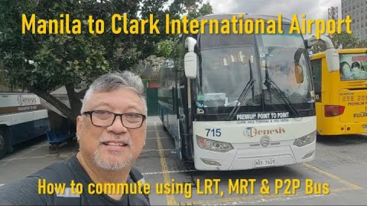
Clark International Airport can be useful if your flight schedule or fare is better, but it is usually a more complex gateway for Antipolo than NAIA. Travelers commonly need a bus or private transfer from Clark toward Metro Manila or another suitable transfer point before continuing east to Antipolo.
If you use Clark, choose your Manila drop-off carefully when possible. A drop-off with easier onward access to Cubao, LRT-2, Ortigas, or eastern Metro Manila can reduce the number of cross-city transfers. A western or southern terminal may still work, but it may add time and complexity.
Do not assume Clark is automatically faster or easier. It can make sense for certain itineraries, but the total journey includes the airport-to-Manila leg, the transfer between terminals or districts, and the final Antipolo leg. Check current Clark bus services, terminal stops, and schedules near your travel date.
Arriving By Ferry Or Long-Distance Bus
Ferry passengers arriving at the Port of Manila need to connect into Metro Manila transport before continuing to Antipolo. This may involve a taxi, ride-hailing car, city transport, or a transfer toward rail and eastern road routes. If your ferry arrives late, consider whether continuing to Antipolo the same day is comfortable and practical.
Long-distance bus travelers from northern or southern Luzon should pay attention to the terminal used by the bus company. A terminal near Cubao or eastern Metro Manila can be more convenient for Antipolo than a terminal that leaves you far to the west or south of the city.
The practical principle is simple: choose an arrival terminal that reduces cross-city transfers. Before booking a long-distance bus, ask where it arrives in Metro Manila and whether that point gives reasonable onward access to Cubao, LRT-2, Ortigas Avenue Extension, Marcos Highway, or other eastern connections.
Best Public Transport Routes From Metro Manila
Public transport to Antipolo is best understood as several route families rather than one fixed instruction. Vehicle types, terminals, signs, and boarding points can change, so confirm the destination before you board.
LRT-2 To The Masinag Area Then Road Transfer
LRT-2 is a useful east-west rail backbone for travelers starting near Recto, Cubao, Katipunan, or other areas connected to the line. For many visitors, traveling by rail toward the Masinag area is a practical way to get closer to Antipolo before switching to road transport.

From the Masinag area, the next step depends on your final destination. You may continue by jeepney, UV Express van, taxi, ride-hailing car, or another local ride. This transfer can be convenient for destinations on the lower side of Antipolo or for travelers who want to avoid crossing Metro Manila entirely by road.
Rail does not remove all uncertainty. You still need to check current LRT operating hours, station access, elevator or escalator availability if mobility matters, and the best last-mile option from the station area. Large luggage can make transfers less comfortable, so direct road transport may still be better for some travelers.
Cubao And Marikina Approach Via Marcos Highway
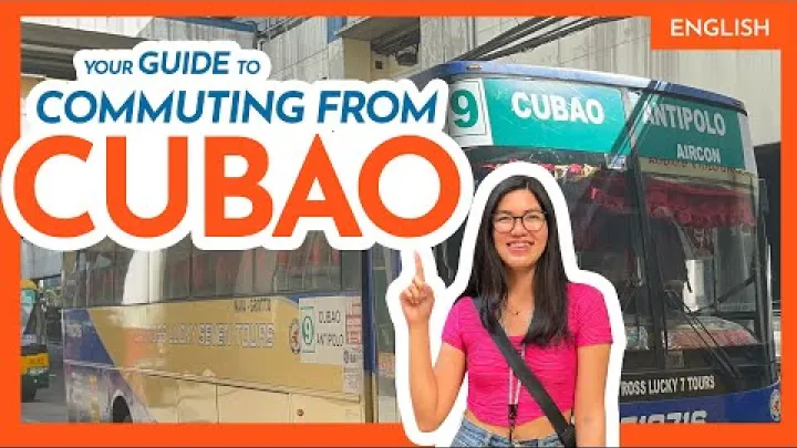
The Cubao and Marikina approach is useful for travelers coming from Quezon City, Cubao, Marikina, or northern Metro Manila. This route family often follows the eastern movement toward Marcos Highway, the Masinag area, and onward points toward Antipolo or nearby Rizal communities.
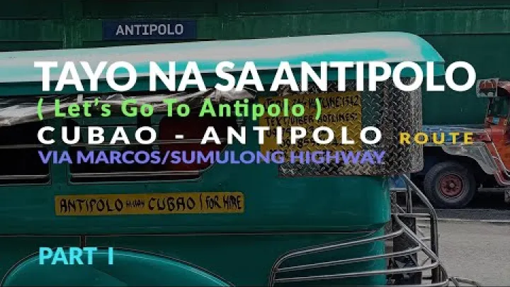
If you are using public transport, look for the actual destination rather than assuming every eastbound vehicle goes to the same place. Some vehicles may go toward Antipolo, some toward Masinag, some toward Cainta or Taytay, and some may only bring you to a transfer point. Ask clearly whether the vehicle passes near Antipolo Cathedral, Robinsons Place Antipolo, Sumulong Highway, your resort, or your specific barangay.
This approach can be practical when your starting point is already in the north or east of Metro Manila. It may be less convenient if you are coming from NAIA, Makati, or the far south unless your route first brings you efficiently to Cubao or the LRT-2 corridor.
Ortigas And Pasig Approach Via Ortigas Avenue Extension
The Ortigas and Pasig approach is useful for travelers starting near Ortigas Center, Shaw Boulevard, Pasig, Mandaluyong, or nearby business districts. The main corridor to understand is Ortigas Avenue Extension, which links parts of eastern Metro Manila with Cainta, Taytay, and routes toward Antipolo.
Depending on current availability, travelers may find jeepneys, UV Express vans, buses, taxis, or ride-hailing cars along this route family. It is especially relevant if your starting point is already near Ortigas or Pasig because you may avoid detouring north to Cubao.
Congestion can be heavy along commercial and suburban sections. If you are comparing this route with the LRT-2 approach, choose based on your starting point, luggage, time of day, and final destination. For a first-time visitor, a direct app-based ride from Ortigas or Pasig may be simpler than finding the right public vehicle during a busy period.
When To Choose Jeepney, UV Express, Bus, Taxi, Or Ride-Hailing
Jeepneys are often the most budget-oriented option and may be frequent on common corridors, but they can be slower, crowded, and less convenient with large bags. They work best for travelers who can confirm the destination, recognize landmarks, and handle roadside boarding or transfers.
UV Express vans can be more direct on some routes, but they depend on terminals, queues, passenger loading, and current route availability. They may suit commuters and travelers who know their target drop-off, but first-time visitors should ask whether the van passes their exact Antipolo area.
Buses may be useful on some corridors, but route coverage and stops can vary. Taxis and ride-hailing cars are usually the easiest for door-to-door movement, especially in rain, heat, late evening, or group travel. The trade-off is cost and sensitivity to traffic, demand, and driver acceptance.
Driving To Antipolo By Car Or Motorcycle
Driving gives the most control over the final destination, but it does not remove traffic, parking, weather, or local navigation issues. Plan your corridor, not only your map pin.
Common Road Corridors
Common route families to Antipolo include Ortigas Avenue Extension, Marcos Highway, Sumulong Highway, and C-5 connections. The best corridor depends on your starting point. A driver from Pasig or Ortigas may naturally use a different approach from a driver starting in Quezon City, Marikina, Taguig, Makati, northern Luzon, or southern Luzon.
Navigation apps are helpful for comparing travel conditions, but they should be used with judgment. A route that looks short may pass through narrow residential streets, steep local roads, or unfamiliar turns. If you are new to the area, staying on established corridors is often easier than following every suggested shortcut.
Before departure, check real-time traffic and confirm whether your destination has parking or a designated drop-off. This is especially important near busy landmarks, restaurants, viewpoints, churches, event venues, and resort entrances.
Traffic, Hills, Weather, And Parking
Antipolo’s elevated position means that some approaches include uphill sections, curves, and slower movement. Rain can reduce visibility and make motorcycle travel less comfortable. Heavy traffic can also build on approaches to commercial areas, viewpoints, churches, and weekend destinations.
Weekends, holidays, religious visits, and popular leisure periods may make traffic and parking more difficult. If you are visiting Antipolo Cathedral or a busy dining and viewpoint area, include time for parking search and walking from your parking spot to the destination.
Weather and road conditions can change quickly. Before a long drive or late-night trip, check current weather, traffic alerts, and local advisories. Avoid relying on old route advice if road works, events, or rerouting may affect your chosen corridor.
Navigation And Local Rules To Check Before Driving
Drivers should check current traffic schemes, road works, event rerouting, and any applicable vehicle restrictions before traveling. Rules and enforcement details can change, and different Metro Manila and Rizal areas may handle traffic management differently.
Map shortcuts may look efficient but may not be suitable for all vehicles. Some roads can be narrow, steep, poorly lit, or difficult during rain. Motorcyclists should pay extra attention to road surface, visibility, and downhill return routes.
If you are unfamiliar with Antipolo, choose main corridors and clear landmarks. Confirm your destination pin with your hotel, host, restaurant, or event venue, because some establishments may have multiple entrances or similar names.
Coming From Other Parts Of The Philippines
Travelers from other provinces usually need to combine a long-distance leg with a Metro Manila or Rizal transfer. Your best route depends on whether you are coming from nearby Calabarzon areas, northern Luzon, Visayas, or Mindanao.
From Nearby Rizal, Laguna, Cavite, And Batangas
From nearby Rizal towns, routes may involve road connections through Taytay, Cainta, and other eastern approaches. If you are already east of Metro Manila, it may be more efficient to avoid going deep into the city and instead use local Rizal or lakeside corridors where practical.
From Laguna, your route may depend on whether you are closer to Rizal-side roads, lakeside routes, or a Metro Manila connection. Ask locally about the most practical current road or public transport path because small route differences can matter.
From Cavite or Batangas, many travelers first enter Metro Manila or a major transfer corridor before heading east to Antipolo. When possible, aim for an eastern Metro Manila transfer point rather than ending at a terminal that forces you to cross the city again.
From Northern Luzon
From northern Luzon, the common public transport pattern is to take a long-distance bus to Metro Manila, then transfer toward Cubao, LRT-2, Marcos Highway, or Antipolo-bound road transport. Terminal choice matters. A Cubao arrival can be more convenient for Antipolo than many western or southern terminals.
If you are driving, northern expressways can bring you toward Metro Manila, after which you connect to eastern corridors such as C-5, Marcos Highway, Ortigas Avenue Extension, or other app-recommended routes. Check real-time traffic before deciding which corridor to use.
Before booking a long-distance bus, ask the company which Manila terminal it uses and whether arrival time allows a comfortable onward transfer. Delays can affect whether it is practical to continue to Antipolo the same day by public transport.
From Visayas And Mindanao
Most travelers from Visayas and Mindanao first fly to NAIA or Clark, or arrive by ferry in Manila, before continuing to Antipolo. There are no practical assumptions to make about direct flights or ferries to Antipolo itself, so treat the Metro Manila-to-Antipolo leg as a separate part of the trip.
Build time and budget for baggage claim, terminal transfers, traffic, and the final ride into Antipolo. If your flight or ferry arrives late, an overnight stop in Metro Manila may be more comfortable than attempting multiple public transport transfers at night.
Check your exact flight terminal, ferry pier, or bus arrival point before choosing the onward route. A small difference in arrival location can change whether rail, Cubao, Ortigas, or a direct ride is the better option.
Arriving In Antipolo And Completing The Last Mile
The last mile is where many route plans succeed or fail. Choose your drop-off area before boarding, not after you arrive somewhere near Antipolo.
Choose Your Drop-Off Area Before Boarding
Antipolo Cathedral, downtown Antipolo, Robinsons Place Antipolo, Sumulong Highway, resort areas, private subdivisions, and the Masinag side can require different drop-off choices. Do not assume every Antipolo-bound vehicle will pass your exact destination.
Before boarding, identify your destination by full address, barangay if available, nearby landmark, and map pin. If you are staying at an accommodation, ask the host for the nearest safe drop-off point, transport terminal, or well-known landmark.
A wrong drop-off can add time, stress, and another last-mile cost. This is especially true if your destination is uphill, inside a subdivision, away from the main road, or known by a local landmark rather than a formal street address.
Using Tricycles, Short Rides, And Host Directions
Tricycles and short local rides are common last-mile solutions from main roads, terminals, commercial areas, and landmarks. They can be helpful for destinations that are too far to walk or not served directly by your main vehicle.
Show a pinned location, written address, or screenshot when names are unclear. Keep your phone charged, save offline maps if possible, and contact your host before the final transfer if the route looks confusing.
If you are hiring a vehicle for a special trip or non-standard route, clarify the fare arrangement before departure. With luggage, choose a vehicle that can safely carry your bags without blocking movement or creating discomfort.
Practical Safety And Scam-Avoidance Tips
Most travel problems come from confusion rather than danger. Reduce risk by confirming the destination before boarding, using official queues or clearly marked terminals when available, and choosing app-based or hotel-arranged rides when you want a record of the trip.
Clarify fares before special hires, keep small bills ready, and watch your belongings in crowded areas. If someone offers a ride that feels unclear or unusually expensive, step aside, compare options, and ask a terminal staff member, guard, host, or another reliable local contact.
Avoid fear-based assumptions about local transport. Jeepneys, vans, buses, taxis, and tricycles all serve real daily travel needs. The key is to confirm where the vehicle goes, agree on unclear costs before riding, and avoid rushing into a decision when tired or unfamiliar with the area.
Route Planning Tips For Reliable Travel
A good Antipolo route is flexible. Because public transport patterns, road works, and traffic conditions can change, verify the parts of your plan that matter most close to your travel date.
How To Check Current Routes And Schedules
Before you travel, check current LRT operating hours, airport transport options, bus services, UV Express terminals, and road conditions. Use official transport pages where available, current operator announcements, map apps, terminal signage, and advice from your hotel or local host.
Philippine public transport routes can change because of regulation, modernization programs, road works, local rerouting, or changes in terminal operations. A route that worked for a previous traveler may still be useful as a pattern, but it should not be treated as guaranteed.
When asking for help, name your exact destination in Antipolo rather than only saying “Antipolo.” Add the landmark if possible, such as Antipolo Cathedral, Robinsons Place Antipolo, Sumulong Highway, Masinag, or the resort or barangay name.
Best Timing For First-Time Visitors
First-time visitors should allow buffer time for airport procedures, ferry delays, long-distance bus arrivals, road congestion, and final transfers. A route that looks simple on a map can take longer when you add waiting time, walking between terminals, and last-mile navigation.
Daylight or early evening arrivals are usually easier for public transport transfers than late-night arrivals. This matters for solo travelers, families, travelers with luggage, and visitors who do not speak the local language confidently.
Rush periods, heavy rain, weekends, religious visits, and holiday travel can affect comfort and reliability. If you have a fixed appointment, event, check-in time, or flight connection, avoid planning the Antipolo leg with no buffer.
Suggested Simple Itineraries
Use these as adaptable templates, not fixed instructions. Always substitute your exact hotel, landmark, or barangay in Antipolo before choosing the final vehicle.
- NAIA to Antipolo by direct ride: Arrive at NAIA, use a taxi, ride-hailing car, hotel transfer, or pre-arranged vehicle, then go directly to your Antipolo address. This is usually the simplest option with luggage or late arrival.
- Central Manila to Antipolo by rail and road: Reach an LRT-2 station, travel east toward the Masinag area, then transfer by local road transport to your specific Antipolo destination.
- Cubao to Antipolo via eastern routes: Start from Cubao, use LRT-2 or eastbound road transport toward Marcos Highway, Masinag, or Antipolo, then confirm the final drop-off before boarding.
- Ortigas or Pasig to Antipolo by road: Use a vehicle option along the Ortigas Avenue Extension route family, or take a direct taxi or ride-hailing car if convenience is more important than minimizing cost.
- Private car to Antipolo: Compare Ortigas Avenue Extension, Marcos Highway, Sumulong Highway, and C-5 connections on a current map app, then choose the corridor that best matches your starting point and traffic conditions.
Before committing to any vehicle, confirm the destination sign, driver answer, or app route. If you are unsure, ask whether it goes near your exact landmark, not just whether it goes to Antipolo.
Frequently Asked Questions
What is the easiest way to get to Antipolo from NAIA?
The easiest way is usually a direct taxi, ride-hailing car, hotel transfer, or pre-arranged vehicle from NAIA to your exact Antipolo address. Public transport may be cheaper, but it usually requires several transfers and is less convenient with luggage or late arrival.
Can I use LRT-2 to reach Antipolo?
Yes, LRT-2 can be useful for reaching the Masinag area, where you can transfer to road transport for the final leg into Antipolo. Check current operating hours and plan the last-mile ride before you travel.
Is there a direct public transport route from Cubao or Ortigas to Antipolo?
There may be public transport options from the Cubao, Marikina, Ortigas, or Pasig corridors toward Antipolo or nearby transfer points, but routes and boarding locations can change. Confirm the destination before boarding and ask if the vehicle passes your specific Antipolo landmark.
Is it better to take a taxi, ride-hailing car, jeepney, UV Express, or bus?
Choose a taxi or ride-hailing car for convenience, luggage, groups, rain, or late travel. Choose jeepneys, UV Express vans, or buses if you want a lower-cost option and are comfortable with transfers, queues, and local navigation.
How should I travel to Antipolo if I arrive late at night?
A direct ride or pre-arranged transfer is usually more practical late at night because public transport choices may be limited. If you arrive very late after a flight, ferry, or long-distance bus trip, staying overnight in Metro Manila may also be more comfortable.
Which drop-off point in Antipolo should I choose?
Choose the drop-off point closest to your exact destination, such as Antipolo Cathedral, Robinsons Place Antipolo, Sumulong Highway, the Masinag side, a resort area, or a named barangay. Ask your host or venue for the nearest landmark before you board.
Final Takeaways For Getting To Antipolo
Getting to Antipolo is easiest when you plan by gateway, corridor, and final drop-off. From NAIA, a direct ride is often the simplest choice, while LRT-2 plus a Masinag-area road transfer can be useful during operating hours for travelers already connected to the rail line. From Cubao, Marikina, Ortigas, and Pasig, choose the route family that matches your starting point and confirm the exact destination before boarding.
For long-distance travelers, terminal choice matters. Arriving near eastern Metro Manila can reduce transfer time, while late-night arrivals may justify a direct vehicle or an overnight stop. For drivers, compare major corridors such as Ortigas Avenue Extension, Marcos Highway, Sumulong Highway, and C-5 connections using current traffic information.
The most important step is to know where in Antipolo you are going before you start the final leg. A clear map pin, nearby landmark, charged phone, and current transport check will make the journey smoother and reduce avoidable last-mile problems.
Select area
Create a post
Posting is free and no registration is required.